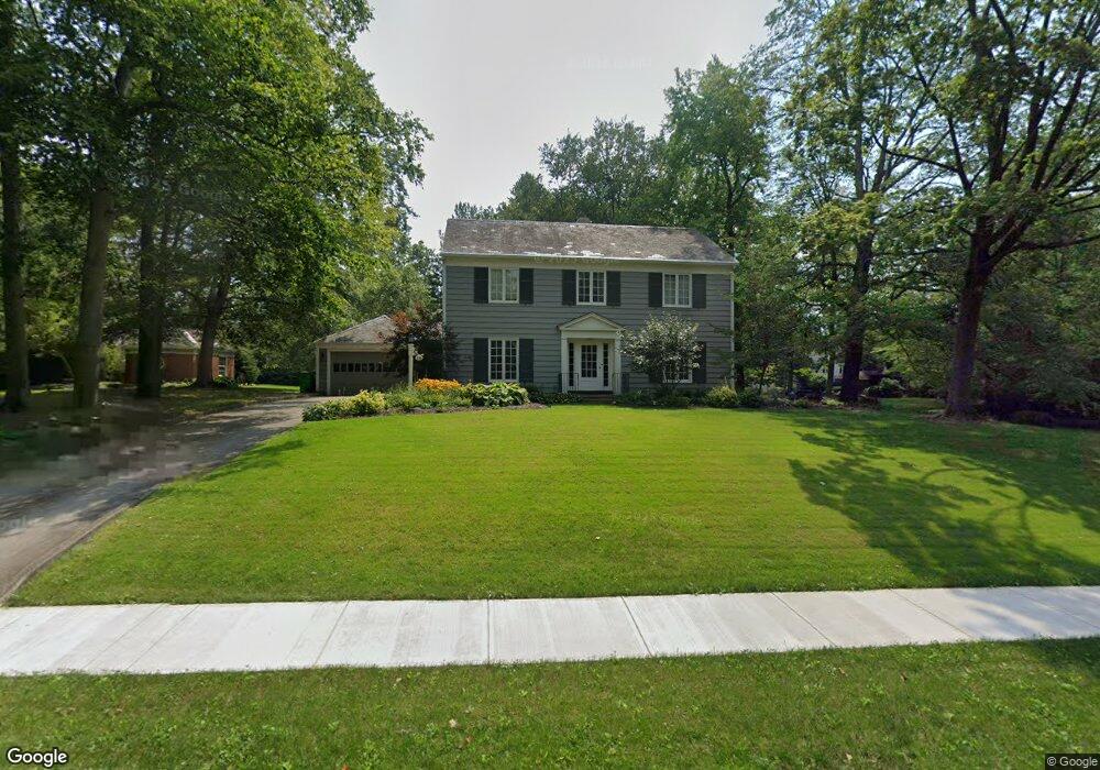
556 Overlook Dr Alliance, OH 44601
Estimated Value: $171,000 - $512,333
--
Bed
--
Bath
--
Sq Ft
9,583
Sq Ft Lot
About This Home
This home is located at 556 Overlook Dr, Alliance, OH 44601 and is currently estimated at $288,444. 556 Overlook Dr is a home located in Stark County with nearby schools including Alliance Early Learning School, Alliance Intermediate School at Northside, and Alliance Middle School.
Ownership History
Date
Name
Owned For
Owner Type
Purchase Details
Closed on
Oct 28, 2022
Sold by
Rodman David L and Rodman Sandra M
Bought by
Fontaine Shaun and Fontaine Amy
Current Estimated Value
Home Financials for this Owner
Home Financials are based on the most recent Mortgage that was taken out on this home.
Original Mortgage
$311,200
Outstanding Balance
$301,497
Interest Rate
6.92%
Mortgage Type
New Conventional
Estimated Equity
-$13,053
Purchase Details
Closed on
Sep 17, 1998
Sold by
Keller Jay H
Bought by
Rodman David L and Rodman Sandra M
Home Financials for this Owner
Home Financials are based on the most recent Mortgage that was taken out on this home.
Original Mortgage
$168,000
Interest Rate
7.02%
Mortgage Type
New Conventional
Create a Home Valuation Report for This Property
The Home Valuation Report is an in-depth analysis detailing your home's value as well as a comparison with similar homes in the area
Home Values in the Area
Average Home Value in this Area
Purchase History
| Date | Buyer | Sale Price | Title Company |
|---|---|---|---|
| Fontaine Shaun | -- | -- | |
| Rodman David L | $210,000 | -- |
Source: Public Records
Mortgage History
| Date | Status | Borrower | Loan Amount |
|---|---|---|---|
| Open | Fontaine Shaun | $311,200 | |
| Previous Owner | Rodman David L | $168,000 |
Source: Public Records
Tax History Compared to Growth
Tax History
| Year | Tax Paid | Tax Assessment Tax Assessment Total Assessment is a certain percentage of the fair market value that is determined by local assessors to be the total taxable value of land and additions on the property. | Land | Improvement |
|---|---|---|---|---|
| 2025 | -- | $8,120 | $7,630 | $490 |
| 2024 | -- | $8,120 | $7,630 | $490 |
| 2023 | $270 | $6,550 | $5,740 | $810 |
| 2022 | $255 | $6,160 | $5,740 | $420 |
| 2021 | $256 | $6,160 | $5,740 | $420 |
| 2020 | $243 | $5,470 | $5,010 | $460 |
| 2019 | $240 | $5,470 | $5,010 | $460 |
| 2018 | $241 | $5,470 | $5,010 | $460 |
| 2017 | $219 | $4,870 | $4,380 | $490 |
| 2016 | $220 | $4,870 | $4,380 | $490 |
| 2015 | $222 | $4,870 | $4,380 | $490 |
| 2014 | $201 | $4,200 | $3,780 | $420 |
| 2013 | $100 | $4,200 | $3,780 | $420 |
Source: Public Records
Map
Nearby Homes
- 1515 S Rockhill Ave
- 1321 Parkway Blvd
- 738 Kingsway St
- 884 W College Rd
- 896 Parkway Blvd
- 970 Kingsway St
- 203 Glamorgan St
- 1038 Fairview Place
- 734 Parkway Blvd
- 1475 Chatauqua Ct
- 645 W Summit St
- 725 W Summit St
- 112 E College St
- 807 S Union Ave
- 140 W Summit St
- 1201 Overlook Dr
- 1437 S Linden Ave
- 390 E College St
- 427 S Union Ave
- 1175 S Freedom Ave
- 556 Overlook Dr
- 510 Overlook Dr
- 622 Overlook Dr
- 541 Overlook Dr
- 541 Overlook Dr
- 1409 Robinwood Rd
- 1425 Robinwood Rd
- 555 Overlook Dr
- 521 Overlook Dr
- 1435 Inwood Rd
- 1444 Robinwood Rd
- 611 Overlook Dr
- 1435 Robinwood Rd
- 507 Overlook Dr
- 1445 Inwood Rd
- 1445 Robinwood Rd
- 638 Overlook Dr
- 440 Overlook Dr
- 1457 Inwood Rd
- 1478 Robinwood Rd