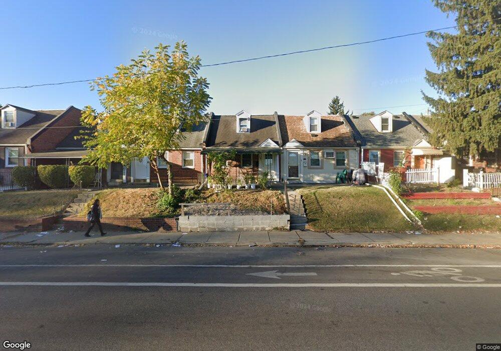
556 S 69th St Upper Darby, PA 19082
Estimated Value: $130,000 - $159,000
2
Beds
1
Bath
1,197
Sq Ft
$121/Sq Ft
Est. Value
About This Home
This home is located at 556 S 69th St, Upper Darby, PA 19082 and is currently estimated at $145,176, approximately $121 per square foot. 556 S 69th St is a home located in Delaware County with nearby schools including Upper Darby Kdg Center, Upper Darby High School, and Lansdowne Friends School.
Ownership History
Date
Name
Owned For
Owner Type
Purchase Details
Closed on
Dec 12, 2001
Sold by
Heffernan Joseph V
Bought by
Mcafee Monica L
Current Estimated Value
Home Financials for this Owner
Home Financials are based on the most recent Mortgage that was taken out on this home.
Original Mortgage
$52,584
Outstanding Balance
$20,502
Interest Rate
6.54%
Mortgage Type
FHA
Estimated Equity
$124,674
Create a Home Valuation Report for This Property
The Home Valuation Report is an in-depth analysis detailing your home's value as well as a comparison with similar homes in the area
Home Values in the Area
Average Home Value in this Area
Purchase History
| Date | Buyer | Sale Price | Title Company |
|---|---|---|---|
| Mcafee Monica L | $53,000 | Commonwealth Land Title Ins |
Source: Public Records
Mortgage History
| Date | Status | Borrower | Loan Amount |
|---|---|---|---|
| Open | Mcafee Monica L | $52,584 |
Source: Public Records
Tax History Compared to Growth
Tax History
| Year | Tax Paid | Tax Assessment Tax Assessment Total Assessment is a certain percentage of the fair market value that is determined by local assessors to be the total taxable value of land and additions on the property. | Land | Improvement |
|---|---|---|---|---|
| 2025 | $2,189 | $51,750 | $14,470 | $37,280 |
| 2024 | $2,189 | $51,750 | $14,470 | $37,280 |
| 2023 | $2,168 | $51,750 | $14,470 | $37,280 |
| 2022 | $2,110 | $51,750 | $14,470 | $37,280 |
| 2021 | $2,845 | $51,750 | $14,470 | $37,280 |
| 2020 | $2,651 | $40,980 | $13,150 | $27,830 |
| 2019 | $2,604 | $40,980 | $13,150 | $27,830 |
| 2018 | $2,574 | $40,980 | $0 | $0 |
| 2017 | $2,507 | $40,980 | $0 | $0 |
| 2016 | $225 | $40,980 | $0 | $0 |
| 2015 | $225 | $40,980 | $0 | $0 |
| 2014 | $225 | $40,980 | $0 | $0 |
Source: Public Records
Map
Nearby Homes
- 525 Wiltshire Rd
- 517 Wiltshire Rd
- 577 Snowden Rd
- 607 Briarcliff Rd
- 6948 Clinton Rd
- 6982 Clinton Rd
- 513 Woodcliffe Rd
- 504 Woodcliffe Rd
- 6858 Clover Ln
- 703 Briarcliff Rd
- 7066 Clover Ln
- 424 Woodcliffe Rd
- 607 Littlecroft Rd
- 6858 Marshall Rd
- 7000 Greenwood Ave
- 7155 Radbourne Rd
- 7162 Radbourne Rd
- 210 Long Ln
- 7139 Guilford Rd
- 6667 Church Ln
- 558 S 69th St
- 554 S 69th St
- 560 S 69th St
- 552 S 69th St
- 562 S 69th St
- 550 S 69th St
- 564 S 69th St
- 548 S 69th St
- 557 Wiltshire Rd
- 555 Wiltshire Rd
- 559 Wiltshire Rd
- 566 S 69th St
- 546 S 69th St
- 553 Wiltshire Rd
- 561 Wiltshire Rd
- 551 Wiltshire Rd
- 568 S 69th St
- 544 S 69th St
- 570 S 69th St
- 547 Wiltshire Rd