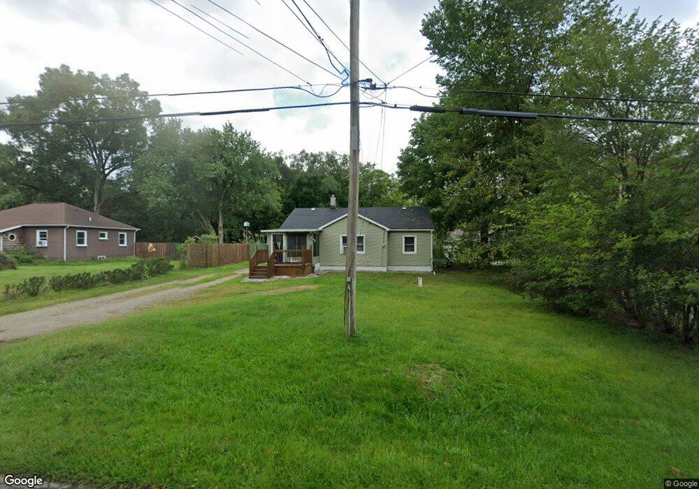
556 Sheridan Rd Jackson, MI 49203
Estimated Value: $124,000 - $164,000
2
Beds
1
Bath
1,056
Sq Ft
$132/Sq Ft
Est. Value
About This Home
This home is located at 556 Sheridan Rd, Jackson, MI 49203 and is currently estimated at $138,929, approximately $131 per square foot. 556 Sheridan Rd is a home located in Jackson County with nearby schools including East Jackson Elementary School, East Jackson Middle School, and East Jackson High School.
Ownership History
Date
Name
Owned For
Owner Type
Purchase Details
Closed on
Feb 13, 2017
Sold by
Arvanitis Michelle
Bought by
Hammond Timothy P
Current Estimated Value
Home Financials for this Owner
Home Financials are based on the most recent Mortgage that was taken out on this home.
Original Mortgage
$40,216
Outstanding Balance
$33,297
Interest Rate
4.2%
Mortgage Type
FHA
Estimated Equity
$105,632
Purchase Details
Closed on
May 19, 1997
Bought by
Dubois Don M and Dubois Jeanie L
Purchase Details
Closed on
Jun 1, 1991
Bought by
Miller
Create a Home Valuation Report for This Property
The Home Valuation Report is an in-depth analysis detailing your home's value as well as a comparison with similar homes in the area
Home Values in the Area
Average Home Value in this Area
Purchase History
| Date | Buyer | Sale Price | Title Company |
|---|---|---|---|
| Hammond Timothy P | $46,500 | Attorney | |
| Hammond Michelle | -- | Attorney | |
| Dubois Don M | $42,900 | -- | |
| Miller | $12,000 | -- |
Source: Public Records
Mortgage History
| Date | Status | Borrower | Loan Amount |
|---|---|---|---|
| Open | Hammond Timothy P | $40,216 |
Source: Public Records
Tax History
| Year | Tax Paid | Tax Assessment Tax Assessment Total Assessment is a certain percentage of the fair market value that is determined by local assessors to be the total taxable value of land and additions on the property. | Land | Improvement |
|---|---|---|---|---|
| 2025 | $1,277 | $64,289 | $0 | $0 |
| 2024 | $9 | $56,545 | $0 | $0 |
| 2023 | $827 | $56,210 | $0 | $0 |
| 2022 | $1,161 | $49,959 | $0 | $0 |
| 2021 | $1,142 | $45,446 | $0 | $0 |
| 2020 | $1,130 | $38,057 | $0 | $0 |
| 2019 | $1,095 | $34,895 | $0 | $0 |
| 2018 | $1,065 | $30,303 | $1,078 | $29,225 |
| 2017 | $927 | $28,887 | $0 | $0 |
| 2016 | $646 | $28,977 | $28,977 | $0 |
| 2015 | -- | $26,975 | $26,975 | $0 |
| 2014 | -- | $31,862 | $0 | $0 |
| 2013 | -- | $31,862 | $31,862 | $0 |
Source: Public Records
Map
Nearby Homes
- 205 S Dettman Rd
- Vl Watts St
- 210 Watts Rd
- 2718 Page Ave
- 1156 Knapp St
- 149 Mantle Ave
- 153 Mantle Ave
- 0 Key St Unit 26001474
- 1139 S Dettman Rd
- 131 Willow St
- 900 S Roberts St
- 3975 Mcarthur Rd
- 111 N Forbes St
- 509 S Gorham St
- 404 Seminole Place
- 106 N Dwight St
- 134 N Gorham St
- 127 Bates St
- 781 Tomlinson St
- 1915 E Ganson St
- 562 Sheridan Rd
- 550 Sheridan Rd
- 559 Sheridan Rd
- 539 Sheridan Rd
- 570 Sheridan Rd
- 530 Sheridan Rd
- 3210 Pearlman Rd
- 537 Sheridan Rd
- 3218 Pearlman Rd
- 557 Sheridan Rd
- 515 Sheridan Rd
- 567 Sheridan Rd
- 3213 Pearlman Rd
- 511 Sheridan Rd
- 3155 Matthews St
- 3217 Matthews St
- 604 Sheridan Rd
- 604 Sheridan St
- 505 Sheridan Rd
- 0 Perlman St
Your Personal Tour Guide
Ask me questions while you tour the home.