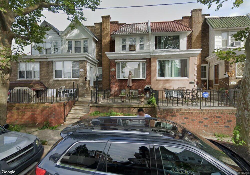
5561 Miriam Rd Philadelphia, PA 19124
Lawncrest NeighborhoodEstimated Value: $190,000 - $249,000
3
Beds
1
Bath
1,340
Sq Ft
$162/Sq Ft
Est. Value
About This Home
This home is located at 5561 Miriam Rd, Philadelphia, PA 19124 and is currently estimated at $216,639, approximately $161 per square foot. 5561 Miriam Rd is a home located in Philadelphia County with nearby schools including Laura H Carnell School, Harding Warren G Middle School, and Samuel Fels High School.
Ownership History
Date
Name
Owned For
Owner Type
Purchase Details
Closed on
Dec 28, 2001
Sold by
Paredes Ardon Magali and Paredes Magali
Bought by
Alyx Ednazela
Current Estimated Value
Home Financials for this Owner
Home Financials are based on the most recent Mortgage that was taken out on this home.
Original Mortgage
$60,291
Outstanding Balance
$24,638
Interest Rate
7.04%
Mortgage Type
FHA
Estimated Equity
$192,001
Purchase Details
Closed on
Mar 28, 1996
Sold by
Looby William and Looby Loretta
Bought by
Paredes Magali
Create a Home Valuation Report for This Property
The Home Valuation Report is an in-depth analysis detailing your home's value as well as a comparison with similar homes in the area
Home Values in the Area
Average Home Value in this Area
Purchase History
| Date | Buyer | Sale Price | Title Company |
|---|---|---|---|
| Alyx Ednazela | $68,000 | Lawyers Title Insurance Co | |
| Paredes Magali | $58,900 | -- |
Source: Public Records
Mortgage History
| Date | Status | Borrower | Loan Amount |
|---|---|---|---|
| Open | Alyx Ednazela | $60,291 |
Source: Public Records
Tax History Compared to Growth
Tax History
| Year | Tax Paid | Tax Assessment Tax Assessment Total Assessment is a certain percentage of the fair market value that is determined by local assessors to be the total taxable value of land and additions on the property. | Land | Improvement |
|---|---|---|---|---|
| 2025 | $2,007 | $182,800 | $36,560 | $146,240 |
| 2024 | $2,007 | $182,800 | $36,560 | $146,240 |
| 2023 | $2,007 | $143,400 | $28,680 | $114,720 |
| 2022 | $736 | $98,400 | $28,680 | $69,720 |
| 2021 | $1,366 | $0 | $0 | $0 |
| 2020 | $1,366 | $0 | $0 | $0 |
| 2019 | $1,312 | $0 | $0 | $0 |
| 2018 | $1,320 | $0 | $0 | $0 |
| 2017 | $1,320 | $0 | $0 | $0 |
| 2016 | $1,320 | $0 | $0 | $0 |
| 2015 | $1,264 | $0 | $0 | $0 |
| 2014 | -- | $94,300 | $15,836 | $78,464 |
| 2012 | -- | $14,304 | $2,189 | $12,115 |
Source: Public Records
Map
Nearby Homes
- 972 Bridge St
- 5640 Miriam Rd
- 5505 Loretto Ave
- 5659 Miriam Rd
- 5661 Miriam Rd
- 938 Marcella St
- 934 Brill St
- 991 Carver St
- 996 Anchor St
- 1048 Bridge St
- 925 E Sanger St
- 894 Granite St
- 894 E Sanger St
- 883 Brill St
- 929 1/2 Anchor St
- 1225 E Cheltenham Ave
- 1211 E Cheltenham Ave
- 951 Wakeling St
- 4046 E Roosevelt Blvd
- 1127 E Cheltenham Ave
- 5559 Miriam Rd
- 5563 Miriam Rd
- 5557 Miriam Rd
- 5565 Miriam Rd
- 5555 Miriam Rd
- 5553 Miriam Rd
- 5551 Miriam Rd
- 5549 Miriam Rd
- 5252 Roosevelt Blvd
- 5547 Miriam Rd
- 5254 Roosevelt Blvd
- 5256 Roosevelt Blvd
- 5562 Miriam Rd
- 5250 Roosevelt Blvd
- 5258 Roosevelt Blvd
- 5545 Miriam Rd
- 5248 Roosevelt Blvd
- 5260 Roosevelt Blvd
- 5246 Roosevelt Blvd
- 5560 Miriam Rd