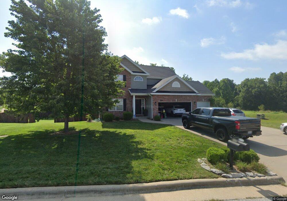
5566 Twelve Oaks Rd Springfield, MO 65810
Southwest Springfield NeighborhoodEstimated Value: $344,000 - $396,127
5
Beds
4
Baths
2,328
Sq Ft
$165/Sq Ft
Est. Value
About This Home
This home is located at 5566 Twelve Oaks Rd, Springfield, MO 65810 and is currently estimated at $383,032, approximately $164 per square foot. 5566 Twelve Oaks Rd is a home with nearby schools including Gray Elementary School, Wilson's Creek Intermediate School, and Cherokee Middle School.
Ownership History
Date
Name
Owned For
Owner Type
Purchase Details
Closed on
Mar 21, 2013
Sold by
Mcbride Springfield Llc
Bought by
Hillman Brian and Hillman Tara
Current Estimated Value
Home Financials for this Owner
Home Financials are based on the most recent Mortgage that was taken out on this home.
Original Mortgage
$228,923
Outstanding Balance
$159,405
Interest Rate
3.25%
Mortgage Type
FHA
Estimated Equity
$223,627
Create a Home Valuation Report for This Property
The Home Valuation Report is an in-depth analysis detailing your home's value as well as a comparison with similar homes in the area
Home Values in the Area
Average Home Value in this Area
Purchase History
| Date | Buyer | Sale Price | Title Company |
|---|---|---|---|
| Hillman Brian | -- | None Available |
Source: Public Records
Mortgage History
| Date | Status | Borrower | Loan Amount |
|---|---|---|---|
| Open | Hillman Brian | $228,923 |
Source: Public Records
Tax History Compared to Growth
Tax History
| Year | Tax Paid | Tax Assessment Tax Assessment Total Assessment is a certain percentage of the fair market value that is determined by local assessors to be the total taxable value of land and additions on the property. | Land | Improvement |
|---|---|---|---|---|
| 2025 | $2,754 | $56,300 | $7,130 | $49,170 |
| 2024 | $2,754 | $49,720 | $6,840 | $42,880 |
| 2023 | $2,739 | $49,720 | $6,840 | $42,880 |
| 2022 | $2,387 | $44,420 | $6,840 | $37,580 |
| 2021 | $2,387 | $44,420 | $6,840 | $37,580 |
| 2020 | $2,348 | $41,440 | $6,840 | $34,600 |
| 2019 | $2,281 | $41,440 | $6,840 | $34,600 |
| 2018 | $1,987 | $36,010 | $6,840 | $29,170 |
| 2017 | $1,967 | $33,650 | $6,840 | $26,810 |
| 2016 | $1,839 | $33,650 | $6,840 | $26,810 |
| 2015 | $1,824 | $33,650 | $6,840 | $26,810 |
| 2014 | $1,709 | $19,060 | $6,840 | $12,220 |
Source: Public Records
Map
Nearby Homes
- 5475 S Farm Road 141
- 2125 W High Point St
- 2052 W High Point St
- 2021 W Melbourne Ct
- 5326 S Faust Ave
- 1951 W Lennox Dr
- 00 W Farm Road 182
- 2637 W Darby St
- 5396 S Woodfield Ave
- 5308 S Lexington Ave
- 5425 S Westwood Ave
- 5940 S Hearthstone Ct
- 4983 S Burrows Ave
- 5946 S Hearthstone Ct
- 5909 S Meadowood Ave
- 5135 S Deborah Ct
- 5921 S Meadowood Ave
- 1632 W Gaslight Dr
- 5389 S Clifton Ave
- 1633 W Silver Oak Dr
- 5548 Twelve Oaks Rd
- 5563 S Twelve Oaks Rd
- 5545 S Twelve Oaks Rd
- 5536 Twelve Oaks Rd
- 5533 S Twelve Oaks Rd
- 5576 S Faust Ave
- 5552 Faust Ave
- 5564 S Faust Ave
- 2184 W Deer Valley Ct
- 5524 Twelve Oaks Rd
- 5540 S Faust Ave
- 5535 S Farm Road 141
- 5521 S Twelve Oaks Rd
- 5528 S Faust Ave
- 5523 S Farm Road 141
- 2208 W Deer Valley Ct
- 5512 S Twelve Oaks Rd
- 5516 S Faust Ave
- 5511 S Farm Road 141
- 5509 S Twelve Oaks Rd