Estimated Value: $201,000 - $273,000
2
Beds
2
Baths
988
Sq Ft
$242/Sq Ft
Est. Value
About This Home
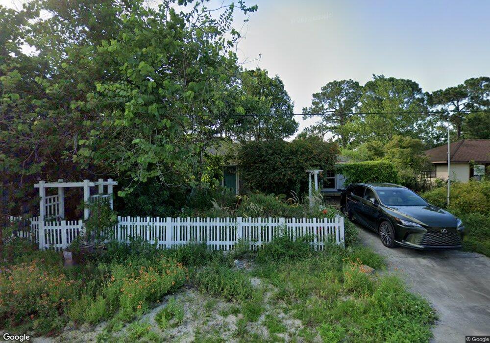
This home is located at 5568 Flint Rd, Cocoa, FL 32927 and is currently estimated at $239,286, approximately $242 per square foot. 5568 Flint Rd is a home located in Brevard County with nearby schools including Enterprise Elementary School, Space Coast Junior/Senior High School, and East Atlantic Prep of Brevard County.
Ownership History
Date
Name
Owned For
Owner Type
Purchase Details
Closed on
Mar 18, 2009
Sold by
Deutsche Bank Trust Company Americas
Bought by
Baran Walter P and Baran Martha A
Current Estimated Value
Purchase Details
Closed on
Nov 12, 2008
Sold by
Galino Janet and Case #05-2008-Ca-008257
Bought by
Deutsche Bank Trust Company Americas and Ixis 2006 He1
Purchase Details
Closed on
Jun 24, 1998
Sold by
Bernhardt Paul C and Bernhardt Constance V
Bought by
Galino Joseph J and Galino Janet
Home Financials for this Owner
Home Financials are based on the most recent Mortgage that was taken out on this home.
Original Mortgage
$53,936
Interest Rate
7.21%
Create a Home Valuation Report for This Property
The Home Valuation Report is an in-depth analysis detailing your home's value as well as a comparison with similar homes in the area
Home Values in the Area
Average Home Value in this Area
Purchase History
| Date | Buyer | Sale Price | Title Company |
|---|---|---|---|
| Baran Walter P | $50,000 | Albertelli Ittle Inc | |
| Deutsche Bank Trust Company Americas | -- | Attorney | |
| Galino Joseph J | $55,000 | -- |
Source: Public Records
Mortgage History
| Date | Status | Borrower | Loan Amount |
|---|---|---|---|
| Previous Owner | Galino Joseph J | $53,936 |
Source: Public Records
Tax History
| Year | Tax Paid | Tax Assessment Tax Assessment Total Assessment is a certain percentage of the fair market value that is determined by local assessors to be the total taxable value of land and additions on the property. | Land | Improvement |
|---|---|---|---|---|
| 2025 | $850 | $56,190 | -- | -- |
| 2024 | $834 | $54,610 | -- | -- |
| 2023 | $834 | $53,020 | $0 | $0 |
| 2022 | $798 | $51,480 | $0 | $0 |
| 2021 | $798 | $49,990 | $0 | $0 |
| 2020 | $760 | $49,300 | $0 | $0 |
| 2019 | $699 | $48,200 | $0 | $0 |
| 2018 | $691 | $47,310 | $0 | $0 |
| 2017 | $683 | $46,340 | $0 | $0 |
| 2016 | $677 | $45,390 | $18,000 | $27,390 |
| 2015 | $674 | $45,080 | $15,000 | $30,080 |
| 2014 | $674 | $44,730 | $11,000 | $33,730 |
Source: Public Records
Map
Nearby Homes
- 6438 Hudson Rd
- 6481 La Brea Ave
- 5720 Flint Rd
- 5715 Fairbridge St
- 6450 Ember Ave
- 5946 Deer Ln
- 5220 Holden Rd
- 5215 Holden Rd
- 5221 Carrick Rd
- 6581 Bancroft Ave
- 5945 Coker Ave
- 6020 Cannon Ave
- 6615 Dock Ave
- 00 Unknown
- 6365 Homestead Ave
- 23-35-21-JX-B-2 Aruin St
- 6010 Fay Blvd
- 6094 Cardiff Ave
- 6375 Cable Ave
- 6760 Cairo Rd
Your Personal Tour Guide
Ask me questions while you tour the home.