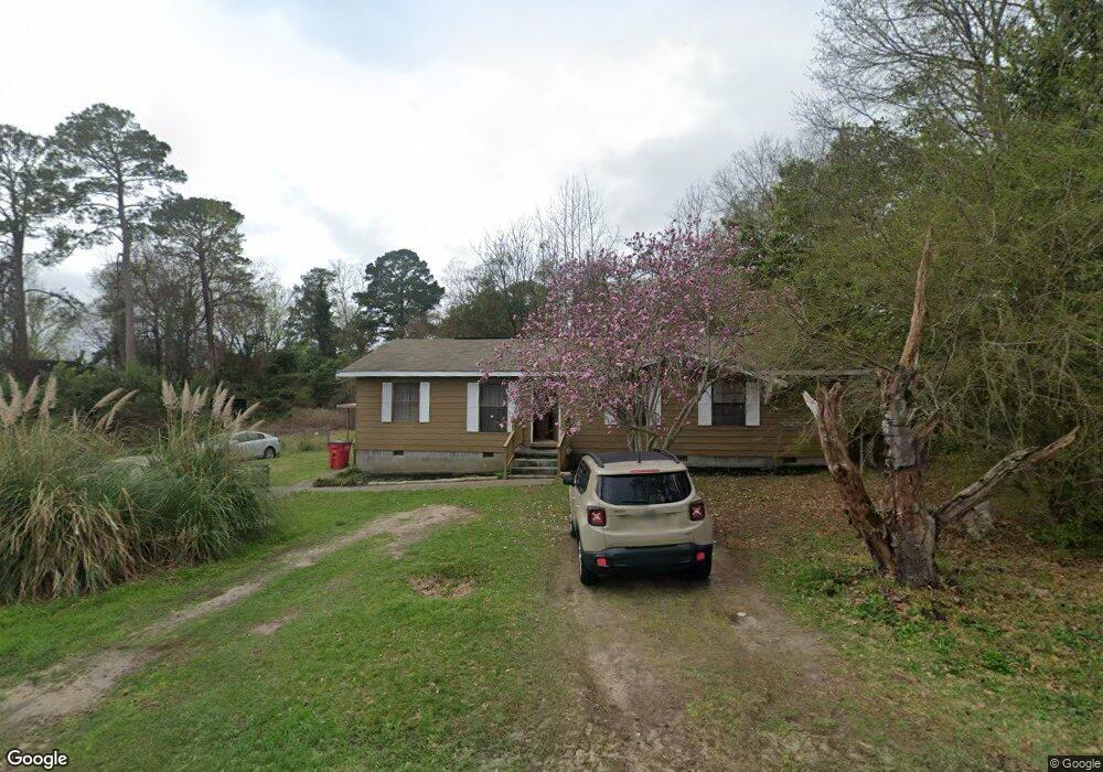
5569 Dale Dr Macon, GA 31206
Estimated Value: $93,000 - $125,000
3
Beds
2
Baths
1,404
Sq Ft
$80/Sq Ft
Est. Value
About This Home
This home is located at 5569 Dale Dr, Macon, GA 31206 and is currently estimated at $112,681, approximately $80 per square foot. 5569 Dale Dr is a home located in Bibb County with nearby schools including Veterans Elementary School, Southwest High School, and Gilead Christian Academy.
Ownership History
Date
Name
Owned For
Owner Type
Purchase Details
Closed on
Aug 6, 2010
Sold by
Rlh Ventures Inc
Bought by
Rsh Entities Llc
Current Estimated Value
Home Financials for this Owner
Home Financials are based on the most recent Mortgage that was taken out on this home.
Original Mortgage
$30,516
Interest Rate
4.61%
Mortgage Type
Unknown
Purchase Details
Closed on
Aug 5, 2010
Sold by
Lendmark Financial Services Inc
Bought by
Rlh Ventures Inc
Home Financials for this Owner
Home Financials are based on the most recent Mortgage that was taken out on this home.
Original Mortgage
$30,516
Interest Rate
4.61%
Mortgage Type
Unknown
Purchase Details
Closed on
Jan 22, 2010
Sold by
Hurst Jacqueline
Bought by
Lendmark Financial Services Inc
Create a Home Valuation Report for This Property
The Home Valuation Report is an in-depth analysis detailing your home's value as well as a comparison with similar homes in the area
Home Values in the Area
Average Home Value in this Area
Purchase History
| Date | Buyer | Sale Price | Title Company |
|---|---|---|---|
| Rsh Entities Llc | -- | None Available | |
| Rlh Ventures Inc | $30,000 | None Available | |
| Lendmark Financial Services Inc | $45,000 | None Available |
Source: Public Records
Mortgage History
| Date | Status | Borrower | Loan Amount |
|---|---|---|---|
| Closed | Rsh Entities Llc | $30,516 |
Source: Public Records
Tax History Compared to Growth
Tax History
| Year | Tax Paid | Tax Assessment Tax Assessment Total Assessment is a certain percentage of the fair market value that is determined by local assessors to be the total taxable value of land and additions on the property. | Land | Improvement |
|---|---|---|---|---|
| 2025 | $1,030 | $41,924 | $2,700 | $39,224 |
| 2024 | $1,065 | $41,924 | $2,700 | $39,224 |
| 2023 | $940 | $31,718 | $2,160 | $29,558 |
| 2022 | $926 | $26,739 | $3,197 | $23,542 |
| 2021 | $760 | $20,004 | $2,238 | $17,766 |
| 2020 | $557 | $14,340 | $1,598 | $12,742 |
| 2019 | $561 | $14,340 | $1,598 | $12,742 |
| 2018 | $1,040 | $14,340 | $1,598 | $12,742 |
| 2017 | $537 | $14,340 | $1,598 | $12,742 |
| 2016 | $490 | $14,157 | $1,598 | $12,558 |
| 2015 | $693 | $14,157 | $1,598 | $12,558 |
| 2014 | $797 | $14,157 | $1,598 | $12,558 |
Source: Public Records
Map
Nearby Homes
- 3078 Alfred Dr
- 2972 Richard Dr
- 2960 Jadan Place
- 2801 Deeb Dr
- 2769 Nancy Dr
- 2768 Nancy Dr
- 2770 Bonnie Ave
- 5711 Sterling Place
- 2995 Virginia Dr
- 2704 Reynolds Dr
- 2830 Village Green Dr
- 5756 Edwina Dr
- 2824 Village Green Dr
- 5746 Sterling Place
- 2841 Shamrock Dr
- 2868 Barrett Ave
- 5780 Edwina Dr
- 2775 Village Green Ln
- 5771 Satterfield Dr