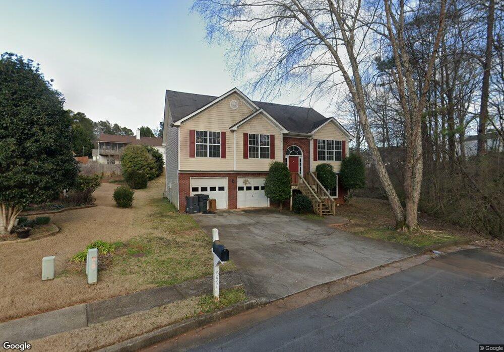
557 Aldgate Ln NW Lawrenceville, GA 30046
Estimated Value: $335,000 - $361,794
4
Beds
3
Baths
1,650
Sq Ft
$211/Sq Ft
Est. Value
About This Home
This home is located at 557 Aldgate Ln NW, Lawrenceville, GA 30046 and is currently estimated at $348,449, approximately $211 per square foot. 557 Aldgate Ln NW is a home located in Gwinnett County with nearby schools including Benefield Elementary School, Richards Middle School, and Discovery High School.
Ownership History
Date
Name
Owned For
Owner Type
Purchase Details
Closed on
Jul 30, 2025
Sold by
Sfr Xii Atl Owner 1 L P
Bought by
Star Borrower Sfr6 Lp
Current Estimated Value
Purchase Details
Closed on
Jul 16, 2021
Sold by
Riley Fornettra
Bought by
Sfr Xii Atl Owner 1 Lp
Purchase Details
Closed on
Aug 31, 1998
Sold by
Burnham Bldrs Lp
Bought by
Riley Adam E and Riley Fornettra
Home Financials for this Owner
Home Financials are based on the most recent Mortgage that was taken out on this home.
Original Mortgage
$142,700
Interest Rate
6.96%
Mortgage Type
VA
Create a Home Valuation Report for This Property
The Home Valuation Report is an in-depth analysis detailing your home's value as well as a comparison with similar homes in the area
Home Values in the Area
Average Home Value in this Area
Purchase History
| Date | Buyer | Sale Price | Title Company |
|---|---|---|---|
| Star Borrower Sfr6 Lp | -- | -- | |
| Sfr Xii Atl Owner 1 Lp | $245,000 | -- | |
| Riley Adam E | $140,000 | -- |
Source: Public Records
Mortgage History
| Date | Status | Borrower | Loan Amount |
|---|---|---|---|
| Previous Owner | Riley Adam E | $142,700 |
Source: Public Records
Tax History Compared to Growth
Tax History
| Year | Tax Paid | Tax Assessment Tax Assessment Total Assessment is a certain percentage of the fair market value that is determined by local assessors to be the total taxable value of land and additions on the property. | Land | Improvement |
|---|---|---|---|---|
| 2024 | $5,361 | $140,000 | $21,600 | $118,400 |
| 2023 | $5,361 | $135,880 | $24,000 | $111,880 |
| 2022 | $3,840 | $98,000 | $24,000 | $74,000 |
| 2021 | $3,711 | $93,240 | $16,000 | $77,240 |
| 2020 | $3,732 | $93,240 | $16,000 | $77,240 |
| 2019 | $2,557 | $78,960 | $13,600 | $65,360 |
| 2018 | $2,557 | $78,960 | $13,600 | $65,360 |
| 2016 | $2,215 | $62,160 | $13,600 | $48,560 |
| 2015 | $1,937 | $50,880 | $10,400 | $40,480 |
| 2014 | -- | $50,880 | $10,400 | $40,480 |
Source: Public Records
Map
Nearby Homes
- 555 Sydney Crest Ln
- 652 Tower Hill Ct
- 2099 Riverlanding Cir Unit II
- 1405 Chris Lake Dr
- 1564 Mill Run Ct Unit 1
- 593 Mill Run Place
- 1584 Park Grove Dr
- 757 Riverlanding Dr
- 537 Sydney Michelle Ln
- 1560 Park Grove Dr
- 1115 Chris Lake Dr
- 1384 Sunrise Way
- 398 Parc River Blvd
- 384 Parc River Blvd
- 1469 Bridgestone Dr
- 1789 Riverlanding Cir
- 1759 Coleville Oak Ln
- 1684 Oak Ridge Way
- 557 Aldgate Ln
- 557 Aldergate Ln
- 550 Burnham Ridge Unit 2
- 530 Burnham Ridge Unit 2
- 577 Aldgate Ln
- 564 Aldgate Ln Unit 2
- 590 Burnham Ridge
- 570 Burnham Ridge
- 600 Burnham Ridge Unit 2
- 574 Aldgate Ln Unit 2
- 660 Burnham Ridge
- 0 Aldgate Ln Unit 8510517
- 581 Brass Key Ct
- 597 Aldgate Ln Unit 2
- 535 Burnham Ridge
- 1410 Charing Cross Way Unit 2
- 584 Aldgate Ln
- 565 Burnham Ridge
- 594 Aldgate Ln
- 605 Burnham Ridge Unit II