Estimated Value: $297,000 - $340,000
4
Beds
3
Baths
2,303
Sq Ft
$138/Sq Ft
Est. Value
About This Home
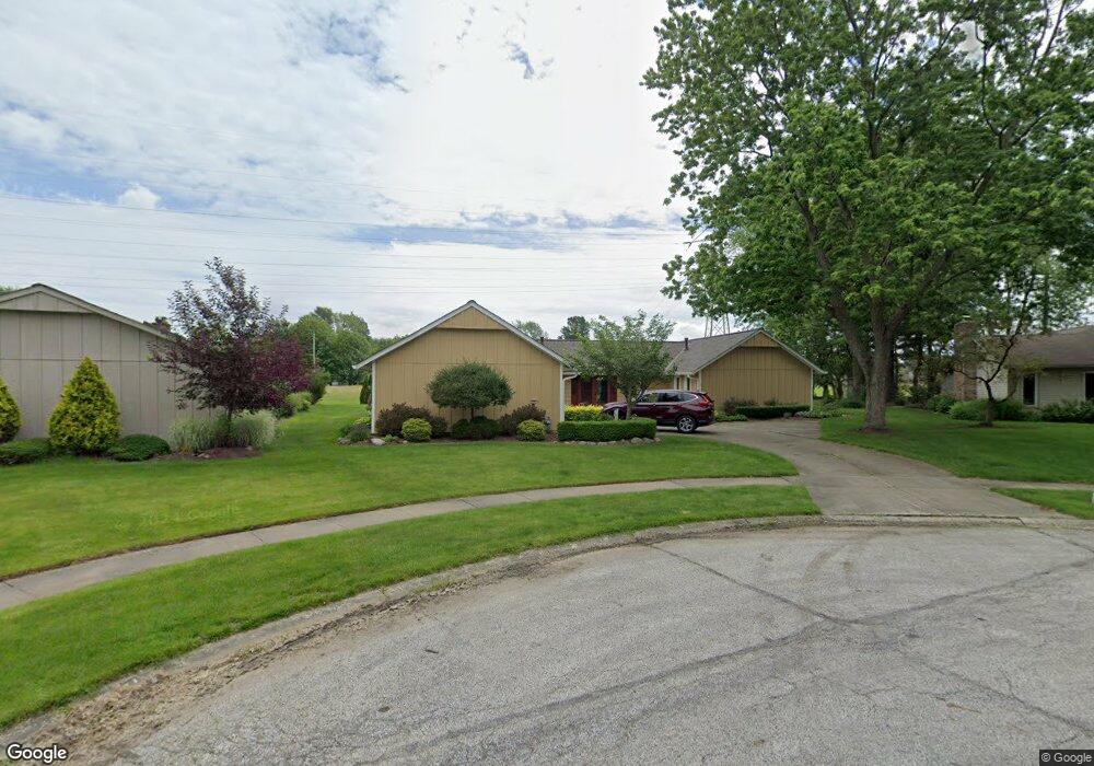
This home is located at 557 Cranston Cir, Berea, OH 44017 and is currently estimated at $318,652, approximately $138 per square foot. 557 Cranston Cir is a home located in Cuyahoga County with nearby schools including Grindstone Elementary School, Berea-Midpark Middle School, and Berea-Midpark High School.
Ownership History
Date
Name
Owned For
Owner Type
Purchase Details
Closed on
Oct 16, 1986
Sold by
Mistak Martha Jane
Bought by
Zelenka Robert M and Zelenka Linda L
Current Estimated Value
Purchase Details
Closed on
Oct 27, 1983
Sold by
Mistak Edward R and Mistak Martha J
Bought by
Mistak Edward R
Purchase Details
Closed on
Jan 1, 1975
Bought by
Mistak Edward R and Mistak Martha J
Create a Home Valuation Report for This Property
The Home Valuation Report is an in-depth analysis detailing your home's value as well as a comparison with similar homes in the area
Home Values in the Area
Average Home Value in this Area
Purchase History
| Date | Buyer | Sale Price | Title Company |
|---|---|---|---|
| Zelenka Robert M | $92,000 | -- | |
| Mistak Martha Jane | -- | -- | |
| Mistak Edward R | -- | -- | |
| Mistak Edward R | -- | -- |
Source: Public Records
Tax History Compared to Growth
Tax History
| Year | Tax Paid | Tax Assessment Tax Assessment Total Assessment is a certain percentage of the fair market value that is determined by local assessors to be the total taxable value of land and additions on the property. | Land | Improvement |
|---|---|---|---|---|
| 2024 | $5,128 | $98,350 | $16,240 | $82,110 |
| 2023 | $4,232 | $70,250 | $13,830 | $56,420 |
| 2022 | $4,234 | $70,250 | $13,830 | $56,420 |
| 2021 | $4,196 | $70,250 | $13,830 | $56,420 |
| 2020 | $3,909 | $59,540 | $11,730 | $47,810 |
| 2019 | $3,805 | $170,100 | $33,500 | $136,600 |
| 2018 | $3,620 | $59,540 | $11,730 | $47,810 |
| 2017 | $3,705 | $54,890 | $10,610 | $44,280 |
| 2016 | $3,678 | $54,890 | $10,610 | $44,280 |
| 2015 | -- | $54,890 | $10,610 | $44,280 |
| 2014 | -- | $57,790 | $11,170 | $46,620 |
Source: Public Records
Map
Nearby Homes
- 517 Wyleswood Dr
- 626 Ensenada Ct Unit 5
- 537 Wyleswood Dr
- 543 Wyleswood Dr
- 549 Wyleswood Dr
- 648 Tampico Ct Unit 37
- 23002 Chandlers Ln Unit 221
- 23002 Chandlers Ln
- 23002 Chandlers Ln Unit 342
- Passionflower II Plan at Aspire at Longbrooke
- Daffodil II Plan at Aspire at Longbrooke
- 23155 Wainwright Terrace
- 540 Crossbrook Dr
- 580 Crossbrook Dr
- 23390 Wainwright Terrace
- 23004 Chandlers Ln Unit 109
- 585 Woodmere Dr
- 23450 Wainwright Terrace
- 9797 Sugarbush Cir
- 396 Crossbrook Dr
- 551 Cranston Cir
- 563 Cranston Cir
- 543 Cranston Cir
- 564 Cranston Cir
- 556 Cranston Cir
- 479 Wyleswood Dr
- 485 Wyleswood Dr
- 455 Wyleswood Dr
- 449 Wyleswood Dr
- 771 Merrimak Dr
- 515 Cranston Dr
- 763 Merrimak Dr
- 445 Wyleswood Dr
- 787 Merrimak Dr
- 755 Merrimak Dr
- 552 Beeler Dr
- 558 Beeler Dr
- 564 Beeler Dr
- 749 Merrimak Dr
- 544 Beeler Dr