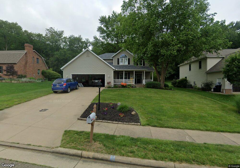
557 Donald Dr SW New Philadelphia, OH 44663
Estimated Value: $307,000 - $398,000
4
Beds
4
Baths
2,250
Sq Ft
$160/Sq Ft
Est. Value
About This Home
This home is located at 557 Donald Dr SW, New Philadelphia, OH 44663 and is currently estimated at $360,823, approximately $160 per square foot. 557 Donald Dr SW is a home located in Tuscarawas County with nearby schools including New Philadelphia High School, Quaker Preparatory Academy, and Quaker Digital Academy.
Ownership History
Date
Name
Owned For
Owner Type
Purchase Details
Closed on
Dec 30, 2008
Sold by
Ley Aaron M and Ley Jami L
Bought by
Riesen Kerry M and Riesen Susan N
Current Estimated Value
Home Financials for this Owner
Home Financials are based on the most recent Mortgage that was taken out on this home.
Original Mortgage
$178,125
Outstanding Balance
$118,519
Interest Rate
6.19%
Mortgage Type
Purchase Money Mortgage
Estimated Equity
$242,304
Purchase Details
Closed on
Sep 24, 1999
Sold by
Lerolynn Dev Corp
Bought by
Ley Aaron M and Ley Jami L
Create a Home Valuation Report for This Property
The Home Valuation Report is an in-depth analysis detailing your home's value as well as a comparison with similar homes in the area
Home Values in the Area
Average Home Value in this Area
Purchase History
| Date | Buyer | Sale Price | Title Company |
|---|---|---|---|
| Riesen Kerry M | $187,500 | Tusc Title | |
| Ley Aaron M | $29,990 | -- |
Source: Public Records
Mortgage History
| Date | Status | Borrower | Loan Amount |
|---|---|---|---|
| Open | Riesen Kerry M | $178,125 |
Source: Public Records
Tax History Compared to Growth
Tax History
| Year | Tax Paid | Tax Assessment Tax Assessment Total Assessment is a certain percentage of the fair market value that is determined by local assessors to be the total taxable value of land and additions on the property. | Land | Improvement |
|---|---|---|---|---|
| 2024 | $3,483 | $90,490 | $14,760 | $75,730 |
| 2023 | $3,483 | $258,540 | $42,180 | $216,360 |
| 2022 | $3,504 | $90,489 | $14,763 | $75,726 |
| 2021 | $3,240 | $78,743 | $12,523 | $66,220 |
| 2020 | $3,257 | $78,743 | $12,523 | $66,220 |
| 2019 | $3,255 | $78,743 | $12,523 | $66,220 |
| 2018 | $2,902 | $66,450 | $10,570 | $55,880 |
| 2017 | $2,855 | $66,450 | $10,570 | $55,880 |
| 2016 | $2,931 | $66,450 | $10,570 | $55,880 |
| 2014 | $2,945 | $65,030 | $9,650 | $55,380 |
| 2013 | $2,424 | $65,030 | $9,650 | $55,380 |
Source: Public Records
Map
Nearby Homes
- 1024 Thomas Dr SW
- 471 Snazzy Cir SW
- 236 Myers Ave SW
- 1166 S Broadway St
- 161 York Dr SE
- 1149 Jefferson St SE
- 427 Sycamore Cir SE
- 1354 Independence Cir SE
- 1273 Concord Cir SE
- 514 Front Ave SW
- 241 Saint Clair Ave SW
- 651 Front Ave SW
- 405 Front Ave SW
- 451 Mill Ave SE
- 902 W High Ave
- 344 Fair Ave NW
- 944 Grant Ave NW
- 231 4th St SE
- 1063 Grant Ave NW
- 1075 Grant Ave NW
- 549 Donald Dr SW
- 541 Donald Dr SW
- 567 Donald Dr SW
- 554 Donald Dr SW
- 581 Donald Dr SW
- 533 Donald Dr SW
- 546 Donald Dr SW
- 1001 Thomas Dr SW
- 540 Donald Dr SW
- 1005 Thomas Dr SW
- 525 Donald Dr SW
- 534 Donald Dr SW
- 528 Donald Dr SW
- 1004 Thomas Dr SW
- 618 Donald Dr SW
- 557 Lockport Ave SW
- 569 Lockport Ave SW
- 619 Donald Dr SW
- 517 Donald Dr SW
- 547 Lockport Ave SW