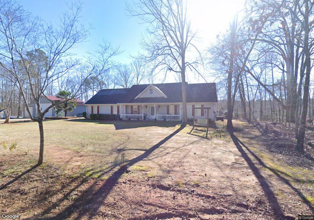
557 Malcom Rd Covington, GA 30014
Estimated Value: $308,000 - $381,000
Studio
2
Baths
1,682
Sq Ft
$199/Sq Ft
Est. Value
About This Home
This home is located at 557 Malcom Rd, Covington, GA 30014 and is currently estimated at $334,627, approximately $198 per square foot. 557 Malcom Rd is a home located in Newton County with nearby schools including Rocky Plains Elementary School, Indian Creek Middle School, and Alcovy High School.
Ownership History
Date
Name
Owned For
Owner Type
Purchase Details
Closed on
Jan 11, 2002
Sold by
Mason & Allen Const
Bought by
Olson Duane S
Current Estimated Value
Home Financials for this Owner
Home Financials are based on the most recent Mortgage that was taken out on this home.
Original Mortgage
$84,400
Outstanding Balance
$32,941
Interest Rate
6.85%
Mortgage Type
New Conventional
Estimated Equity
$301,686
Create a Home Valuation Report for This Property
The Home Valuation Report is an in-depth analysis detailing your home's value as well as a comparison with similar homes in the area
Home Values in the Area
Average Home Value in this Area
Purchase History
| Date | Buyer | Sale Price | Title Company |
|---|---|---|---|
| Olson Duane S | $108,000 | -- |
Source: Public Records
Mortgage History
| Date | Status | Borrower | Loan Amount |
|---|---|---|---|
| Open | Olson Duane S | $84,400 |
Source: Public Records
Tax History
| Year | Tax Paid | Tax Assessment Tax Assessment Total Assessment is a certain percentage of the fair market value that is determined by local assessors to be the total taxable value of land and additions on the property. | Land | Improvement |
|---|---|---|---|---|
| 2025 | $3,422 | $144,440 | $19,960 | $124,480 |
| 2024 | $3,233 | $131,480 | $17,280 | $114,200 |
| 2023 | $3,279 | $124,720 | $12,120 | $112,600 |
| 2022 | $2,506 | $96,240 | $9,720 | $86,520 |
| 2021 | $2,377 | $82,280 | $9,720 | $72,560 |
| 2020 | $2,358 | $74,080 | $9,000 | $65,080 |
| 2019 | $1,829 | $57,520 | $7,000 | $50,520 |
| 2018 | $1,775 | $55,600 | $7,000 | $48,600 |
| 2017 | $1,479 | $46,960 | $5,000 | $41,960 |
| 2016 | $1,211 | $39,160 | $4,000 | $35,160 |
| 2015 | $1,196 | $38,720 | $4,000 | $34,720 |
| 2014 | $993 | $32,880 | $0 | $0 |
Source: Public Records
Map
Nearby Homes
- 230 Friar Tuck Cir
- 0 Malcom Rd Unit 10594529
- 35 Emerald Ln Unit 14
- 25 Emerald Ln Unit 15
- 480 Friar Tuck Cir
- 45 Glen Ridge Ct
- 355 Parker Rd
- 390 Rocky Point Rd
- 0000 Rocky Point Rd
- 80 Hunters Trace
- 386 Parker Rd
- 103 Campbell Rd
- 91 Campbell Rd
- 97 Malcom Rd
- 45 Stewart Glen Dr
- 658 Campbell Rd
- 632 Campbell Rd
- 646 Campbell Rd
- 0 S River Dr Unit 7644682
- 470 Haley Rd
- 587 Malcom Rd
- 547 Malcolm Rd
- 537 Malcom Rd
- 515 Malcom Rd
- 90 Quarry Ct Unit 1
- 80 Quarry Ct
- 625 Malcom Rd
- 100 Quarry Ct
- 100 Quarry Ct Unit 1
- 495 Malcom Rd
- 60 Quarry Ct Unit 1
- 105 Quarry Ct Unit 1
- 85 Quarry Ct
- 95 Quarry Ct
- 50 Quarry Ct
- 50 Quarry Ct Unit 49
- 450 Malcom Rd
- 495 Malcolm
- 495 Malcolm Unit 495
- 65 Quarry Ct
Your Personal Tour Guide
Ask me questions while you tour the home.