Estimated Value: $249,995 - $285,000
3
Beds
2
Baths
1,066
Sq Ft
$248/Sq Ft
Est. Value
About This Home
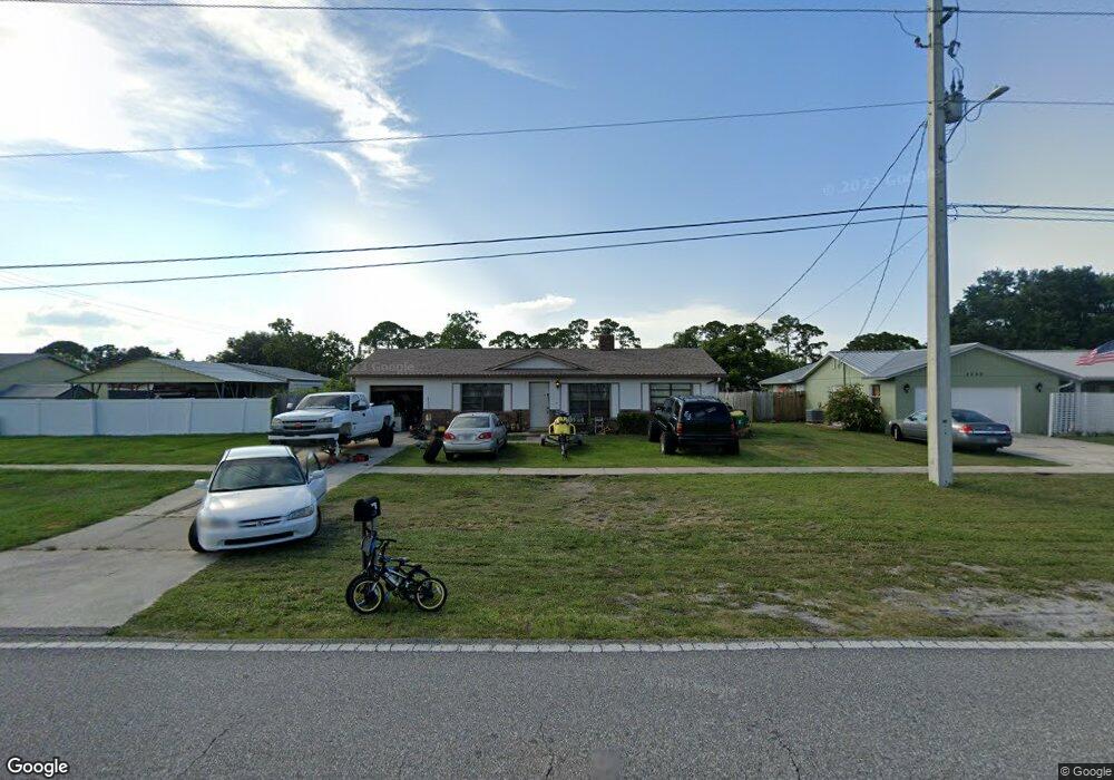
This home is located at 5570 Fay Blvd, Cocoa, FL 32927 and is currently estimated at $263,999, approximately $247 per square foot. 5570 Fay Blvd is a home located in Brevard County with nearby schools including Enterprise Elementary School, Space Coast Junior/Senior High School, and East Atlantic Prep of Brevard County.
Ownership History
Date
Name
Owned For
Owner Type
Purchase Details
Closed on
Jun 2, 2011
Sold by
Canter Karen A
Bought by
Canter Karen Ashe and The Karen Ashe Canter Living T
Current Estimated Value
Purchase Details
Closed on
Jun 26, 1995
Sold by
Dept Housing & Urban Dev
Bought by
Canter Karen A
Purchase Details
Closed on
Mar 30, 1995
Sold by
Clerk Circuit Court
Bought by
Amer Bk S
Purchase Details
Closed on
Mar 21, 1995
Sold by
Amer Bk S
Bought by
Housing & Urban Dev
Create a Home Valuation Report for This Property
The Home Valuation Report is an in-depth analysis detailing your home's value as well as a comparison with similar homes in the area
Home Values in the Area
Average Home Value in this Area
Purchase History
| Date | Buyer | Sale Price | Title Company |
|---|---|---|---|
| Canter Karen Ashe | -- | None Available | |
| Canter Karen A | $47,900 | -- | |
| Amer Bk S | -- | -- | |
| Housing & Urban Dev | -- | -- |
Source: Public Records
Tax History Compared to Growth
Tax History
| Year | Tax Paid | Tax Assessment Tax Assessment Total Assessment is a certain percentage of the fair market value that is determined by local assessors to be the total taxable value of land and additions on the property. | Land | Improvement |
|---|---|---|---|---|
| 2025 | $2,710 | $196,050 | -- | -- |
| 2024 | $2,657 | $199,750 | -- | -- |
| 2023 | $2,657 | $199,370 | $0 | $0 |
| 2022 | $2,399 | $190,540 | $0 | $0 |
| 2021 | $2,152 | $141,220 | $42,000 | $99,220 |
| 2020 | $1,984 | $125,810 | $40,000 | $85,810 |
| 2019 | $1,872 | $120,900 | $35,000 | $85,900 |
| 2018 | $1,772 | $109,570 | $27,000 | $82,570 |
| 2017 | $1,674 | $96,510 | $24,000 | $72,510 |
| 2016 | $1,565 | $82,010 | $18,000 | $64,010 |
| 2015 | $1,487 | $64,390 | $15,000 | $49,390 |
| 2014 | $1,360 | $58,540 | $11,000 | $47,540 |
Source: Public Records
Map
Nearby Homes
- 5460 Holden Rd
- 5446 Jamaica Rd
- 5997 Jenkins Ave
- 6017 Flamingo Ave
- 5940 Flamingo Ave
- 5275 Holden Rd
- 6309 Alleghany Ave
- 6003 Gilson
- 4650 N Highway 1 Hwy
- 5946 Deer Ln
- 5715 Fairbridge St
- 5220 Holden Rd
- 5575 Curtis Blvd
- 6581 Bancroft Ave
- 5145 Fay Blvd
- 6615 Dock Ave
- 00 Unknown
- 6643 Emil Ave
- 6365 Homestead Ave
- 6061 Banbury Ave