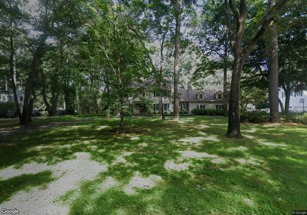
5570 N Nithsdale Dr Unit N Salisbury, MD 21801
South Salisbury NeighborhoodEstimated Value: $771,000 - $919,000
4
Beds
6
Baths
4,665
Sq Ft
$181/Sq Ft
Est. Value
About This Home
This home is located at 5570 N Nithsdale Dr Unit N, Salisbury, MD 21801 and is currently estimated at $843,570, approximately $180 per square foot. 5570 N Nithsdale Dr Unit N is a home located in Wicomico County with nearby schools including Westside Primary School, Westside Intermediate School, and Salisbury Middle School.
Ownership History
Date
Name
Owned For
Owner Type
Purchase Details
Closed on
May 9, 2013
Sold by
Marshall Michael P and Marshall Kathleen
Bought by
Mccutcheon Brion L and Mccutcheon Tonia W
Current Estimated Value
Home Financials for this Owner
Home Financials are based on the most recent Mortgage that was taken out on this home.
Original Mortgage
$372,000
Outstanding Balance
$263,247
Interest Rate
3.45%
Mortgage Type
New Conventional
Estimated Equity
$580,323
Purchase Details
Closed on
Aug 9, 1999
Sold by
Darby Keith A
Bought by
Marshall Michael P and Marshall Kathleen
Purchase Details
Closed on
Aug 11, 1995
Sold by
Darby Keith A and Darby Donna J
Bought by
Darby Keith A
Create a Home Valuation Report for This Property
The Home Valuation Report is an in-depth analysis detailing your home's value as well as a comparison with similar homes in the area
Home Values in the Area
Average Home Value in this Area
Purchase History
| Date | Buyer | Sale Price | Title Company |
|---|---|---|---|
| Mccutcheon Brion L | $465,000 | Delmarva Title Co | |
| Marshall Michael P | $335,000 | -- | |
| Darby Keith A | -- | -- |
Source: Public Records
Mortgage History
| Date | Status | Borrower | Loan Amount |
|---|---|---|---|
| Open | Mccutcheon Brion L | $372,000 | |
| Closed | Darby Keith A | -- |
Source: Public Records
Tax History Compared to Growth
Tax History
| Year | Tax Paid | Tax Assessment Tax Assessment Total Assessment is a certain percentage of the fair market value that is determined by local assessors to be the total taxable value of land and additions on the property. | Land | Improvement |
|---|---|---|---|---|
| 2025 | $4,685 | $532,533 | $0 | $0 |
| 2024 | $4,685 | $495,167 | $0 | $0 |
| 2023 | $4,586 | $457,800 | $100,900 | $356,900 |
| 2022 | $4,699 | $455,233 | $0 | $0 |
| 2021 | $4,702 | $452,667 | $0 | $0 |
| 2020 | $4,702 | $450,100 | $100,900 | $349,200 |
| 2019 | $4,660 | $441,667 | $0 | $0 |
| 2018 | $4,477 | $433,233 | $0 | $0 |
| 2017 | $4,280 | $424,800 | $0 | $0 |
| 2016 | -- | $397,933 | $0 | $0 |
| 2015 | $3,805 | $371,067 | $0 | $0 |
| 2014 | $3,805 | $344,200 | $0 | $0 |
Source: Public Records
Map
Nearby Homes
- 5686 N Nithsdale Dr Unit N
- 5541 E Nithsdale Dr
- 5437 Nithsdale Dr
- 5709 Royal Mile Blvd
- 5703 Royal Mile Blvd
- 5461 Loch Ness Terrace
- 5474 Royal Mile Blvd
- 5688 Kirkpatrick Ct
- 5781 King Stuart Dr
- 0 King Stuart Dr Unit MDWC2018516
- 5973 Smithys Ln
- 26882 Pratt Rd
- 26694 Pemberton Dr
- 6058 Gloucester Ct
- 5079 Old Mill Branch Rd
- 6151 Trails End Ct
- 27640 Belgian Way
- 6209 Rockawalkin Rd
- 26924 Black Horse Run
- 6177 Ayrshire Dr
- 5588 N Nithsdale Dr
- 5564 N Nithsdale Dr Unit N
- 5596 N Nithsdale Dr
- 5573 N Nithsdale Dr
- 5583 N Nithsdale Dr Unit N
- 5560 N Nithsdale Dr
- 5600 N Nithsdale Dr Unit N
- 5616 N Nithsdale Dr
- 5605 N Nithsdale Dr Unit N
- 27100 Scotland Pkwy
- 5552 Nithsdale Dr
- 5545 Nithsdale Dr
- 5581 Clydesdale Dr
- 5626 N Nithsdale Dr Unit N
- 27110 Scotland Pkwy
- 5548 Nithsdale Dr
- 5594 Clydesdale Dr
- 5615 N Nithsdale Dr Unit N
- 5531 Nithsdale Dr
- 5585 Clydesdale Dr