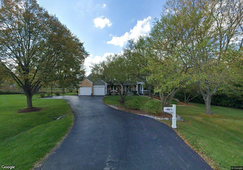
5571 Brookbank Ln Unit 2 Long Grove, IL 60047
Estimated Value: $787,496 - $893,000
4
Beds
3
Baths
3,146
Sq Ft
$263/Sq Ft
Est. Value
About This Home
This home is located at 5571 Brookbank Ln Unit 2, Long Grove, IL 60047 and is currently estimated at $828,624, approximately $263 per square foot. 5571 Brookbank Ln Unit 2 is a home located in Lake County with nearby schools including Country Meadows Elementary School, Woodlawn Middle School, and Adlai E Stevenson High School.
Ownership History
Date
Name
Owned For
Owner Type
Purchase Details
Closed on
Jul 5, 2011
Sold by
Constabileo John and Constabileo Kendall
Bought by
Adelman David and Adelman Adina
Current Estimated Value
Purchase Details
Closed on
Apr 14, 2005
Sold by
Lees James H
Bought by
Constabileo John and Constabileo Kendall K
Home Financials for this Owner
Home Financials are based on the most recent Mortgage that was taken out on this home.
Original Mortgage
$430,000
Interest Rate
5.62%
Mortgage Type
Purchase Money Mortgage
Purchase Details
Closed on
Jun 22, 2002
Sold by
Lees James H and Lee Melissa J
Bought by
Department Of Transportation
Purchase Details
Closed on
Mar 10, 2000
Sold by
Purac America Inc
Bought by
Lees James H
Home Financials for this Owner
Home Financials are based on the most recent Mortgage that was taken out on this home.
Original Mortgage
$272,000
Interest Rate
8%
Purchase Details
Closed on
Nov 1, 1999
Sold by
Cook Frank T and Cook Frances M
Bought by
Purac America Inc
Create a Home Valuation Report for This Property
The Home Valuation Report is an in-depth analysis detailing your home's value as well as a comparison with similar homes in the area
Home Values in the Area
Average Home Value in this Area
Purchase History
| Date | Buyer | Sale Price | Title Company |
|---|---|---|---|
| Adelman David | $450,000 | Attorneys Title Guaranty Fun | |
| Constabileo John | $586,000 | Ticor Title Insurance Compan | |
| Department Of Transportation | -- | -- | |
| Lees James H | $372,000 | -- | |
| Purac America Inc | $372,000 | -- |
Source: Public Records
Mortgage History
| Date | Status | Borrower | Loan Amount |
|---|---|---|---|
| Previous Owner | Constabileo John | $430,000 | |
| Previous Owner | Lees James H | $272,000 |
Source: Public Records
Tax History Compared to Growth
Tax History
| Year | Tax Paid | Tax Assessment Tax Assessment Total Assessment is a certain percentage of the fair market value that is determined by local assessors to be the total taxable value of land and additions on the property. | Land | Improvement |
|---|---|---|---|---|
| 2024 | $17,031 | $197,322 | $35,356 | $161,966 |
| 2023 | $17,031 | $180,765 | $32,389 | $148,376 |
| 2022 | $15,577 | $166,725 | $29,873 | $136,852 |
| 2021 | $15,056 | $164,927 | $29,551 | $135,376 |
| 2020 | $14,716 | $165,490 | $29,652 | $135,838 |
| 2019 | $14,330 | $164,880 | $29,543 | $135,337 |
| 2018 | $13,678 | $163,376 | $32,112 | $131,264 |
| 2017 | $13,533 | $159,562 | $31,362 | $128,200 |
| 2016 | $14,165 | $166,501 | $30,032 | $136,469 |
| 2015 | $13,863 | $155,711 | $28,086 | $127,625 |
| 2014 | $12,683 | $141,079 | $30,166 | $110,913 |
| 2012 | $12,613 | $141,361 | $30,226 | $111,135 |
Source: Public Records
Map
Nearby Homes
- 2770 Sandalwood Rd Unit 3
- 5328 Oak Grove Dr
- 1998 Sheridan Ct
- 5727 Hampton Dr
- 486 Satinwood Terrace Unit 11
- 5255 Danbury Ct
- 5801 Port Clinton Rd
- 361 Willow Pkwy Unit 234
- 321 Foxford Dr
- 259 Willow Pkwy Unit 403
- 1903 Sheridan Rd
- 1901 Brandywyn Ln
- 5802 Teal Ct
- 333 Didier Ct
- 5898 Partridge Ln
- 4438 Hearthmoor Ct
- 4420 Stonehaven Dr
- 4436 Hearthmoor Ct
- 361 Hoffmann Dr
- 2861 Whispering Oaks Dr
- 5569 Brookbank Ln
- 5570 Brookbank Ln
- 5560 Old Field Rd
- 5508 Il Route 22
- 5508 Illinois Route 22
- 5562 Old Field Rd
- 5558 Old Field Rd
- 5567 Brookbank Ln
- 5565 Old Field Rd
- 5557 Old Field Rd
- 5555 Old Field Rd
- 5568 Brookbank Ln
- 2750 Acacia Ct S
- 5563 Old Field Rd
- 2760 Acacia Ct S
- 5556 Oak Grove Dr
- 860 Wedgewood Ct
- 850 Wedgewood Ct
- 5566 Brookbank Ln
- 5559 Old Field Rd