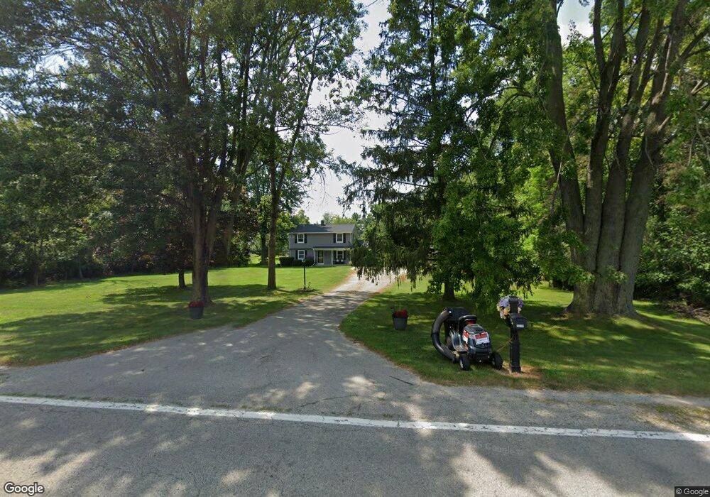
55739 Broughton Rd Macomb, MI 48042
Estimated Value: $307,027 - $399,000
Studio
1
Bath
1,836
Sq Ft
$196/Sq Ft
Est. Value
About This Home
This home is located at 55739 Broughton Rd, Macomb, MI 48042 and is currently estimated at $359,757, approximately $195 per square foot. 55739 Broughton Rd is a home located in Macomb County with nearby schools including New Haven High School and St. Peter Lutheran School.
Ownership History
Date
Name
Owned For
Owner Type
Purchase Details
Closed on
Apr 11, 2003
Sold by
Kondrat Catherine R
Bought by
Kondrat Lawrence P and Kondrat Catherine R
Current Estimated Value
Purchase Details
Closed on
Oct 20, 1994
Sold by
Duynslager Amiel A
Bought by
Konopacki Jayne and Konopacki Catherine
Home Financials for this Owner
Home Financials are based on the most recent Mortgage that was taken out on this home.
Original Mortgage
$86,900
Interest Rate
8.68%
Mortgage Type
New Conventional
Create a Home Valuation Report for This Property
The Home Valuation Report is an in-depth analysis detailing your home's value as well as a comparison with similar homes in the area
Home Values in the Area
Average Home Value in this Area
Purchase History
| Date | Buyer | Sale Price | Title Company |
|---|---|---|---|
| Kondrat Lawrence P | -- | Lawyers Title Insurance Corp | |
| Konopacki Jayne | $105,000 | -- |
Source: Public Records
Mortgage History
| Date | Status | Borrower | Loan Amount |
|---|---|---|---|
| Closed | Konopacki Jayne | $86,900 |
Source: Public Records
Tax History
| Year | Tax Paid | Tax Assessment Tax Assessment Total Assessment is a certain percentage of the fair market value that is determined by local assessors to be the total taxable value of land and additions on the property. | Land | Improvement |
|---|---|---|---|---|
| 2025 | $1,884 | $158,400 | $0 | $0 |
| 2024 | $18 | $143,400 | $0 | $0 |
| 2023 | $1,737 | $124,000 | $0 | $0 |
| 2022 | $2,601 | $115,700 | $0 | $0 |
| 2021 | $2,472 | $105,700 | $0 | $0 |
| 2020 | $1,479 | $93,200 | $0 | $0 |
| 2019 | $2,168 | $92,100 | $0 | $0 |
| 2018 | $2,061 | $95,100 | $0 | $0 |
| 2017 | $2,019 | $92,150 | $39,320 | $52,830 |
| 2016 | $1,912 | $92,140 | $0 | $0 |
| 2015 | $1,917 | $81,390 | $0 | $0 |
| 2014 | $1,917 | $72,370 | $37,210 | $35,160 |
| 2011 | $543 | $81,210 | $44,210 | $37,000 |
Source: Public Records
Map
Nearby Homes
- 19164 Hazelton Dr Unit 80
- 56452 Scotland
- 54568 Ann Dr Unit 37
- 54791 Brenda Dr
- 55144 Saint Paul Dr
- 55203 Saint Paul Dr
- 56543 Hastings Dr
- 18620 Stallmann Dr
- 56508 Topaz Dr
- 56844 Topaz Dr
- 18582 Stallmann Dr
- 55670 Faldo Dr Unit 139
- 55649 Faldo Dr Unit 141
- 18101 Player Dr Unit 151
- 53731 Champlain St
- 18064 Stallman Dr
- 18081 25 Mile Rd
- 18008 Stallman Dr Unit 145
- 54853 Cabrillo Dr
- 18005 Player Dr
- 55767 Broughton Rd
- 55591 Broughton Rd
- 55795 Broughton Rd
- 55711 Broughton Rd
- 55555 Broughton Rd
- 20449 Colby Dr
- 55748 Frost Dr
- 55776 Frost Dr
- 20423 Colby Dr
- 55720 Frost Dr
- 20395 Colby Dr
- 55533 Broughton Rd
- 55692 Frost Dr
- 55710 Broughton Rd
- 55664 Frost Dr
- 55505 Broughton Rd
- 55636 Frost Dr
- 20367 Olden Way Dr
- 55590 Broughton Rd
- 55608 Frost Dr
Your Personal Tour Guide
Ask me questions while you tour the home.