Estimated Value: $267,000 - $286,000
2
Beds
2
Baths
1,376
Sq Ft
$201/Sq Ft
Est. Value
About This Home
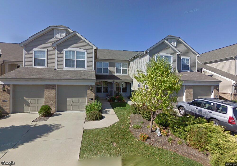
This home is located at 5577 Dockside Dr, Mason, OH 45040 and is currently estimated at $276,278, approximately $200 per square foot. 5577 Dockside Dr is a home located in Warren County with nearby schools including Mason Intermediate Elementary School, Mason Middle School, and William Mason High School.
Ownership History
Date
Name
Owned For
Owner Type
Purchase Details
Closed on
May 1, 2015
Sold by
Bergman Ruth and Mendelsohn Marcie
Bought by
Davidovich Leonid and Zhestkova Ekaterina
Current Estimated Value
Purchase Details
Closed on
Aug 1, 2002
Sold by
Lee Clifford
Bought by
Ser Prudential Res
Purchase Details
Closed on
Dec 11, 2001
Sold by
Fischer Att Homes Ltd
Bought by
Lee Clifford C and Lee Elise S
Home Financials for this Owner
Home Financials are based on the most recent Mortgage that was taken out on this home.
Original Mortgage
$103,180
Interest Rate
6.68%
Mortgage Type
New Conventional
Purchase Details
Closed on
Jul 3, 2001
Sold by
Grand Comm Ltd
Bought by
Fischer Attached Homes
Create a Home Valuation Report for This Property
The Home Valuation Report is an in-depth analysis detailing your home's value as well as a comparison with similar homes in the area
Home Values in the Area
Average Home Value in this Area
Purchase History
| Date | Buyer | Sale Price | Title Company |
|---|---|---|---|
| Davidovich Leonid | -- | Attorney | |
| Ser Prudential Res | $126,000 | -- | |
| Lee Clifford C | $128,980 | -- | |
| Fischer Attached Homes | $206,800 | -- |
Source: Public Records
Mortgage History
| Date | Status | Borrower | Loan Amount |
|---|---|---|---|
| Previous Owner | Lee Clifford C | $103,180 |
Source: Public Records
Tax History
| Year | Tax Paid | Tax Assessment Tax Assessment Total Assessment is a certain percentage of the fair market value that is determined by local assessors to be the total taxable value of land and additions on the property. | Land | Improvement |
|---|---|---|---|---|
| 2025 | $3,347 | $76,870 | $21,000 | $55,870 |
| 2024 | $3,347 | $76,870 | $21,000 | $55,870 |
| 2023 | $3,026 | $58,306 | $8,610 | $49,696 |
| 2022 | $3,026 | $58,307 | $8,610 | $49,697 |
| 2021 | $2,876 | $58,307 | $8,610 | $49,697 |
| 2020 | $2,761 | $47,404 | $7,000 | $40,404 |
| 2019 | $2,563 | $47,404 | $7,000 | $40,404 |
| 2018 | $2,573 | $47,404 | $7,000 | $40,404 |
| 2017 | $2,372 | $40,306 | $6,332 | $33,975 |
| 2016 | $2,438 | $40,306 | $6,332 | $33,975 |
| 2015 | $2,378 | $40,306 | $6,332 | $33,975 |
| 2014 | $2,406 | $37,670 | $5,920 | $31,750 |
| 2013 | $2,411 | $44,560 | $7,000 | $37,560 |
Source: Public Records
Map
Nearby Homes
- 5369 N Shore Place
- 6266 Trailwood Ct
- 6304 Trailwood Ct
- 5576 Winding Cape Way
- 5673 Melbury Ct
- 5641 Melbury Ct
- 4796 White Blossom Blvd
- 6285 Greenwood Ct
- 9018 Boylston St
- 6315 Greenwood Ct
- 9024 Beacon St
- 6713 Quail Lake
- 8588 Charleston Creek Dr
- 6589 Quail Lake
- 7064 Celebration Way
- 7076 Celebration Way
- 7080 Celebration Way
- 7103 Celebration Way
- 7068 Celebration Way
- 9240 Beacon St
- 5577 Dockside Dr
- 5575 Dockside Dr
- 5575 Dockside Dr
- 5573 Dockside Dr Unit 6301
- 5573 Dockside Dr
- 5581 Dockside Dr Unit 6303
- 5581 Dockside Dr
- 5579 Dockside Dr
- 5579 Dockside Dr
- 5571 Dockside Dr Unit 6201
- 5571 Dockside Dr Unit G151
- 5571 Dockside Dr
- 5583 Dockside Dr Unit 6304
- 5583 Dockside Dr Unit G157
- 5583 Dockside Dr
- 5585 Dockside Dr
- 5585 Dockside Dr
- 5633 Dockside Dr Unit 7204
- 5633 Dockside Dr Unit G202
- 5633 Dockside Dr
Your Personal Tour Guide
Ask me questions while you tour the home.