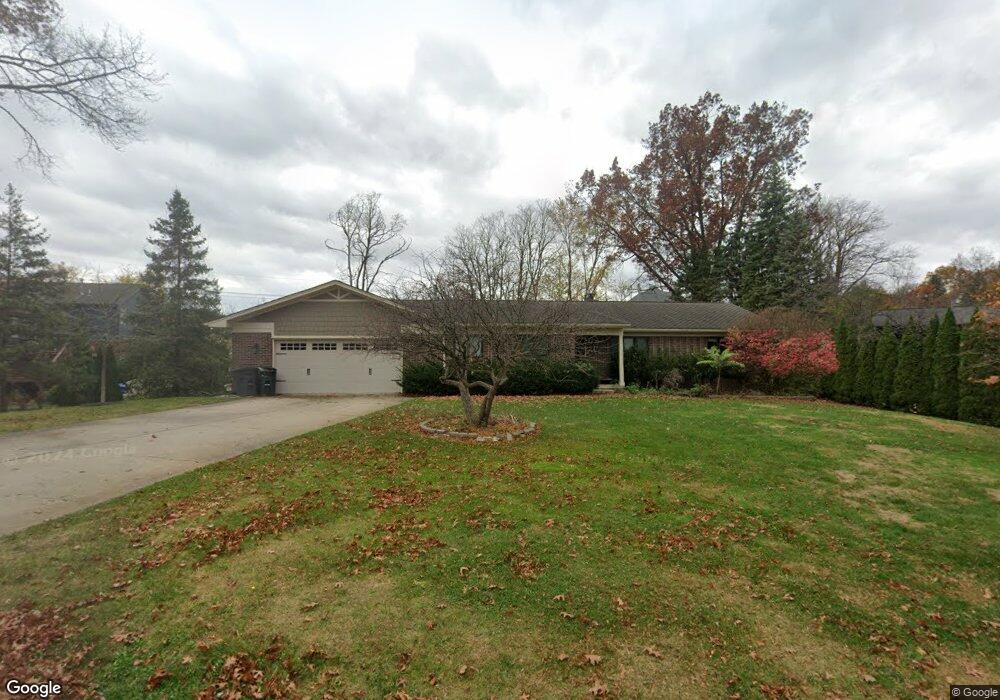
5577 Orchard Grove St West Bloomfield, MI 48323
Estimated Value: $326,000 - $485,000
4
Beds
2
Baths
1,540
Sq Ft
$247/Sq Ft
Est. Value
About This Home
This home is located at 5577 Orchard Grove St, West Bloomfield, MI 48323 and is currently estimated at $380,822, approximately $247 per square foot. 5577 Orchard Grove St is a home located in Oakland County with nearby schools including Walled Lake Central High School, The Susan And Rabbi Harold Loss Ecc, and Brookfield Academy - West Bloomfield.
Ownership History
Date
Name
Owned For
Owner Type
Purchase Details
Closed on
Nov 2, 2020
Sold by
Ploch Jonathon T and Ploch Jenna V
Bought by
George Brandon Jeffrey
Current Estimated Value
Purchase Details
Closed on
Oct 13, 2017
Sold by
Ploch Jonathon T and Ploch Jenna V
Bought by
George Brandon Jeffrey
Purchase Details
Closed on
Mar 9, 2012
Sold by
Ploch Jonathon T and Ploch Jenna V
Bought by
Ploch Jonathon T and Ploch Jenna V
Purchase Details
Closed on
Jan 19, 2010
Sold by
Ploch Jonathon T
Bought by
Ploch Jonathon T
Purchase Details
Closed on
Jul 16, 2009
Sold by
Ploch Jonathon T and Ploch Victor T
Bought by
Ploch Jonathon T
Purchase Details
Closed on
Jun 17, 2009
Sold by
Ploch Carol A and Ploch Victor T
Bought by
Ploch Jonathan T
Create a Home Valuation Report for This Property
The Home Valuation Report is an in-depth analysis detailing your home's value as well as a comparison with similar homes in the area
Home Values in the Area
Average Home Value in this Area
Purchase History
| Date | Buyer | Sale Price | Title Company |
|---|---|---|---|
| George Brandon Jeffrey | $450,000 | Bbc Title Agency | |
| George Brandon Jeffrey | $450,000 | Bbc Title Agency | |
| Ploch Jonathon T | -- | Bbc Title Agency Llc | |
| Ploch Jonathon T | -- | None Available | |
| Ploch Jonathon T | -- | None Available | |
| Ploch Jonathon T | -- | None Available | |
| Ploch Jonathan T | -- | None Available |
Source: Public Records
Tax History Compared to Growth
Tax History
| Year | Tax Paid | Tax Assessment Tax Assessment Total Assessment is a certain percentage of the fair market value that is determined by local assessors to be the total taxable value of land and additions on the property. | Land | Improvement |
|---|---|---|---|---|
| 2024 | $5,296 | $138,130 | $0 | $0 |
| 2022 | $2,837 | $131,970 | $39,150 | $92,820 |
| 2021 | $5,418 | $124,140 | $0 | $0 |
| 2020 | $2,838 | $124,670 | $39,150 | $85,520 |
| 2018 | $4,875 | $137,540 | $38,850 | $98,690 |
| 2015 | -- | $120,420 | $0 | $0 |
| 2014 | -- | $113,220 | $0 | $0 |
| 2011 | -- | $108,230 | $0 | $0 |
Source: Public Records
Map
Nearby Homes
- 4540 Rolling Pine Ct
- 7545/7585 Pontiac Trail
- 7585/7548 Pontiac Trail
- 6140 Pontiac Trail
- 000 Pontiac Trail
- 6100 Pontiac Trail
- 4442 Borland St
- 6675 Langtoft St
- 0000 Langtoft
- 4066 Green Lake Rd
- 6980 Hambro St
- 5994 Glen Eagles Dr
- 3950 Bradmore Ave
- 3965 Carrick Ave
- 3991 Fieldview Ave
- 6978 Colony Dr
- 4335 Crestdale Ave
- 6903 Dandison Blvd
- 6433 Walnut Lake Rd
- 4245 Bunker Ave
- 4520 Deckerland St
- 6415 Lakeshore St
- 6401 Lakeshore St
- 4559 Deckerland St
- 6430 Pontiac Trail
- 4529 Deckerland St
- 6451 Lakeshore St
- 4491 Deckerland St
- 6430 Lakeshore St
- 4479 Deckerland St
- 6400 Lakeshore St
- 6465 Lakeshore St
- 6450 Lakeshore St
- 6390 Lakeshore St
- 4469 Deckerland St
- 6482 Lakeshore St
- 6485 Lakeshore St
- 4455 Deckerland St
- 4857 Woodbine Cir
- 6352 Lakeshore St