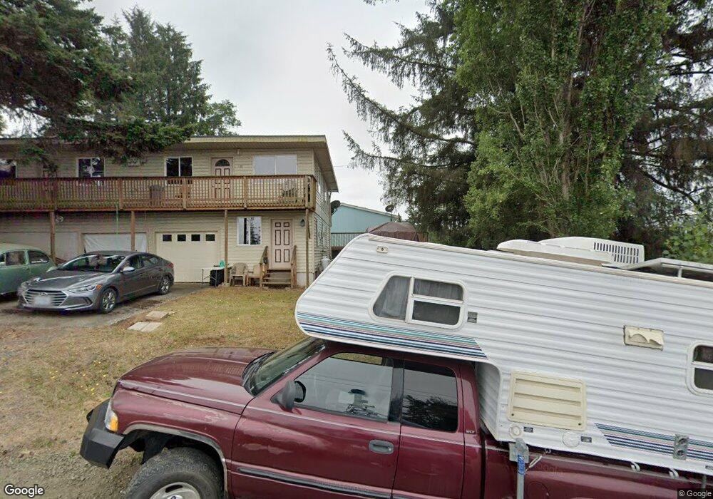
558 11th Ave Unit 1 Coos Bay, OR 97420
Estimated Value: $329,878 - $391,000
3
Beds
2
Baths
1,635
Sq Ft
$220/Sq Ft
Est. Value
About This Home
This home is located at 558 11th Ave Unit 1, Coos Bay, OR 97420 and is currently estimated at $360,439, approximately $220 per square foot. 558 11th Ave Unit 1 is a home located in Coos County with nearby schools including Eastside School, Millicoma School, and Marshfield Senior High School.
Ownership History
Date
Name
Owned For
Owner Type
Purchase Details
Closed on
Aug 27, 2012
Sold by
Brown Cheryl L
Bought by
Brown Cheryl
Current Estimated Value
Home Financials for this Owner
Home Financials are based on the most recent Mortgage that was taken out on this home.
Original Mortgage
$92,000
Outstanding Balance
$62,963
Interest Rate
3.49%
Mortgage Type
New Conventional
Estimated Equity
$297,476
Purchase Details
Closed on
Sep 21, 2006
Sold by
Bubrick Paul Dennis
Bought by
Brown Cheryl Louise
Create a Home Valuation Report for This Property
The Home Valuation Report is an in-depth analysis detailing your home's value as well as a comparison with similar homes in the area
Purchase History
| Date | Buyer | Sale Price | Title Company |
|---|---|---|---|
| Brown Cheryl | -- | Ticor Title Company | |
| Brown Cheryl Louise | -- | None Available |
Source: Public Records
Mortgage History
| Date | Status | Borrower | Loan Amount |
|---|---|---|---|
| Open | Brown Cheryl | $92,000 |
Source: Public Records
Tax History
| Year | Tax Paid | Tax Assessment Tax Assessment Total Assessment is a certain percentage of the fair market value that is determined by local assessors to be the total taxable value of land and additions on the property. | Land | Improvement |
|---|---|---|---|---|
| 2025 | $1,837 | $107,180 | -- | -- |
| 2024 | $1,809 | $104,060 | -- | -- |
| 2023 | $1,754 | $101,030 | $0 | $0 |
| 2022 | $1,725 | $98,090 | $0 | $0 |
| 2021 | $1,681 | $95,240 | $0 | $0 |
| 2020 | $1,633 | $95,240 | $0 | $0 |
| 2019 | $1,568 | $89,780 | $0 | $0 |
| 2018 | $1,514 | $87,170 | $0 | $0 |
| 2017 | $1,342 | $84,640 | $0 | $0 |
| 2016 | $1,274 | $82,180 | $0 | $0 |
| 2015 | $1,243 | $79,790 | $0 | $0 |
| 2014 | $1,238 | $78,230 | $0 | $0 |
Source: Public Records
Map
Nearby Homes
- 859 E St
- 0 Shon-Sta Way
- 1376 D St
- 0 7th Ct
- 0 17th Ave Unit 2600 24400970
- 322 5th Ave
- 770 18th Ave
- 460 2nd Ave
- 235 1st Ave
- 63586 Isthmus Heights Rd
- 62885 Isthmus Heights Rd
- 62348 Olive Barber Rd
- 62251 Olive Barber Rd
- 63776 Flanagan Rd
- 93720 Adams Ln
- 63505 2nd Street Loop
- 63503 Third Rd
- 0 20th Ln
- 0 Flanagan Rd
- 63474 3rd Rd
Your Personal Tour Guide
Ask me questions while you tour the home.