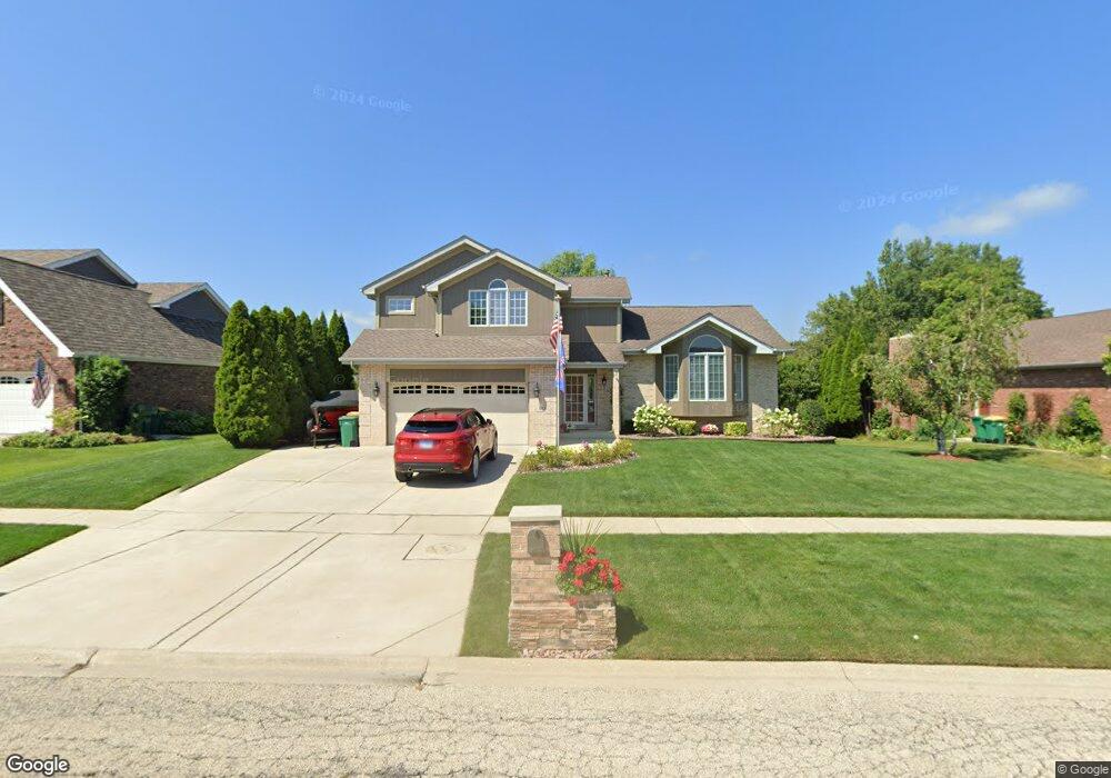
558 Carriage Ridge Ln Lemont, IL 60439
Northeast Lemont NeighborhoodEstimated Value: $605,946 - $658,000
4
Beds
3
Baths
2,134
Sq Ft
$297/Sq Ft
Est. Value
About This Home
This home is located at 558 Carriage Ridge Ln, Lemont, IL 60439 and is currently estimated at $633,737, approximately $296 per square foot. 558 Carriage Ridge Ln is a home located in Cook County with nearby schools including Oakwood School, River Valley School, and Old Quarry Middle School.
Ownership History
Date
Name
Owned For
Owner Type
Purchase Details
Closed on
Apr 15, 2022
Sold by
Komperda Andrew J and Komperda Donna E
Bought by
Komperda Donna E and Komperda Andrew J
Current Estimated Value
Purchase Details
Closed on
Nov 10, 2021
Sold by
Komperda Andrew J and Komperda Donna E
Bought by
Donna E Komperda 2021 Living Trust and Komperda
Create a Home Valuation Report for This Property
The Home Valuation Report is an in-depth analysis detailing your home's value as well as a comparison with similar homes in the area
Home Values in the Area
Average Home Value in this Area
Purchase History
| Date | Buyer | Sale Price | Title Company |
|---|---|---|---|
| Komperda Donna E | -- | -- | |
| Donna E Komperda 2021 Living Trust | -- | Overmann Michael |
Source: Public Records
Tax History Compared to Growth
Tax History
| Year | Tax Paid | Tax Assessment Tax Assessment Total Assessment is a certain percentage of the fair market value that is determined by local assessors to be the total taxable value of land and additions on the property. | Land | Improvement |
|---|---|---|---|---|
| 2024 | $9,286 | $43,312 | $7,098 | $36,214 |
| 2023 | $7,910 | $48,000 | $7,098 | $40,902 |
| 2022 | $7,910 | $35,999 | $6,279 | $29,720 |
| 2021 | $7,689 | $35,999 | $6,279 | $29,720 |
| 2020 | $7,824 | $35,999 | $6,279 | $29,720 |
| 2019 | $7,129 | $34,253 | $6,279 | $27,974 |
| 2018 | $7,011 | $34,253 | $6,279 | $27,974 |
| 2017 | $7,404 | $36,413 | $6,279 | $30,134 |
| 2016 | $6,117 | $28,407 | $5,187 | $23,220 |
| 2015 | $6,617 | $30,236 | $5,187 | $25,049 |
| 2014 | $6,693 | $30,236 | $5,187 | $25,049 |
| 2013 | $6,525 | $31,334 | $5,187 | $26,147 |
Source: Public Records
Map
Nearby Homes
- 1170 Mccarthy Rd
- 11716 Center Dr
- 14517 Albany Ave
- 1216 Country Ln
- 611 Houston St
- 1297 Mccarthy Rd
- 11174 Tuscany Ln
- 12183 Morandi Ct
- 12185 Morandi Ct
- 1200 Leinster Dr
- 12444 Killarney Dr
- 1156 Covington Dr
- 614 Czacki St
- 700 Czacki St
- 8 Division Ct
- 1078 Amber Dr
- 523 Talcott Ave
- 1249 Cronin Ct
- Fremont Plan at Covington Knolls
- Briarcliffe Plan at Covington Knolls
- 548 Carriage Ridge Ln
- 568 Carriage Ridge Ln
- 561 Kromray Rd
- 578 Carriage Ridge Ln
- 538 Carriage Ridge Ln
- 538 Carriage Ridge Ln Unit 1
- 551 Kromray Rd
- 547 Carriage Ridge Ln
- 1008 Coach Ln
- 571 Kromray Rd
- 541 Kromray Rd
- 588 Carriage Ridge Ln
- 528 Carriage Ridge Ln
- 1010 Blacksmith Ln
- 1021 Coach Ln
- 1012 Coach Ln
- 581 Kromray Rd
- 1021 119th St
- 531 Kromray Rd
- 518 Carriage Ridge Ln