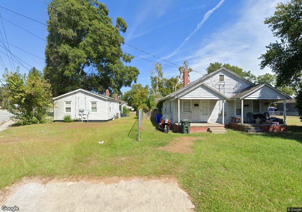
558 Davenport St Greenville, NC 27834
Estimated Value: $232,000 - $439,951
4
Beds
3
Baths
2,451
Sq Ft
$149/Sq Ft
Est. Value
About This Home
This home is located at 558 Davenport St, Greenville, NC 27834 and is currently estimated at $366,238, approximately $149 per square foot. 558 Davenport St is a home located in Pitt County with nearby schools including Creekside Elementary School, A.G. Cox Middle School, and South Central High School.
Ownership History
Date
Name
Owned For
Owner Type
Purchase Details
Closed on
Jul 3, 2018
Sold by
D&J Baker Holdings Llc
Bought by
Davenport Darren and Davenport Carla
Current Estimated Value
Purchase Details
Closed on
Jun 17, 2008
Sold by
Edwards Lori A
Bought by
Davenport Darren E and Davenport Carla C
Purchase Details
Closed on
Jun 11, 2008
Sold by
Davenport Rebecca E
Bought by
Edwards Lori A
Create a Home Valuation Report for This Property
The Home Valuation Report is an in-depth analysis detailing your home's value as well as a comparison with similar homes in the area
Home Values in the Area
Average Home Value in this Area
Purchase History
| Date | Buyer | Sale Price | Title Company |
|---|---|---|---|
| Davenport Darren | -- | -- | |
| Davenport Darren E | -- | None Available | |
| Edwards Lori A | -- | None Available | |
| Davenport Darren E | -- | None Available | |
| Edwards Donna L | -- | None Available | |
| Davenport Darren E | -- | None Available | |
| Edwards Carl L | -- | None Available | |
| Davenport Darren E | -- | None Available |
Source: Public Records
Tax History Compared to Growth
Tax History
| Year | Tax Paid | Tax Assessment Tax Assessment Total Assessment is a certain percentage of the fair market value that is determined by local assessors to be the total taxable value of land and additions on the property. | Land | Improvement |
|---|---|---|---|---|
| 2025 | $4,438 | $446,463 | $65,100 | $381,363 |
| 2024 | $4,426 | $446,463 | $65,100 | $381,363 |
| 2023 | $3,328 | $272,358 | $35,100 | $237,258 |
| 2022 | $3,316 | $272,358 | $35,100 | $237,258 |
| 2021 | $3,316 | $272,358 | $35,100 | $237,258 |
| 2020 | $3,393 | $272,358 | $35,100 | $237,258 |
| 2019 | $3,393 | $265,340 | $35,100 | $230,240 |
| 2018 | $3,298 | $265,340 | $35,100 | $230,240 |
| 2017 | $3,298 | $265,340 | $35,100 | $230,240 |
| 2016 | $3,271 | $265,340 | $35,100 | $230,240 |
| 2015 | $3,190 | $271,527 | $46,250 | $225,277 |
| 2014 | $3,190 | $259,900 | $46,250 | $213,650 |
Source: Public Records
Map
Nearby Homes
- 520 Huff Dr
- 2420 Bray Ct
- 2409 Bray Ct
- 4316 Davencroft Village Dr
- 2601 Rhinestone Dr
- 4304 Davencroft Village Dr
- 2104 Rhinestone Dr
- 2201 Rhinestone Dr
- 2375 Vineyard Dr Unit H6
- 2313 Saddleback Dr Unit B
- 2441 Surry Ln
- 2324 Rhinestone Dr
- 2341 Rhinestone Dr
- Turner Plan at Davenport Farms
- Jordan Plan at Davenport Farms
- Sumner Plan at Davenport Farms
- Bradley Plan at Davenport Farms
- Rockbridge Plan at Davenport Farms
- Dakota Plan at Davenport Farms
- Dunley Plan at Davenport Farms
- 558 Davenport Farm Rd
- 547 Davenport St
- 563 Davenport St
- 516 Davenport Farm Rd
- 606 Davenport Farm Rd
- 599 Davenport Farm Rd
- 2213 Woodridge Dr
- 2231 Woodridge Dr
- 505 Cliff Ct
- 620 Davenport Farm Rd
- 535 Davenport Farm Rd
- 535 Davenport Farm Rd
- 2243 Woodridge Dr
- 507 Cliff Ct
- 503 Cliff Ct
- 2208 Woodridge Dr
- 2251 Woodridge Dr
- 509 Cliff Ct
- 2226 Woodridge Dr
- 630 Davenport Farm Rd