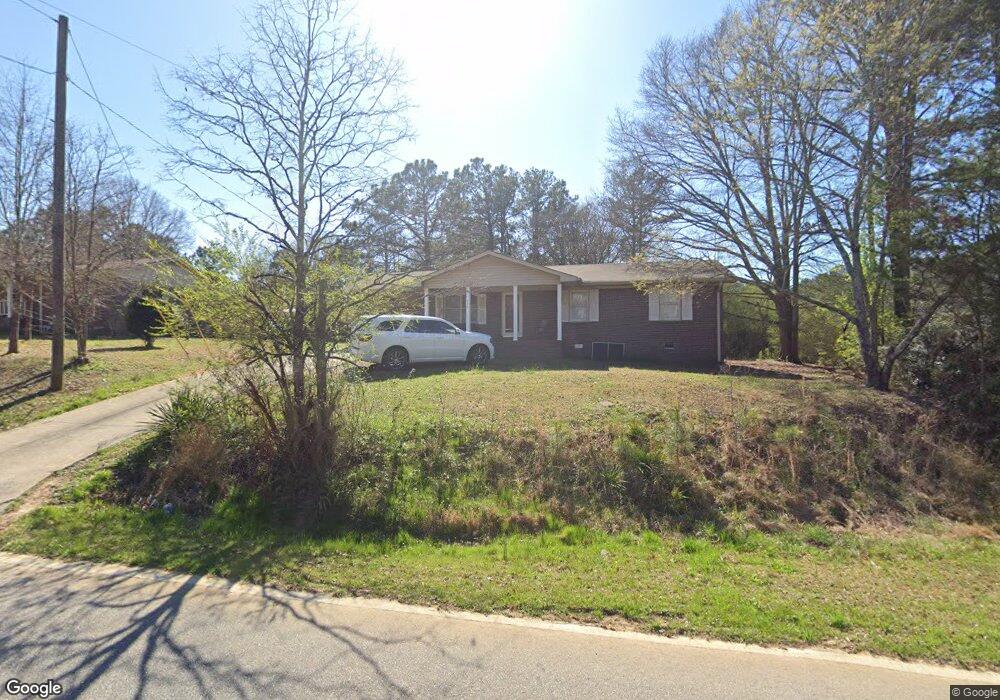
558 E Point Rd Cedartown, GA 30125
Estimated Value: $159,200 - $218,000
3
Beds
1
Bath
1,167
Sq Ft
$160/Sq Ft
Est. Value
About This Home
This home is located at 558 E Point Rd, Cedartown, GA 30125 and is currently estimated at $187,300, approximately $160 per square foot. 558 E Point Rd is a home located in Polk County with nearby schools including Cedar Christian School and Vineyard Harvester Christian Academy.
Ownership History
Date
Name
Owned For
Owner Type
Purchase Details
Closed on
Feb 25, 1992
Sold by
Farmers Home Admn
Bought by
Cox Carl R
Current Estimated Value
Purchase Details
Closed on
Mar 5, 1991
Sold by
Farmers Home Admn
Bought by
United States Americ
Purchase Details
Closed on
Jun 4, 1982
Sold by
Forsyth Dan
Bought by
Sewell Geraldine D
Purchase Details
Closed on
Apr 3, 1981
Sold by
Appley Richard D
Bought by
Forsyth Dan
Purchase Details
Closed on
Mar 16, 1981
Sold by
Salmon Noel E
Bought by
Appley Richard D
Purchase Details
Closed on
Dec 5, 1972
Sold by
Williams Edna D and Winn Marceline C
Bought by
Salmon Noel E
Purchase Details
Closed on
Mar 28, 1958
Sold by
Williams J B
Bought by
Williams Mrs Edna D and Mrs Marceline
Purchase Details
Closed on
Nov 30, 1957
Sold by
Sproull R B
Bought by
Williams J B
Create a Home Valuation Report for This Property
The Home Valuation Report is an in-depth analysis detailing your home's value as well as a comparison with similar homes in the area
Purchase History
| Date | Buyer | Sale Price | Title Company |
|---|---|---|---|
| Cox Carl R | $16,000 | -- | |
| United States Americ | -- | -- | |
| Sewell Geraldine D | -- | -- | |
| Forsyth Dan | -- | -- | |
| Appley Richard D | -- | -- | |
| Salmon Noel E | -- | -- | |
| Williams Mrs Edna D | -- | -- | |
| Williams J B | -- | -- |
Source: Public Records
Tax History
| Year | Tax Paid | Tax Assessment Tax Assessment Total Assessment is a certain percentage of the fair market value that is determined by local assessors to be the total taxable value of land and additions on the property. | Land | Improvement |
|---|---|---|---|---|
| 2025 | $843 | $37,488 | $1,815 | $35,673 |
| 2024 | $772 | $36,911 | $1,238 | $35,673 |
| 2023 | $558 | $23,504 | $1,238 | $22,266 |
| 2022 | $468 | $19,740 | $825 | $18,915 |
| 2021 | $475 | $19,740 | $825 | $18,915 |
| 2020 | $476 | $19,740 | $825 | $18,915 |
| 2019 | $517 | $19,252 | $825 | $18,427 |
| 2018 | $515 | $18,671 | $825 | $17,846 |
| 2017 | $508 | $18,671 | $825 | $17,846 |
| 2016 | $528 | $19,398 | $1,552 | $17,846 |
| 2015 | $534 | $19,557 | $1,552 | $18,005 |
| 2014 | $538 | $19,557 | $1,552 | $18,005 |
Source: Public Records
Map
Nearby Homes
- 0 Coaling Rd Unit 9221-D 10352096
- 0 Coaling Rd Unit 9221-C 10352086
- 0 Coaling Rd Unit 9221 10352063
- 0 Coaling Rd Unit 9221-B 10352079
- 873 E Point Rd
- 202 Ridgewood Rd
- 305 Greenview Ct
- 10 Woodglen Dr
- 00 Juliette St
- 0 Woodall Rd Unit 7730884
- 0 Woodall Rd Unit 10705831
- 117 Hicklen Dr
- 1101 East Ave
- 232 Tuck St
- 206 Turner St
- 645 Valley Rd
- 427 Park St
- 117 Cason Rd
- 55 Lovvorn Rd
- 65 Oakwood Dr
- 568 E Point Rd
- 578 E Point Rd
- 603 E Point Rd
- 40 Hutto Rd
- 624 E Point Rd
- 634 E Point Rd
- 1118 Hutto Rd
- 644 E Point Rd
- 1029 Hutto Rd
- 457 E Point Rd
- 654 E Point Rd
- 1023 Hutto Rd
- 664 E Point Rd
- 412 E E Point Rd
- 674 E Point Rd
- 0 Coaling Rd
- 0 Coaling Rd Unit 7460783
- 0 Coaling Rd Unit 7319399
- 0 Coaling Rd Unit R8-1133 8972438
- 0 Coaling Rd Unit 8308697
Your Personal Tour Guide
Ask me questions while you tour the home.