Estimated Value: $118,000 - $201,000
3
Beds
1
Bath
1,472
Sq Ft
$104/Sq Ft
Est. Value
About This Home
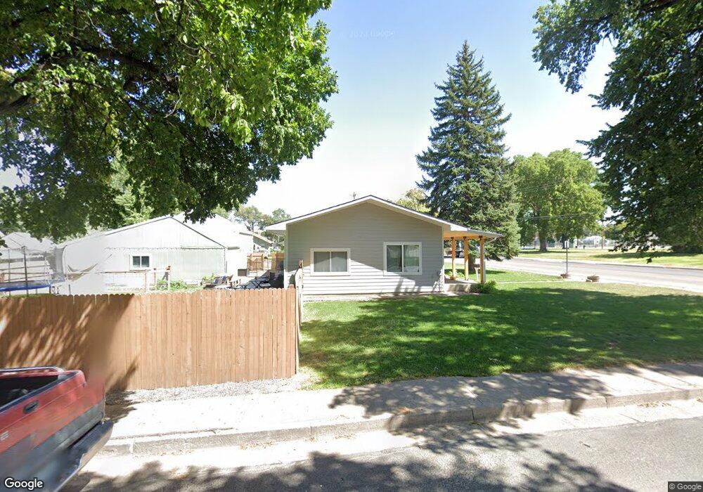
This home is located at 558 Emerson St, Yuma, CO 80759 and is currently estimated at $152,734, approximately $103 per square foot. 558 Emerson St is a home located in Yuma County with nearby schools including Wray Elementary School, Buchanan Middle School, and Wray Junior/Senior High School.
Ownership History
Date
Name
Owned For
Owner Type
Purchase Details
Closed on
Oct 27, 2011
Sold by
Fannie Mae
Bought by
Rosales Manuel A and Rosales Cynthia M
Current Estimated Value
Home Financials for this Owner
Home Financials are based on the most recent Mortgage that was taken out on this home.
Original Mortgage
$20,000
Outstanding Balance
$13,678
Interest Rate
4.08%
Mortgage Type
Purchase Money Mortgage
Estimated Equity
$139,056
Purchase Details
Closed on
Jun 1, 2011
Sold by
Pittman Ellen Lousie
Bought by
Financial Freedom Senior Funding Corp
Create a Home Valuation Report for This Property
The Home Valuation Report is an in-depth analysis detailing your home's value as well as a comparison with similar homes in the area
Home Values in the Area
Average Home Value in this Area
Purchase History
| Date | Buyer | Sale Price | Title Company |
|---|---|---|---|
| Rosales Manuel A | $25,000 | None Available | |
| Financial Freedom Senior Funding Corp | -- | None Available |
Source: Public Records
Mortgage History
| Date | Status | Borrower | Loan Amount |
|---|---|---|---|
| Open | Rosales Manuel A | $20,000 |
Source: Public Records
Tax History Compared to Growth
Tax History
| Year | Tax Paid | Tax Assessment Tax Assessment Total Assessment is a certain percentage of the fair market value that is determined by local assessors to be the total taxable value of land and additions on the property. | Land | Improvement |
|---|---|---|---|---|
| 2024 | $189 | $1,980 | $0 | $0 |
| 2023 | $189 | $6,730 | $796 | $5,934 |
| 2022 | $180 | $4,826 | $796 | $4,030 |
| 2021 | $423 | $4,826 | $796 | $4,030 |
| 2020 | $393 | $4,493 | $796 | $3,697 |
| 2019 | $401 | $4,493 | $796 | $3,697 |
| 2018 | $377 | $3,760 | $0 | $0 |
| 2017 | $335 | $3,760 | $0 | $0 |
| 2016 | $353 | $3,970 | $0 | $0 |
| 2015 | $293 | $3,970 | $0 | $0 |
| 2014 | $293 | $3,690 | $0 | $0 |
| 2013 | $293 | $3,690 | $0 | $0 |
Source: Public Records
Map
Nearby Homes
- 549 Emerson St
- 526 Emerson St
- 731 W 9th St
- 820 Grant St Unit D
- 820 Grant St Unit E
- 820 Grant St Unit G
- 541 W 5th St
- G4 Grant St Unit G4
- 734 W 8th St
- 841 Dexter St
- 742 W 9th St
- 924 Grant St
- 410 Clay St Unit 9
- TBD Dexter St Unit Lot B
- 440 Blake St
- 1021 Grant St
- 1124 W 7th St
- 1037 Cottonwood Dr
- 18124 U S Highway 385
- 30342 Us Highway 34