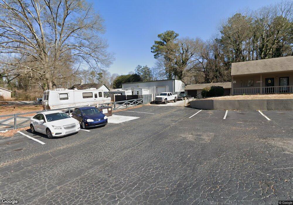
5581 Davis Dr Austell, GA 30106
Estimated Value: $238,000 - $324,000
3
Beds
1
Bath
2,871
Sq Ft
$95/Sq Ft
Est. Value
About This Home
This home is located at 5581 Davis Dr, Austell, GA 30106 and is currently estimated at $272,775, approximately $95 per square foot. 5581 Davis Dr is a home located in Cobb County with nearby schools including Mableton Elementary School, Garrett Middle School, and South Cobb High School.
Ownership History
Date
Name
Owned For
Owner Type
Purchase Details
Closed on
Jan 29, 2016
Sold by
D&G Capital Holding Llc
Bought by
Lutz John and Lutz Olga
Current Estimated Value
Purchase Details
Closed on
Aug 6, 2013
Sold by
Preventative Maintenance S
Bought by
D&G Capital Holdings Llc
Purchase Details
Closed on
Aug 12, 2004
Sold by
Sibley Realty Inc
Bought by
Preventative Maintenance Svcs Ll
Home Financials for this Owner
Home Financials are based on the most recent Mortgage that was taken out on this home.
Original Mortgage
$155,000
Interest Rate
5.97%
Mortgage Type
Commercial
Purchase Details
Closed on
Jul 2, 2002
Sold by
West Adrian
Bought by
Sibley Rty Inc
Purchase Details
Closed on
Nov 14, 1997
Sold by
Sibley Realty Inc
Bought by
West Adrian
Home Financials for this Owner
Home Financials are based on the most recent Mortgage that was taken out on this home.
Original Mortgage
$65,000
Interest Rate
7.27%
Mortgage Type
Seller Take Back
Create a Home Valuation Report for This Property
The Home Valuation Report is an in-depth analysis detailing your home's value as well as a comparison with similar homes in the area
Home Values in the Area
Average Home Value in this Area
Purchase History
| Date | Buyer | Sale Price | Title Company |
|---|---|---|---|
| Lutz John | $115,000 | -- | |
| D&G Capital Holdings Llc | -- | -- | |
| Preventative Maintenance Svcs Ll | $175,000 | -- | |
| Sibley Rty Inc | $63,642 | -- | |
| West Adrian | $75,000 | -- |
Source: Public Records
Mortgage History
| Date | Status | Borrower | Loan Amount |
|---|---|---|---|
| Previous Owner | Preventative Maintenance Svcs Ll | $155,000 | |
| Previous Owner | West Adrian | $65,000 |
Source: Public Records
Tax History
| Year | Tax Paid | Tax Assessment Tax Assessment Total Assessment is a certain percentage of the fair market value that is determined by local assessors to be the total taxable value of land and additions on the property. | Land | Improvement |
|---|---|---|---|---|
| 2025 | $1,925 | $70,864 | $33,808 | $37,056 |
| 2024 | $1,925 | $70,864 | $33,808 | $37,056 |
| 2023 | $1,925 | $70,864 | $33,808 | $37,056 |
Source: Public Records
Map
Nearby Homes
- 5425 Davis Dr
- 0 Dogwood Cir Unit 10666145
- 0 Dogwood Cir Unit 7671035
- 0 Dogwood Cir Unit 10630776
- 0 Dogwood Cir Unit 7697362
- 5590 Lakeview Dr SW
- 1676 Veterans Memorial Hwy SW
- 5466 Davis Dr
- 0 Harris St Unit 7719748
- 1841 Mobley St
- 5489 Janet Ln
- 5320 Beth Dr
- 5474 June Dr SW
- 5410 Beth Dr
- 5472 June Dr SW
- 5804 S Gordon Rd
- 5393 Janet Ln
- 1995 Oak Ct
- 1628 Pendley Dr
- 1995 Matt Dr
- 1753 Spring Rd
- 1748 Spring Rd
- 1738 Spring Rd
- 5553 Davis Dr
- 1734 Spring Rd Unit 1738
- 1734 Spring Rd
- 1743 Spring Rd
- 1760 Veterans Memorial Hwy SW
- 1744 Spring Rd
- 1750 Veterans Memorial Hwy
- 5551 Davis Dr
- 5578 Davis Dr
- 1733 Spring Rd
- 5549 Davis Dr Unit 5555
- 1728 Spring Rd
- 1742 Veterans Memorial Hwy
- 1723 Spring Rd
- 5556 Davis Dr
- 5585 Harris St
- 1722 Veterans Memorial Hwy
Your Personal Tour Guide
Ask me questions while you tour the home.