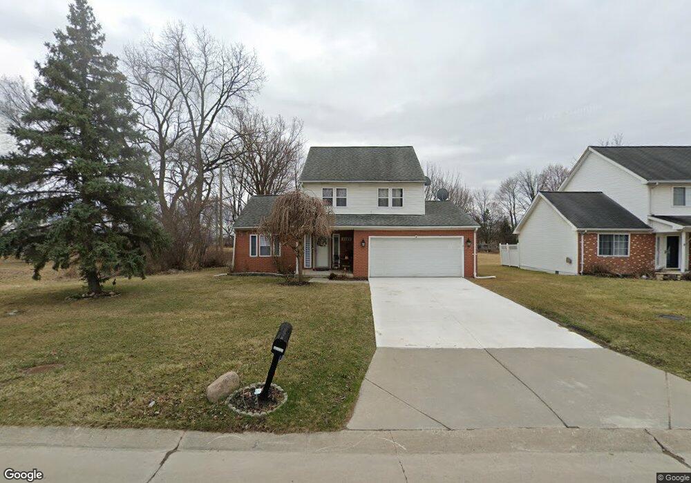
5582 Branch St Sterling Heights, MI 48310
Estimated Value: $330,738 - $377,000
3
Beds
3
Baths
1,644
Sq Ft
$218/Sq Ft
Est. Value
About This Home
This home is located at 5582 Branch St, Sterling Heights, MI 48310 and is currently estimated at $357,935, approximately $217 per square foot. 5582 Branch St is a home located in Macomb County with nearby schools including Schuchard Elementary School, Frank Jeannette Junior High School, and Adlai Stevenson High School.
Ownership History
Date
Name
Owned For
Owner Type
Purchase Details
Closed on
Jul 18, 2012
Sold by
Abdulahad Saher D and Yousif Asma
Bought by
Abdulahad Saher D and Yousif Asma
Current Estimated Value
Home Financials for this Owner
Home Financials are based on the most recent Mortgage that was taken out on this home.
Original Mortgage
$155,834
Outstanding Balance
$107,008
Interest Rate
3.56%
Mortgage Type
New Conventional
Estimated Equity
$250,927
Purchase Details
Closed on
Feb 19, 2009
Sold by
Citimortgage Inc
Bought by
Abdulahad Saher D and Yousif Asma
Purchase Details
Closed on
Mar 15, 2004
Sold by
Kattoula Latif and Kattoula Shatha
Bought by
Abdulahad Saher D and Yousif Asma
Purchase Details
Closed on
Aug 5, 1996
Sold by
Emerald Const Of Mi
Bought by
Kattoula L and Kattoula S
Create a Home Valuation Report for This Property
The Home Valuation Report is an in-depth analysis detailing your home's value as well as a comparison with similar homes in the area
Home Values in the Area
Average Home Value in this Area
Purchase History
| Date | Buyer | Sale Price | Title Company |
|---|---|---|---|
| Abdulahad Saher D | -- | 1St Choice Title Services In | |
| Abdulahad Saher D | -- | None Available | |
| Abdulahad Saher D | $196,000 | -- | |
| Kattoula L | $142,000 | -- |
Source: Public Records
Mortgage History
| Date | Status | Borrower | Loan Amount |
|---|---|---|---|
| Open | Abdulahad Saher D | $155,834 |
Source: Public Records
Tax History Compared to Growth
Tax History
| Year | Tax Paid | Tax Assessment Tax Assessment Total Assessment is a certain percentage of the fair market value that is determined by local assessors to be the total taxable value of land and additions on the property. | Land | Improvement |
|---|---|---|---|---|
| 2025 | $3,190 | $141,900 | $0 | $0 |
| 2024 | $2,917 | $133,100 | $0 | $0 |
| 2023 | $2,754 | $120,200 | $0 | $0 |
| 2022 | $2,871 | $97,900 | $0 | $0 |
| 2021 | $2,812 | $94,500 | $0 | $0 |
| 2020 | $2,508 | $91,800 | $0 | $0 |
| 2019 | $2,398 | $89,700 | $0 | $0 |
| 2018 | $2,598 | $83,500 | $0 | $0 |
| 2017 | $2,482 | $79,300 | $18,000 | $61,300 |
| 2016 | $2,398 | $79,300 | $0 | $0 |
| 2015 | -- | $73,500 | $0 | $0 |
| 2014 | -- | $64,600 | $0 | $0 |
Source: Public Records
Map
Nearby Homes
- 5573 Branch St
- 40058 Fraser Dr
- 5118 Fredrick Dr
- 39329 Hyland Dr
- 5477 Victory Cir Unit 70
- 38968 Harrison Dr
- 5055 Scarsdale Dr
- 5294 Argyle Ct
- 4768 Dreon Ct
- 4726 Harrow Ct
- 4539 Carlton Rd
- 38638 Harrison Dr
- 40166 Kristen Dr
- 40663 Drury Rd
- 40665 Drury Rd
- 40034 Kristen Dr
- 40116 Steel Dr
- 40444 Harmon Dr
- 4732 Ardmore Dr
- 4622 Ardmore Dr
- 5568 Branch St
- 5540 Branch St
- 5595 Branch St
- 0 Branch St
- 5607 Branch St
- 39765 Mound Rd
- 5530 Branch St
- 39791 Mound Rd
- 39735 Mound Rd
- 5555 Branch St
- 5521 Branch St
- 5521 Branch St
- 5521 Branch St Unit 5521 Branch St
- 5543 Branch St
- 5520 Branch St
- 39705 Mound Rd
- 39675 Mound Rd
- 5531 Gardner St E
- 39645 Mound Rd
- 5507 Branch St