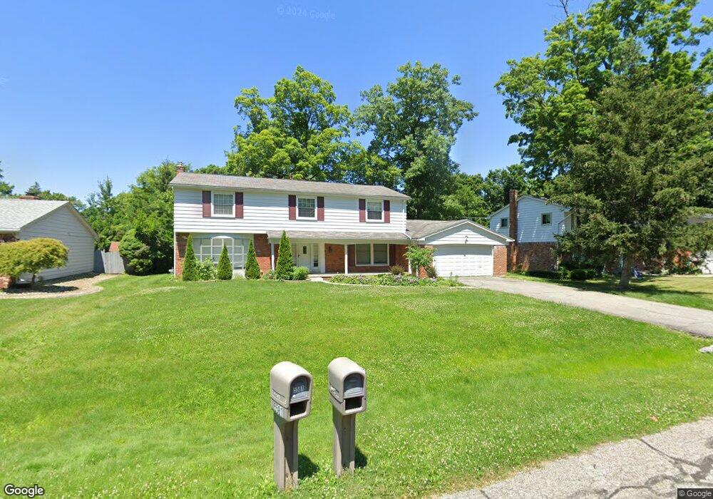
5582 Northcote Unit Bldg-Unit West Bloomfield, MI 48322
Estimated Value: $410,000 - $481,000
4
Beds
3
Baths
2,912
Sq Ft
$157/Sq Ft
Est. Value
About This Home
This home is located at 5582 Northcote Unit Bldg-Unit, West Bloomfield, MI 48322 and is currently estimated at $456,467, approximately $156 per square foot. 5582 Northcote Unit Bldg-Unit is a home located in Oakland County with nearby schools including Wood Creek Elementary School, Warner Upper Elementary School, and Bloomfield Maples Montessori.
Ownership History
Date
Name
Owned For
Owner Type
Purchase Details
Closed on
Apr 13, 2018
Sold by
The Rank Of New York Mellon
Bought by
Kallabat John and Kallabat Jameela
Current Estimated Value
Purchase Details
Closed on
Aug 30, 2016
Sold by
Harris Michele D and Harris Eddie V
Bought by
The Bank Of New York Mellon and The Bank Of New York
Purchase Details
Closed on
Sep 15, 2005
Sold by
Smith Robert W and Smith Marcia A
Bought by
Harris Eddie V and Harris Michele D
Home Financials for this Owner
Home Financials are based on the most recent Mortgage that was taken out on this home.
Original Mortgage
$241,200
Interest Rate
6.99%
Mortgage Type
Fannie Mae Freddie Mac
Create a Home Valuation Report for This Property
The Home Valuation Report is an in-depth analysis detailing your home's value as well as a comparison with similar homes in the area
Home Values in the Area
Average Home Value in this Area
Purchase History
| Date | Buyer | Sale Price | Title Company |
|---|---|---|---|
| Kallabat John | $225,704 | Premium Title Services Inc | |
| The Bank Of New York Mellon | $164,143 | None Available | |
| Harris Eddie V | $301,500 | Capital Title Ins Agency |
Source: Public Records
Mortgage History
| Date | Status | Borrower | Loan Amount |
|---|---|---|---|
| Previous Owner | Harris Eddie V | $241,200 | |
| Closed | Harris Eddie V | $60,300 |
Source: Public Records
Tax History Compared to Growth
Tax History
| Year | Tax Paid | Tax Assessment Tax Assessment Total Assessment is a certain percentage of the fair market value that is determined by local assessors to be the total taxable value of land and additions on the property. | Land | Improvement |
|---|---|---|---|---|
| 2024 | $4,496 | $204,220 | $0 | $0 |
| 2022 | $4,287 | $167,410 | $39,990 | $127,420 |
| 2021 | $7,752 | $156,710 | $0 | $0 |
| 2020 | $4,036 | $159,100 | $39,850 | $119,250 |
| 2018 | $4,591 | $132,540 | $28,880 | $103,660 |
| 2015 | -- | $102,080 | $0 | $0 |
| 2014 | -- | $90,000 | $0 | $0 |
| 2011 | -- | $83,790 | $0 | $0 |
Source: Public Records
Map
Nearby Homes
- 7023 Wild Ridge Ln
- 7027 Beverly Crest Dr
- 6769 Heather Heath
- 7335 Coach Ln
- 6843 Leslee Crest Dr
- 7421 Heather Heath
- 6624 Mellow Wood Ln
- 7251 N Briarcliff Knoll Dr
- 7477 Heather Heath
- 7431 N Briarcliff Knoll Dr
- 30515 W 14 Mile Rd Unit 30
- 30515 W 14 Mile Rd Unit 37
- 30475 W 14 Mile Rd Unit 80
- 30475 W 14 Mile Rd Unit 95
- 7496 Cornwall Ct
- 6564 Alderley Way
- 5312 Cambourne Place
- 4392 Gateway Cir Unit 59
- 6651 Hearthside Ct Unit 1
- 6621 Bellows Ct Unit 62
- 5582 Northcote
- 5576 Northcote
- 5588 Northcote Ln
- 5588 Northcote
- 5583 Wild Ridge Ln
- 5575 Wild Ridge Ln
- 5570 Northcote
- 5575 Northcote
- 5581 Northcote
- 5594 Northcote
- 5591 Wild Ridge Ln
- 5569 Northcote
- 5567 Wild Ridge Ln
- 5587 Northcote
- 5564 Northcote
- 5599 Wild Ridge Ln
- 5559 Wild Ridge Ln
- 5578 Normanhurst
- 5572 Normanhurst
- 5563 Northcote