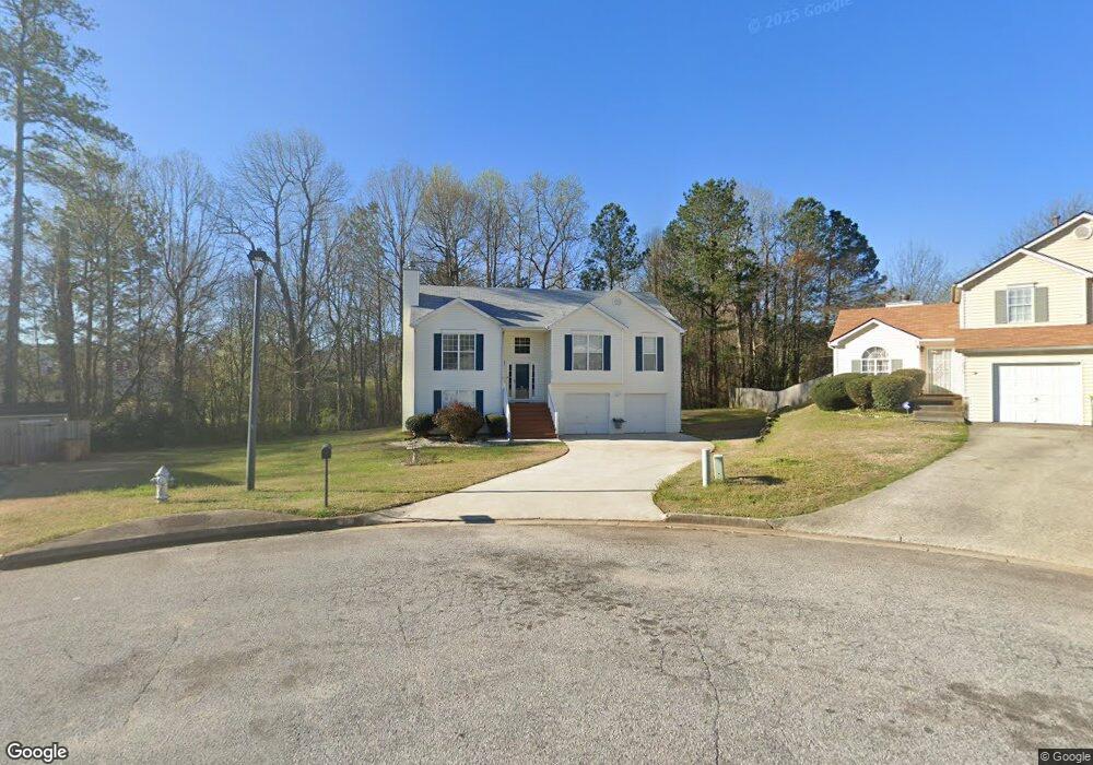
5583 Ben Ln Unit 2 Ellenwood, GA 30294
Estimated Value: $243,000 - $340,866
3
Beds
2
Baths
1,369
Sq Ft
$197/Sq Ft
Est. Value
About This Home
This home is located at 5583 Ben Ln Unit 2, Ellenwood, GA 30294 and is currently estimated at $270,217, approximately $197 per square foot. 5583 Ben Ln Unit 2 is a home located in Clayton County with nearby schools including Thurgood Marshall Elementary School, Morrow Middle School, and Morrow High School.
Ownership History
Date
Name
Owned For
Owner Type
Purchase Details
Closed on
Mar 30, 2001
Sold by
Gt Architecture Contractors Corp
Bought by
Manchurian Robert D and Manchurian Diana
Current Estimated Value
Home Financials for this Owner
Home Financials are based on the most recent Mortgage that was taken out on this home.
Original Mortgage
$129,536
Outstanding Balance
$47,645
Interest Rate
6.99%
Mortgage Type
FHA
Estimated Equity
$222,572
Create a Home Valuation Report for This Property
The Home Valuation Report is an in-depth analysis detailing your home's value as well as a comparison with similar homes in the area
Home Values in the Area
Average Home Value in this Area
Purchase History
| Date | Buyer | Sale Price | Title Company |
|---|---|---|---|
| Manchurian Robert D | $130,000 | -- |
Source: Public Records
Mortgage History
| Date | Status | Borrower | Loan Amount |
|---|---|---|---|
| Open | Manchurian Robert D | $129,536 |
Source: Public Records
Tax History Compared to Growth
Tax History
| Year | Tax Paid | Tax Assessment Tax Assessment Total Assessment is a certain percentage of the fair market value that is determined by local assessors to be the total taxable value of land and additions on the property. | Land | Improvement |
|---|---|---|---|---|
| 2024 | $1,858 | $103,760 | $8,800 | $94,960 |
| 2023 | $3,641 | $100,840 | $8,800 | $92,040 |
| 2022 | $1,398 | $80,640 | $8,800 | $71,840 |
| 2021 | $1,180 | $68,560 | $8,800 | $59,760 |
| 2020 | $1,182 | $67,231 | $8,800 | $58,431 |
| 2019 | $1,126 | $62,812 | $6,400 | $56,412 |
| 2018 | $884 | $51,063 | $6,400 | $44,663 |
| 2017 | $724 | $41,745 | $6,400 | $35,345 |
| 2016 | $455 | $29,299 | $6,400 | $22,899 |
| 2015 | $447 | $0 | $0 | $0 |
| 2014 | $401 | $28,136 | $6,400 | $21,736 |
Source: Public Records
Map
Nearby Homes
- 0 Old Rex Morrow Rd Unit 7659496
- 0 Old Rex Morrow Rd Unit 10616003
- 5753 Gum Ct
- 2635 Luke Dr
- 5712 Wesson Dr Unit 2
- 2850 Amerson Trail
- 5790 Twain Dr
- 5871 Dan Dr
- 5838 Highway 42
- 2811 Appaloosa Run
- 2436 Rex Rd
- 2382 Old Rex Morrow Rd
- 0 Poplar Ave Unit 10580022
- 0 Poplar Ave Unit 10481115
- 0 Poplar Ave Unit 7543163
- 2820 Rex Rd
- 6020 Cristie Dr
- 2247 Cypress Ave
- 2276 Santa fe St Unit 19
- 6010 Fieldcrest Dr
- 5579 Ben Ln
- 5582 Ben Ln Unit 2
- 5573 Ben Ln Unit 2
- 2696 Lolli Ct Unit 2
- 5576 Ben Ln Unit 2
- 2687 Deann Dr
- 2695 Deann Dr Unit 2
- 2704 Lolli Ct Unit 2
- 2703 Deann Dr
- 5599 Brenston Ln
- 2690 Lolli Ct Unit 2
- 2679 Deann Dr
- 2711 Deann Dr Unit 2
- 2712 Lolli Ct
- 5607 Brenston Ln Unit 2
- 5565 Brenston Way
- 5571 Brenston Way Unit 2
- 2700 Brenston Dr Unit 2
- 5596 Brenston Ln
- 2708 Brenston Dr