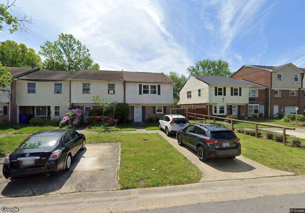
5585 New Colony Dr Virginia Beach, VA 23464
Estimated Value: $269,975 - $308,000
3
Beds
2
Baths
1,340
Sq Ft
$211/Sq Ft
Est. Value
About This Home
This home is located at 5585 New Colony Dr, Virginia Beach, VA 23464 and is currently estimated at $283,244, approximately $211 per square foot. 5585 New Colony Dr is a home located in Virginia Beach City with nearby schools including Fairfield Elementary School, Kempsville Middle School, and Tallwood High School.
Ownership History
Date
Name
Owned For
Owner Type
Purchase Details
Closed on
May 30, 2012
Sold by
Secretary Of Veterans Affairs
Bought by
Versic Michael R
Current Estimated Value
Home Financials for this Owner
Home Financials are based on the most recent Mortgage that was taken out on this home.
Original Mortgage
$112,955
Outstanding Balance
$78,077
Interest Rate
3.85%
Mortgage Type
VA
Estimated Equity
$205,167
Purchase Details
Closed on
Jan 20, 2012
Sold by
Prfsnl Foreclosure Corp Of Va and Bradshaw William A
Bought by
Secretary Of Veterans Affairs
Purchase Details
Closed on
Oct 21, 2008
Sold by
Cuartas Victor H
Bought by
Bradshaw William A
Home Financials for this Owner
Home Financials are based on the most recent Mortgage that was taken out on this home.
Original Mortgage
$172,552
Interest Rate
5.94%
Mortgage Type
New Conventional
Purchase Details
Closed on
Oct 24, 2002
Sold by
Ginn Elmer S
Bought by
Cuartas Victor H
Home Financials for this Owner
Home Financials are based on the most recent Mortgage that was taken out on this home.
Original Mortgage
$83,230
Interest Rate
6.09%
Create a Home Valuation Report for This Property
The Home Valuation Report is an in-depth analysis detailing your home's value as well as a comparison with similar homes in the area
Home Values in the Area
Average Home Value in this Area
Purchase History
| Date | Buyer | Sale Price | Title Company |
|---|---|---|---|
| Versic Michael R | $118,900 | -- | |
| Secretary Of Veterans Affairs | $114,569 | -- | |
| Bradshaw William A | $169,900 | -- | |
| Cuartas Victor H | $83,900 | -- |
Source: Public Records
Mortgage History
| Date | Status | Borrower | Loan Amount |
|---|---|---|---|
| Open | Versic Michael R | $112,955 | |
| Previous Owner | Bradshaw William A | $172,552 | |
| Previous Owner | Cuartas Victor H | $83,230 |
Source: Public Records
Tax History Compared to Growth
Tax History
| Year | Tax Paid | Tax Assessment Tax Assessment Total Assessment is a certain percentage of the fair market value that is determined by local assessors to be the total taxable value of land and additions on the property. | Land | Improvement |
|---|---|---|---|---|
| 2025 | $2,386 | $260,900 | $95,000 | $165,900 |
| 2024 | $2,386 | $246,000 | $95,000 | $151,000 |
| 2023 | $2,096 | $211,700 | $75,000 | $136,700 |
| 2022 | $1,934 | $195,400 | $70,000 | $125,400 |
| 2021 | $1,359 | $137,300 | $45,000 | $92,300 |
| 2020 | $1,372 | $134,800 | $42,500 | $92,300 |
| 2019 | $1,346 | $124,700 | $40,000 | $84,700 |
| 2018 | $1,250 | $124,700 | $40,000 | $84,700 |
| 2017 | $1,250 | $124,700 | $40,000 | $84,700 |
| 2016 | $1,174 | $118,600 | $39,000 | $79,600 |
| 2015 | $1,157 | $116,900 | $39,000 | $77,900 |
| 2014 | $1,017 | $110,800 | $49,200 | $61,600 |
Source: Public Records
Map
Nearby Homes
- 928 Old Homestead Ln
- 928 Richland Dr
- 813 Oglesby Ct
- 881 Strickland Blvd
- 5448 Todd St
- 5317 Chabot Way
- 1032 Taylor Rd
- 609 Avalon Ave
- 738 Driskill Ct
- 5304 Gale Dr
- 700 Achilles Ct
- 1104 Derken Ct
- 764 Woodstock Rd
- 5805 Sherman Ct
- 5809 Sherman Ct
- 5817 Sherman Ct
- 5821 Sherman Ct
- 5825 Sherman Ct
- 5829 Sherman Ct
- 945 Lord Dunmore Dr
- 5583 New Colony Dr
- 5587 New Colony Dr
- 5581 New Colony Dr
- 5589 New Colony Dr
- 5579 New Colony Dr
- 5591 New Colony Dr
- 5577 New Colony Dr
- 5593 New Colony Dr
- 5575 New Colony Dr
- 5544 Old Providence Rd
- 5595 New Colony Dr
- 5573 New Colony Dr
- 5548 Old Providence Rd
- 5597 New Colony Dr
- 5571 New Colony Dr
- 5599 New Colony Dr
- 5572 New Colony Dr
- 5570 New Colony Dr
- 5574 New Colony Dr
- 5576 New Colony Dr