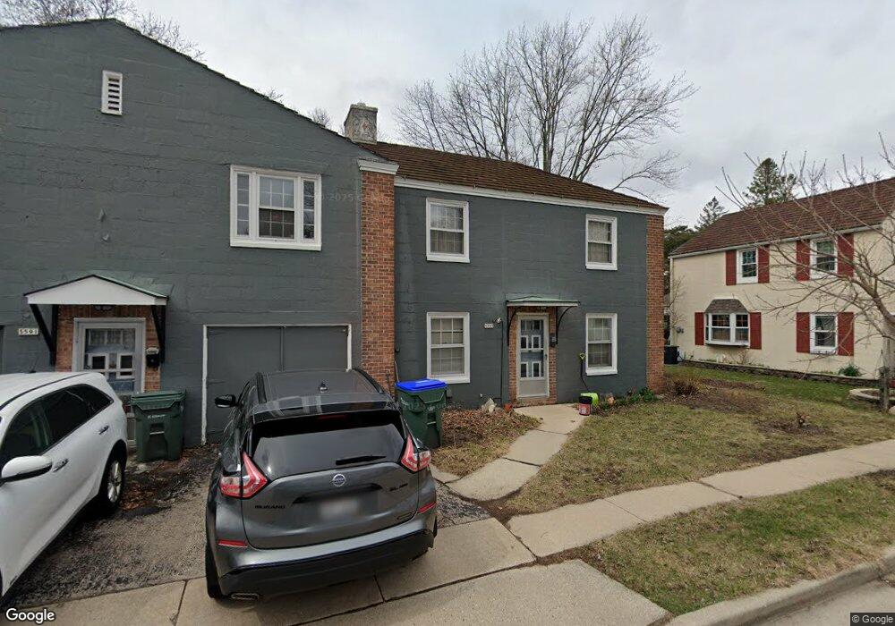
5589 Butternut Ct Unit 9 Greendale, WI 53129
Estimated Value: $434,000 - $803,000
--
Bed
--
Bath
3,536
Sq Ft
$162/Sq Ft
Est. Value
About This Home
This home is located at 5589 Butternut Ct Unit 9, Greendale, WI 53129 and is currently estimated at $572,960, approximately $162 per square foot. 5589 Butternut Ct Unit 9 is a home located in Milwaukee County with nearby schools including Canterbury Elementary School, Greendale Middle School, and Greendale High School.
Ownership History
Date
Name
Owned For
Owner Type
Purchase Details
Closed on
Dec 30, 2019
Sold by
Halwas Brian D and Halwas Lynn R
Bought by
Halwas Brian D
Current Estimated Value
Purchase Details
Closed on
Dec 1, 2019
Sold by
Halwas Brian D
Bought by
Butternutct Llc
Purchase Details
Closed on
Dec 31, 2004
Sold by
Riesen John H and Riesen Jeanne M
Bought by
Halwas Brian D and Halwas Lynn R
Home Financials for this Owner
Home Financials are based on the most recent Mortgage that was taken out on this home.
Original Mortgage
$464,700
Interest Rate
5.71%
Mortgage Type
Purchase Money Mortgage
Create a Home Valuation Report for This Property
The Home Valuation Report is an in-depth analysis detailing your home's value as well as a comparison with similar homes in the area
Home Values in the Area
Average Home Value in this Area
Purchase History
| Date | Buyer | Sale Price | Title Company |
|---|---|---|---|
| Halwas Brian D | -- | None Available | |
| Butternutct Llc | -- | None Available | |
| Halwas Brian D | $583,000 | -- |
Source: Public Records
Mortgage History
| Date | Status | Borrower | Loan Amount |
|---|---|---|---|
| Previous Owner | Halwas Brian D | $464,700 |
Source: Public Records
Tax History Compared to Growth
Tax History
| Year | Tax Paid | Tax Assessment Tax Assessment Total Assessment is a certain percentage of the fair market value that is determined by local assessors to be the total taxable value of land and additions on the property. | Land | Improvement |
|---|---|---|---|---|
| 2024 | $6,964 | $382,600 | $66,300 | $316,300 |
| 2023 | $7,764 | $363,000 | $66,300 | $296,700 |
| 2022 | $7,142 | $363,000 | $66,300 | $296,700 |
| 2021 | $7,897 | $281,000 | $59,200 | $221,800 |
| 2020 | $7,147 | $281,000 | $59,200 | $221,800 |
| 2019 | $8,134 | $281,000 | $59,200 | $221,800 |
| 2018 | $6,725 | $281,000 | $59,200 | $221,800 |
| 2017 | $6,153 | $242,700 | $56,900 | $185,800 |
| 2016 | $6,122 | $242,700 | $56,900 | $185,800 |
| 2015 | $6,595 | $250,200 | $56,900 | $193,300 |
| 2014 | $6,567 | $250,200 | $56,900 | $193,300 |
| 2013 | $7,169 | $250,200 | $56,900 | $193,300 |
Source: Public Records
Map
Nearby Homes
- 5905 Dendron Ln
- 6190 W Loomis Rd
- 5491 Laura Ln
- 7316 Earl Ave
- 5619 Exeter St
- 5221 W Loomis Rd Unit 5221
- 6230 W College Ave Unit 29
- 5241 S 51st St
- 5005 W Loomis Rd
- 4731 W Abbott Ave
- 4739 W Edgerton Ave
- 5818 Riverside Dr
- 4848 S 76th St
- 6210 Fisher Ln
- 4300 W Grange Ave Unit 8
- 4343 W Mallory Ave
- 4225 W Grange Ave Unit 4225
- 6980 Horizon Dr
- 8201 Fairmont Ln
- 7701 W Barnard Ave
- 5588 Butternut Ct
- 5590 Butternut Ct Unit 2
- 5592 Butternut Ct Unit 3
- 5586 Butternut Ct
- 5594 Butternut Ct Unit 9
- 5595 Butternut Ct Unit 9
- 5587 Butternut Ct
- 5593 Bluebird Ct
- 5599 Bluebird Ct
- 5594 Bluebird Ct Unit 9
- 5595 Bluebird Ct Unit 9
- 5597 Bluebird Ct
- 5588 Balsam Ct Unit 9
- 5582 Balsam Ct Unit 8
- 5582 Balsam Ct Unit 5584-5586
- 5582 Balsam Ct
- 5594 Balsam Ct Unit 9
- 5513 Brandon St
- 5600 Berry Ct
- 5601 Beaver Ct