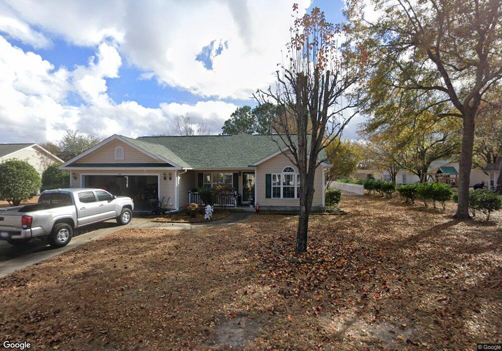
559 Crusade Cir Conway, SC 29526
Estimated Value: $278,000 - $328,000
3
Beds
2
Baths
1,539
Sq Ft
$197/Sq Ft
Est. Value
About This Home
This home is located at 559 Crusade Cir, Conway, SC 29526 and is currently estimated at $303,924, approximately $197 per square foot. 559 Crusade Cir is a home located in Horry County with nearby schools including Palmetto Bays Elementary School, Black Water Middle School, and Carolina Forest High School.
Ownership History
Date
Name
Owned For
Owner Type
Purchase Details
Closed on
Oct 28, 2004
Sold by
Frontier Home Developers Inc
Bought by
Fraleigh Kenneth A and Fraleigh Kathleen A
Current Estimated Value
Home Financials for this Owner
Home Financials are based on the most recent Mortgage that was taken out on this home.
Original Mortgage
$111,050
Outstanding Balance
$53,007
Interest Rate
5.65%
Mortgage Type
Purchase Money Mortgage
Estimated Equity
$250,917
Purchase Details
Closed on
Dec 31, 2003
Sold by
Godwin Donald D
Bought by
Frontier Home Developers Inc
Create a Home Valuation Report for This Property
The Home Valuation Report is an in-depth analysis detailing your home's value as well as a comparison with similar homes in the area
Home Values in the Area
Average Home Value in this Area
Purchase History
| Date | Buyer | Sale Price | Title Company |
|---|---|---|---|
| Fraleigh Kenneth A | $138,850 | -- | |
| Frontier Home Developers Inc | $28,500 | -- | |
| Godwin Donald D | $28,500 | -- |
Source: Public Records
Mortgage History
| Date | Status | Borrower | Loan Amount |
|---|---|---|---|
| Open | Fraleigh Kenneth A | $111,050 |
Source: Public Records
Tax History
| Year | Tax Paid | Tax Assessment Tax Assessment Total Assessment is a certain percentage of the fair market value that is determined by local assessors to be the total taxable value of land and additions on the property. | Land | Improvement |
|---|---|---|---|---|
| 2025 | $620 | $0 | $0 | $0 |
| 2024 | $620 | $19,325 | $5,265 | $14,060 |
| 2023 | $620 | $6,759 | $1,186 | $5,573 |
| 2021 | $540 | $11,226 | $1,992 | $9,234 |
| 2020 | $459 | $11,226 | $1,992 | $9,234 |
| 2019 | $459 | $11,226 | $1,992 | $9,234 |
| 2018 | $392 | $8,816 | $1,532 | $7,284 |
| 2017 | $377 | $8,816 | $1,532 | $7,284 |
| 2016 | -- | $8,816 | $1,532 | $7,284 |
| 2015 | $377 | $8,817 | $1,533 | $7,284 |
| 2014 | $349 | $8,817 | $1,533 | $7,284 |
Source: Public Records
Map
Nearby Homes
- 800 Riverbirch Dr
- 761 Drawbridge Dr Unit CASTLEWOOD
- 973 Castlewood Dr
- 2208 Blair Ct
- 2043 Palm Meadows Way Unit Lot 102
- 1127 Lancelot Ln
- 2047 Palm Meadows Way Unit Lot 103
- 104 Persivant Dr
- 1011 Rudder Ct
- 1008 Oak Meadow Dr Unit Lot 105
- 153 Myrtle Grande Dr
- 101 Peninsula Ct
- 936 Woodwinds Dr
- 945 Woodwinds Dr
- 3599 Ashridge Way
- 208 Myrtle Grande Dr
- 380 Myrtle Meadows Dr Unit 473A
- 382 Myrtle Meadows Dr Unit 473B
- 384 Myrtle Meadows Dr Unit 473C
- 386 Myrtle Meadows Dr Unit 473D
- 557 Crusade Cir
- 558 Crusade Cir
- 561 Crusade Cir
- 555 Crusade Cir
- 567 Crusade Cir
- 562 Crusade Cir
- 560 Crusade Cir
- 560 Crusade Cir Unit Castlewood
- 554 Crusade Cir
- 547 Crusade Cir
- 564 Crusade Cir
- 545 Crusade Cir
- 566 Crusade Cir
- 568 Crusade Cir
- 568 Crusade Cir Unit CASTLEWOOD
- 571 Crusade Cir
- 552 Crusade Cir
- 303 Blenheim Ct
- 305 Blenheim Ct
- 301 Blenheim Ct Unit Corner of Blenheim a
Your Personal Tour Guide
Ask me questions while you tour the home.