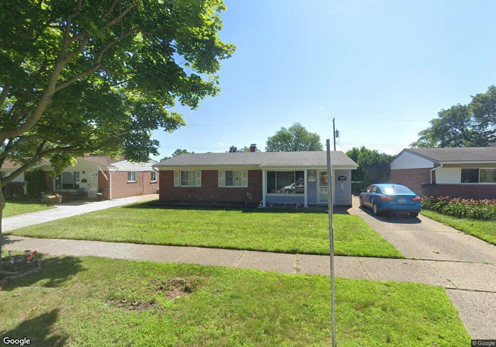
559 Darwin St Westland, MI 48186
Estimated Value: $225,950 - $258,000
4
Beds
1
Bath
1,425
Sq Ft
$167/Sq Ft
Est. Value
About This Home
This home is located at 559 Darwin St, Westland, MI 48186 and is currently estimated at $237,738, approximately $166 per square foot. 559 Darwin St is a home located in Wayne County with nearby schools including Wildwood Elementary School, Marshall Upper Elementary School, and John Glenn High School.
Ownership History
Date
Name
Owned For
Owner Type
Purchase Details
Closed on
Aug 28, 2008
Sold by
Sandack Alanna L and Haggerty Timothy
Bought by
Alvarez Maria
Current Estimated Value
Purchase Details
Closed on
Apr 27, 2000
Sold by
Ladda Skinner
Bought by
Alanna L Sandack
Create a Home Valuation Report for This Property
The Home Valuation Report is an in-depth analysis detailing your home's value as well as a comparison with similar homes in the area
Home Values in the Area
Average Home Value in this Area
Purchase History
| Date | Buyer | Sale Price | Title Company |
|---|---|---|---|
| Alvarez Maria | $113,000 | Multiple | |
| Alanna L Sandack | $114,000 | -- |
Source: Public Records
Tax History Compared to Growth
Tax History
| Year | Tax Paid | Tax Assessment Tax Assessment Total Assessment is a certain percentage of the fair market value that is determined by local assessors to be the total taxable value of land and additions on the property. | Land | Improvement |
|---|---|---|---|---|
| 2025 | $2,250 | $103,200 | $0 | $0 |
| 2024 | $2,250 | $97,400 | $0 | $0 |
| 2023 | $2,149 | $85,800 | $0 | $0 |
| 2022 | $2,503 | $77,100 | $0 | $0 |
| 2021 | $2,440 | $71,800 | $0 | $0 |
| 2020 | $2,413 | $65,100 | $0 | $0 |
| 2019 | $2,326 | $61,200 | $0 | $0 |
| 2018 | $1,741 | $51,300 | $0 | $0 |
| 2017 | $827 | $50,500 | $0 | $0 |
| 2016 | $2,225 | $50,600 | $0 | $0 |
| 2015 | $4,310 | $47,430 | $0 | $0 |
| 2013 | $4,175 | $42,700 | $0 | $0 |
| 2012 | $2,066 | $44,970 | $0 | $0 |
Source: Public Records
Map
Nearby Homes
- 711 S Hawthorne St
- 366 S Wildwood St
- 451 Darwin St
- 34114 Avondale St
- 232 S Wildwood St
- 34728 Somerset St
- 284 S Byfield St
- 357 S Dobson St
- 34465 Fairchild St
- 344 S Christine
- 123 N Hawthorne St
- 754 Alvin St
- 34553 Hazelwood St
- 34610 School St
- 35193 Sansburn St
- 33532 Leona St
- 360 van Sull St
- 00000 Cherry Hill Rd
- 183 Daniel Ave Unit 6
- 1631 Ackley Ave