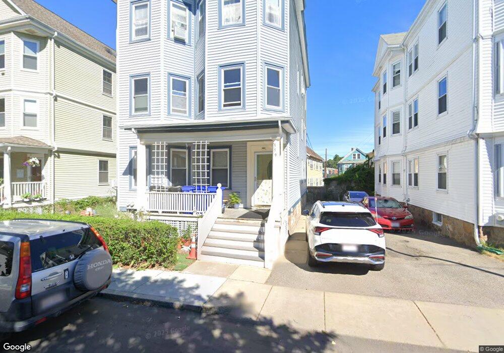
559 Heath St Chestnut Hill, MA 02467
Chestnut Hill NeighborhoodEstimated Value: $1,812,000 - $2,502,000
8
Beds
3
Baths
4,008
Sq Ft
$533/Sq Ft
Est. Value
About This Home
This home is located at 559 Heath St, Chestnut Hill, MA 02467 and is currently estimated at $2,135,333, approximately $532 per square foot. 559 Heath St is a home located in Norfolk County with nearby schools including Heath Elementary School, Brimmer & May School, and The Chestnut Hill School.
Ownership History
Date
Name
Owned For
Owner Type
Purchase Details
Closed on
Nov 1, 2012
Sold by
Lycourgos Sofocles G and Lycourgos Dorothy S
Bought by
Lycourgos Dorothy S
Current Estimated Value
Purchase Details
Closed on
Dec 29, 1986
Bought by
Lycourgos Dorothy S
Create a Home Valuation Report for This Property
The Home Valuation Report is an in-depth analysis detailing your home's value as well as a comparison with similar homes in the area
Home Values in the Area
Average Home Value in this Area
Purchase History
| Date | Buyer | Sale Price | Title Company |
|---|---|---|---|
| Lycourgos Dorothy S | -- | -- | |
| Lycourgos Dorothy S | -- | -- |
Source: Public Records
Mortgage History
| Date | Status | Borrower | Loan Amount |
|---|---|---|---|
| Previous Owner | Lycourgos Dorothy S | $100,000 | |
| Previous Owner | Lycourgos Dorothy S | $121,000 | |
| Previous Owner | Lycourgos Dorothy S | $100,000 | |
| Previous Owner | Lycourgos Dorothy S | $100,000 |
Source: Public Records
Tax History Compared to Growth
Tax History
| Year | Tax Paid | Tax Assessment Tax Assessment Total Assessment is a certain percentage of the fair market value that is determined by local assessors to be the total taxable value of land and additions on the property. | Land | Improvement |
|---|---|---|---|---|
| 2025 | $15,197 | $1,539,700 | $600,400 | $939,300 |
| 2024 | $15,332 | $1,569,300 | $577,300 | $992,000 |
| 2023 | $15,186 | $1,523,200 | $524,100 | $999,100 |
| 2022 | $14,783 | $1,450,700 | $499,100 | $951,600 |
| 2021 | $13,670 | $1,394,900 | $479,900 | $915,000 |
| 2020 | $12,979 | $1,373,400 | $436,300 | $937,100 |
| 2019 | $12,256 | $1,308,000 | $415,500 | $892,500 |
| 2018 | $12,136 | $1,282,900 | $413,400 | $869,500 |
| 2017 | $11,736 | $1,187,900 | $390,000 | $797,900 |
| 2016 | $11,178 | $1,072,700 | $364,400 | $708,300 |
| 2015 | $10,415 | $975,200 | $340,600 | $634,600 |
| 2014 | $10,481 | $920,200 | $309,600 | $610,600 |
Source: Public Records
Map
Nearby Homes
- 3 Glenoe Rd
- 0 Glenoe Rd
- 76 Norfolk Rd
- 15 Glenland Rd
- 11 Hammond Pond Pkwy Unit 3
- 33 Hammond Pond Pkwy Unit 2
- 1014 Boylston St
- 321 Hammond Pond Pkwy Unit 103
- 321 Hammond Pond Pkwy Unit 301
- 138 Woodland Rd
- 335 Heath St
- 771 Heath St Unit 771
- 809-811 Heath St Unit 811
- 799 Heath St Unit 2
- 811 Heath St
- 174 Middlesex Rd
- 5 Heathwood Ln
- 130 Cabot St
- 85 Gate House Rd
- 142 Crafts Rd
- 559 Heath St Unit 2
- 563 Heath St Unit 1
- 563 Heath St Unit 3
- 563 Heath St Unit 2
- 563 Heath St Unit 3,1
- 557 Heath St
- 557 Heath St Unit 1
- 557 Heath St Unit 2
- 557 Heath St Unit 3
- 26 Sheafe St Unit 1
- 26 Sheafe St
- 26 Sheafe St
- 26 Sheafe St Unit 2
- 26 Sheafe St Unit B
- 22 Sheafe St Unit 2
- 22 Sheafe St
- 30 Sheafe St Unit 1
- 30 Sheafe St
- 30 Sheafe St
- 30 Sheafe St Unit sheafe st