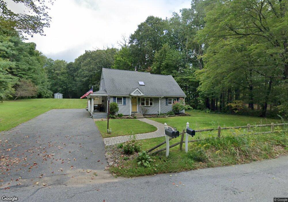
559 Leadmine Rd Sturbridge, MA 01566
Estimated Value: $400,000 - $545,000
2
Beds
1
Bath
1,899
Sq Ft
$244/Sq Ft
Est. Value
About This Home
This home is located at 559 Leadmine Rd, Sturbridge, MA 01566 and is currently estimated at $463,735, approximately $244 per square foot. 559 Leadmine Rd is a home located in Worcester County with nearby schools including Burgess Elementary School, Tantasqua Regional Junior High School, and Tantasqua Regional High School.
Ownership History
Date
Name
Owned For
Owner Type
Purchase Details
Closed on
May 6, 2002
Sold by
Flament Molly J
Bought by
Harvey Kimberly M and Harvey Jamie Lee
Current Estimated Value
Purchase Details
Closed on
Oct 29, 1999
Sold by
Hoffey James J
Bought by
Flament Molly J
Create a Home Valuation Report for This Property
The Home Valuation Report is an in-depth analysis detailing your home's value as well as a comparison with similar homes in the area
Home Values in the Area
Average Home Value in this Area
Purchase History
| Date | Buyer | Sale Price | Title Company |
|---|---|---|---|
| Harvey Kimberly M | $180,000 | -- | |
| Flament Molly J | $148,000 | -- |
Source: Public Records
Mortgage History
| Date | Status | Borrower | Loan Amount |
|---|---|---|---|
| Open | Flament Molly J | $25,000 | |
| Open | Flament Molly J | $160,000 |
Source: Public Records
Tax History Compared to Growth
Tax History
| Year | Tax Paid | Tax Assessment Tax Assessment Total Assessment is a certain percentage of the fair market value that is determined by local assessors to be the total taxable value of land and additions on the property. | Land | Improvement |
|---|---|---|---|---|
| 2025 | $5,489 | $344,600 | $76,400 | $268,200 |
| 2024 | $5,270 | $319,600 | $75,000 | $244,600 |
| 2023 | $4,964 | $274,700 | $65,500 | $209,200 |
| 2022 | $4,776 | $249,400 | $59,400 | $190,000 |
| 2021 | $4,335 | $227,900 | $56,700 | $171,200 |
| 2020 | $4,335 | $227,900 | $56,700 | $171,200 |
| 2019 | $4,056 | $211,800 | $58,400 | $153,400 |
| 2018 | $3,896 | $200,400 | $55,600 | $144,800 |
| 2017 | $3,705 | $191,000 | $53,400 | $137,600 |
| 2016 | $3,594 | $187,100 | $51,800 | $135,300 |
| 2015 | $3,544 | $184,200 | $51,800 | $132,400 |
Source: Public Records
Map
Nearby Homes
- 17 Vinton Rd
- 99 Breakneck Rd
- 122 Vinton Rd
- 3 Sunset Ln
- 3 Forest Dr
- 6 Kimball Hill Rd
- 26 Stony Hill Rd
- 21 Howard Rd
- 60 Gilbronson Rd
- 9 Chandler Rd
- 2 Farrar Dr
- 54 Mashapaug Rd
- 0 E Brimfield Rd
- 44 Mashapaug Rd
- 38 Bentwood Dr
- 40 Bentwood Dr
- 30 Mashapaug Rd
- 344 Leadmine Rd
- 606 Skyline Dr Unit 606
- 73 Stafford Rd
- 558 Leadmine Rd
- 561 Leadmine Rd
- 557 Leadmine Rd
- 552 Leadmine Rd
- 0 Vinton Road (Lot 9) Unit 72042794
- 551 Leadmine Rd
- 544 Leadmine Rd
- 7 Vinton Rd
- 540 Leadmine Rd
- 9 Vinton Rd
- 5 Vinton Rd
- 538 Leadmine Rd
- 8 Vinton Rd
- 534 Leadmine Rd
- 15 Vinton Rd
- 6 Vinton Rd
- 19 Vinton Rd
- 12 Vinton Rd
- 12 Vinton Rd
- 564 Route 15