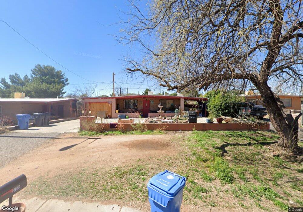
559 N Target Range Rd Nogales, AZ 85621
Estimated Value: $182,173 - $218,000
--
Bed
--
Bath
1,183
Sq Ft
$167/Sq Ft
Est. Value
About This Home
This home is located at 559 N Target Range Rd, Nogales, AZ 85621 and is currently estimated at $197,543, approximately $166 per square foot. 559 N Target Range Rd is a home located in Santa Cruz County with nearby schools including Nogales High School and Sacred Heart Catholic School.
Ownership History
Date
Name
Owned For
Owner Type
Purchase Details
Closed on
Apr 27, 2022
Sold by
Patricia Corrales
Bought by
Violante Laura
Current Estimated Value
Home Financials for this Owner
Home Financials are based on the most recent Mortgage that was taken out on this home.
Original Mortgage
$152,192
Outstanding Balance
$144,396
Interest Rate
5.11%
Mortgage Type
FHA
Estimated Equity
$53,147
Purchase Details
Closed on
Apr 28, 2017
Sold by
Estrada Octavio L and Estrada Martha N
Bought by
Corrales Patricia
Home Financials for this Owner
Home Financials are based on the most recent Mortgage that was taken out on this home.
Original Mortgage
$101,010
Interest Rate
4.23%
Mortgage Type
New Conventional
Create a Home Valuation Report for This Property
The Home Valuation Report is an in-depth analysis detailing your home's value as well as a comparison with similar homes in the area
Home Values in the Area
Average Home Value in this Area
Purchase History
| Date | Buyer | Sale Price | Title Company |
|---|---|---|---|
| Violante Laura | $155,000 | Lawyers Title | |
| Corrales Patricia | $100,000 | Lawyers Title Of Az Nogales |
Source: Public Records
Mortgage History
| Date | Status | Borrower | Loan Amount |
|---|---|---|---|
| Open | Violante Laura | $152,192 | |
| Previous Owner | Corrales Patricia | $101,010 |
Source: Public Records
Tax History Compared to Growth
Tax History
| Year | Tax Paid | Tax Assessment Tax Assessment Total Assessment is a certain percentage of the fair market value that is determined by local assessors to be the total taxable value of land and additions on the property. | Land | Improvement |
|---|---|---|---|---|
| 2025 | $857 | $11,730 | $314 | $11,416 |
| 2024 | $857 | $11,942 | $314 | $11,628 |
| 2023 | $728 | $8,725 | $314 | $8,411 |
| 2022 | $693 | $7,938 | $314 | $7,624 |
| 2021 | $563 | $6,297 | $314 | $5,983 |
| 2020 | $543 | $6,303 | $314 | $5,989 |
| 2019 | $429 | $5,502 | $314 | $5,188 |
| 2018 | $411 | $3,807 | $314 | $3,493 |
| 2017 | $389 | $3,807 | $314 | $3,493 |
| 2016 | $801 | $3,807 | $314 | $3,493 |
| 2015 | $393 | $3,806 | $0 | $0 |
Source: Public Records
Map
Nearby Homes
- 753 N Santa Rita Ln
- 789 N Santa Rita Ln
- TBD Arizona 189 Unit 5
- 659 N Goodman St
- TBD W Noon St Unit 22
- 493 W Walnut St
- 0 N Siqueiros St Unit 22522179
- 478 W Noon St
- TBD W Elm St
- 432 W Crawford St
- 429 W Crawford St
- 152 N Terrace Ave
- 65 N Grand Ave
- 117 E Dumbauld St
- 575 N Newman St
- 289B W 1st St
- 570 N Morley Ave
- 180 E La Castellana Dr
- 336 E Calle Soto
- 214 W Kino St
- 567 N Target Range Rd
- 559 W Target Range Rd
- 1336 W Camino de La Paloma
- 1330 W Camino de La Paloma
- 575 N Target Range Rd
- 1342 W Camino de La Paloma
- 1342 W Camino de La Paloma
- 551 N Target Range Rd
- 1324 W Camino de La Paloma
- 583 N Target Range Rd
- 1354 W Camino de La Paloma
- 312 N West St
- 543 N Target Range Rd
- E 1/2 L 5 W Target Range Rd
- 1330 W Calle Paisano
- 1359 W Camino de La Paloma
- 1360 W Camino de La Paloma
- 589 N Linda Vista Dr
- 1365 W Camino de La Paloma
- 1341 W Camino de La Paloma