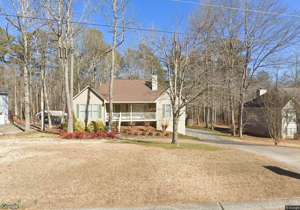
559 Sterling Dr Powder Springs, GA 30127
Estimated Value: $309,662 - $344,000
3
Beds
2
Baths
1,728
Sq Ft
$189/Sq Ft
Est. Value
About This Home
This home is located at 559 Sterling Dr, Powder Springs, GA 30127 and is currently estimated at $327,416, approximately $189 per square foot. 559 Sterling Dr is a home located in Paulding County with nearby schools including Hal Hutchens Elementary School, J. A. Dobbins Middle School, and Hiram High School.
Ownership History
Date
Name
Owned For
Owner Type
Purchase Details
Closed on
Jul 15, 1997
Sold by
Southlife Homes Inc
Bought by
Boulware William E and Boulware Colleen P
Current Estimated Value
Home Financials for this Owner
Home Financials are based on the most recent Mortgage that was taken out on this home.
Original Mortgage
$103,068
Outstanding Balance
$15,032
Interest Rate
7.7%
Mortgage Type
FHA
Estimated Equity
$312,384
Create a Home Valuation Report for This Property
The Home Valuation Report is an in-depth analysis detailing your home's value as well as a comparison with similar homes in the area
Home Values in the Area
Average Home Value in this Area
Purchase History
| Date | Buyer | Sale Price | Title Company |
|---|---|---|---|
| Boulware William E | $105,700 | -- |
Source: Public Records
Mortgage History
| Date | Status | Borrower | Loan Amount |
|---|---|---|---|
| Open | Boulware William E | $103,068 |
Source: Public Records
Tax History Compared to Growth
Tax History
| Year | Tax Paid | Tax Assessment Tax Assessment Total Assessment is a certain percentage of the fair market value that is determined by local assessors to be the total taxable value of land and additions on the property. | Land | Improvement |
|---|---|---|---|---|
| 2024 | $853 | $127,016 | $12,000 | $115,016 |
| 2023 | $1,032 | $130,088 | $12,000 | $118,088 |
| 2022 | $1,914 | $118,416 | $12,000 | $106,416 |
| 2021 | $1,501 | $83,092 | $10,000 | $73,092 |
| 2020 | $1,352 | $73,308 | $10,000 | $63,308 |
| 2019 | $1,358 | $72,140 | $10,000 | $62,140 |
| 2018 | $2,046 | $69,768 | $10,000 | $59,768 |
| 2017 | $1,807 | $61,020 | $8,000 | $53,020 |
| 2016 | $1,745 | $59,588 | $8,000 | $51,588 |
| 2015 | $1,586 | $53,388 | $8,000 | $45,388 |
| 2014 | $1,252 | $41,520 | $8,000 | $33,520 |
| 2013 | -- | $22,400 | $8,000 | $14,400 |
Source: Public Records
Map
Nearby Homes
- 215 Troy Path
- 260 Sterling Dr
- 397 Lovejoy Cir
- 00 Sleepy Hollow Trail
- 0 N Burnt Hickory Rd Unit 10596150
- 0 N Burnt Hickory Rd Unit 7579551
- 0 Sleepy Hollow Trail Unit 10607505
- 0 Sleepy Hollow Trail Unit 10596360
- 99 Breckenridge Ln
- 484 Legacy Park Dr
- 231 Breckenridge Ln
- 821 Prickett Ln
- 407 Yellowstone Dr
- 430 Pilgrim Ln
- 4557 Gresham Rd
- 6133 Brownsville Lithia Springs Rd
- 426 N Burnt Hickory Rd
- 62 Yosemite Ln
- 145 Mary Hill Ln
- 537 Sterling Dr
- 579 Sterling Dr
- 579 Sterling Dr Unit 48
- 521 Sterling Dr
- 562 Sterling Dr
- 546 Sterling Dr
- 574 Sterling Dr
- 595 Sterling Dr
- 508 Sterling Dr
- 511 Sterling Dr
- 602 Sterling Dr
- 615 Sterling Dr
- 486 Sterling Dr
- 497 Sterling Dr
- 271 Sterling Trail
- 271 Sterling Trail Unit 92
- 291 Sterling Trail
- 625 Sterling Dr
- 321 Sterling Trail
- 638 Sterling Dr