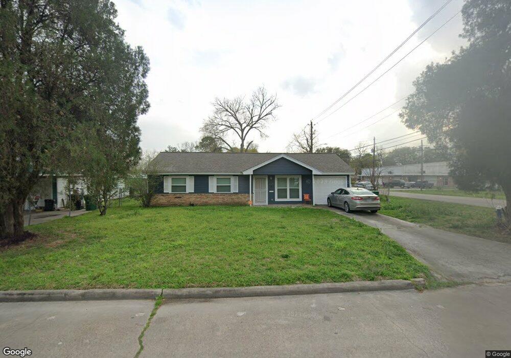
559 W Obion Rd Houston, TX 77091
Northside-Northline NeighborhoodEstimated Value: $178,017 - $200,000
3
Beds
1
Bath
975
Sq Ft
$193/Sq Ft
Est. Value
About This Home
This home is located at 559 W Obion Rd, Houston, TX 77091 and is currently estimated at $187,754, approximately $192 per square foot. 559 W Obion Rd is a home located in Harris County with nearby schools including Wesley Elementary School, Williams Middle, and Booker T Washington Sr High.
Ownership History
Date
Name
Owned For
Owner Type
Purchase Details
Closed on
Apr 8, 2004
Sold by
Lewis Jerome K and Lewis Carla A
Bought by
Lewis Jerome K and Lewis Carla A
Current Estimated Value
Home Financials for this Owner
Home Financials are based on the most recent Mortgage that was taken out on this home.
Original Mortgage
$44,850
Interest Rate
5.42%
Mortgage Type
New Conventional
Create a Home Valuation Report for This Property
The Home Valuation Report is an in-depth analysis detailing your home's value as well as a comparison with similar homes in the area
Home Values in the Area
Average Home Value in this Area
Purchase History
| Date | Buyer | Sale Price | Title Company |
|---|---|---|---|
| Lewis Jerome K | -- | -- |
Source: Public Records
Mortgage History
| Date | Status | Borrower | Loan Amount |
|---|---|---|---|
| Closed | Lewis Jerome K | $44,850 |
Source: Public Records
Tax History Compared to Growth
Tax History
| Year | Tax Paid | Tax Assessment Tax Assessment Total Assessment is a certain percentage of the fair market value that is determined by local assessors to be the total taxable value of land and additions on the property. | Land | Improvement |
|---|---|---|---|---|
| 2025 | $1,373 | $168,355 | $76,570 | $91,785 |
| 2024 | $1,373 | $168,355 | $76,570 | $91,785 |
| 2023 | $1,373 | $158,861 | $76,570 | $82,291 |
| 2022 | $2,433 | $118,597 | $53,599 | $64,998 |
| 2021 | $2,341 | $114,628 | $53,599 | $61,029 |
| 2020 | $2,211 | $109,303 | $53,599 | $55,704 |
| 2019 | $2,101 | $95,537 | $38,285 | $57,252 |
| 2018 | $1,234 | $78,183 | $22,971 | $55,212 |
| 2017 | $1,735 | $68,609 | $22,971 | $45,638 |
| 2016 | $1,735 | $68,609 | $22,971 | $45,638 |
| 2015 | $1,239 | $68,609 | $22,971 | $45,638 |
| 2014 | $1,239 | $68,609 | $22,971 | $45,638 |
Source: Public Records
Map
Nearby Homes
- 0 Pickering St
- 6100 Stuebner Airline Rd
- 422 Surratt Dr
- 522 Surratt Dr
- 434 Yale Oaks Ln
- 609 W Parker Rd
- 422 Yale Oaks Ln
- 427 Yale Oaks Ln
- 406 Red Ripple Rd
- 6057 Yale St
- 410 Yale Oaks Ln
- 334 Yale Oaks Ln
- 327 Yale Oaks Ln
- 615 Northew St Unit J
- 615 Northew St Unit K
- 6315 N Shepherd Dr
- 0 Brinkman Unit 54849680
- 6105 Morrow St
- 5736 Stuebner Airline Rd
- 5503 Beall St Unit A
- 555 W Obion Rd
- 558 W Troy Rd
- 551 W Obion Rd
- 554 W Troy Rd
- 550 W Troy Rd
- 547 W Obion Rd
- 6225 Stuebner Airline Rd
- 546 W Troy Rd
- 543 W Obion Rd
- 542 W Troy Rd
- 559 W Troy Rd
- 555 W Troy Rd
- 539 W Obion Rd
- 551 W Troy Rd
- 538 W Troy Rd
- 624 Leago St
- 547 W Troy Rd
- 535 W Obion Rd
- 543 W Troy Rd
- 6125 Stuebner Airline Rd