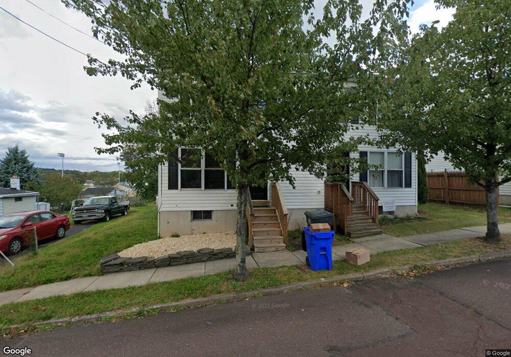
559 West St Pottstown, PA 19464
Beech-Wilson NeighborhoodEstimated Value: $159,000 - $284,451
3
Beds
2
Baths
1,296
Sq Ft
$160/Sq Ft
Est. Value
About This Home
This home is located at 559 West St, Pottstown, PA 19464 and is currently estimated at $207,113, approximately $159 per square foot. 559 West St is a home located in Montgomery County with nearby schools including Pottstown Middle School, Pottstown Senior High School, and Saint Aloysius Parish School.
Ownership History
Date
Name
Owned For
Owner Type
Purchase Details
Closed on
May 4, 2011
Sold by
Patten Stephen A
Bought by
Patten Stephen A and Patten Jennifer L
Current Estimated Value
Home Financials for this Owner
Home Financials are based on the most recent Mortgage that was taken out on this home.
Original Mortgage
$78,000
Outstanding Balance
$54,206
Interest Rate
4.88%
Estimated Equity
$152,907
Purchase Details
Closed on
Sep 24, 2010
Sold by
Wells Fargo Bank Na
Bought by
Patten Stephen A
Purchase Details
Closed on
Mar 25, 2010
Sold by
Usa and Shearba Theodore T
Bought by
Deutsche Bank National Trust Company
Purchase Details
Closed on
Oct 9, 2003
Sold by
Vagnozzi Dean
Bought by
Shearba Theodore T
Purchase Details
Closed on
Oct 14, 2002
Sold by
Real Solutions Inc
Bought by
Vagnozzi Dean
Create a Home Valuation Report for This Property
The Home Valuation Report is an in-depth analysis detailing your home's value as well as a comparison with similar homes in the area
Home Values in the Area
Average Home Value in this Area
Purchase History
| Date | Buyer | Sale Price | Title Company |
|---|---|---|---|
| Patten Stephen A | -- | None Available | |
| Patten Stephen A | $79,900 | None Available | |
| Deutsche Bank National Trust Company | $1,444 | None Available | |
| Shearba Theodore T | $110,000 | -- | |
| Vagnozzi Dean | $24,637 | Commonwealth Land Title Ins |
Source: Public Records
Mortgage History
| Date | Status | Borrower | Loan Amount |
|---|---|---|---|
| Open | Patten Stephen A | $78,000 |
Source: Public Records
Tax History Compared to Growth
Tax History
| Year | Tax Paid | Tax Assessment Tax Assessment Total Assessment is a certain percentage of the fair market value that is determined by local assessors to be the total taxable value of land and additions on the property. | Land | Improvement |
|---|---|---|---|---|
| 2025 | $3,739 | $60,900 | -- | -- |
| 2024 | $3,739 | $60,900 | -- | -- |
| 2023 | $3,687 | $60,900 | $0 | $0 |
| 2022 | $3,668 | $60,900 | $0 | $0 |
| 2021 | $3,625 | $60,900 | $0 | $0 |
| 2020 | $3,562 | $60,900 | $0 | $0 |
| 2019 | $3,480 | $60,900 | $0 | $0 |
| 2018 | $2,474 | $60,900 | $0 | $0 |
| 2017 | $3,255 | $60,900 | $0 | $0 |
| 2016 | $3,231 | $60,900 | $0 | $0 |
| 2015 | $3,229 | $60,900 | $0 | $0 |
| 2014 | $3,210 | $60,900 | $0 | $0 |
Source: Public Records
Map
Nearby Homes
- 570 Jefferson Ave
- 359 N Washington St
- 535 N Franklin St
- 514 Lincoln Ave
- 506 Lincoln Ave
- 648 Lincoln Ave
- 406 Jefferson Ave
- 516 N Charlotte St
- 399 Lincoln Ave
- 377 N Evans St
- 651 Walnut St
- 564 Walnut St
- 627 Chestnut St
- 516 Spruce St
- 173 N Franklin St
- 418 Walnut St
- 368 Spruce St
- 526 Chestnut St
- 354 Beech St
- 352 Beech St