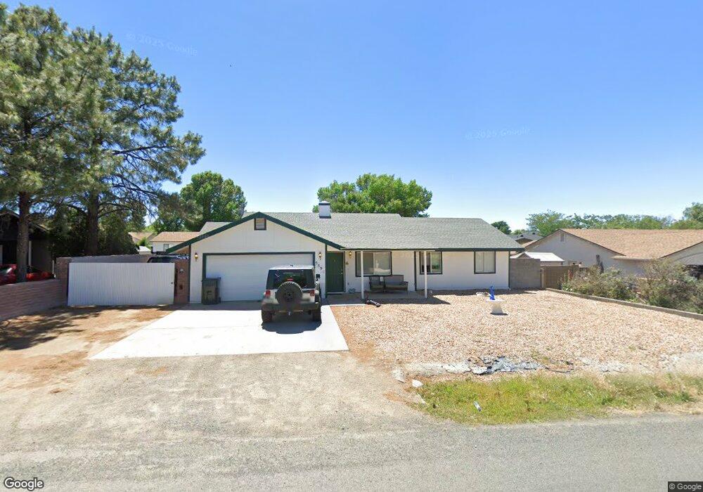
5590 N Long Rifle Rd Prescott Valley, AZ 86314
Estimated Value: $359,459 - $407,000
3
Beds
2
Baths
1,188
Sq Ft
$325/Sq Ft
Est. Value
About This Home
This home is located at 5590 N Long Rifle Rd, Prescott Valley, AZ 86314 and is currently estimated at $386,615, approximately $325 per square foot. 5590 N Long Rifle Rd is a home located in Yavapai County with nearby schools including Coyote Springs Elementary School, Glassford Hill Middle School, and Bradshaw Mountain High School.
Ownership History
Date
Name
Owned For
Owner Type
Purchase Details
Closed on
Jan 13, 2004
Sold by
Stutzman Alvin H and Stutzman Patricia Kaye
Bought by
Stutzman Alvin H and Stutzman Patricia K
Current Estimated Value
Create a Home Valuation Report for This Property
The Home Valuation Report is an in-depth analysis detailing your home's value as well as a comparison with similar homes in the area
Home Values in the Area
Average Home Value in this Area
Purchase History
| Date | Buyer | Sale Price | Title Company |
|---|---|---|---|
| Stutzman Alvin H | -- | -- |
Source: Public Records
Tax History Compared to Growth
Tax History
| Year | Tax Paid | Tax Assessment Tax Assessment Total Assessment is a certain percentage of the fair market value that is determined by local assessors to be the total taxable value of land and additions on the property. | Land | Improvement |
|---|---|---|---|---|
| 2026 | $1,435 | $28,275 | -- | -- |
| 2024 | $1,331 | $29,408 | -- | -- |
| 2023 | $1,331 | $24,307 | $4,168 | $20,139 |
| 2022 | $1,310 | $19,672 | $2,868 | $16,804 |
| 2021 | $1,344 | $18,217 | $2,883 | $15,334 |
| 2020 | $1,297 | $0 | $0 | $0 |
| 2019 | $1,280 | $0 | $0 | $0 |
| 2018 | $1,224 | $0 | $0 | $0 |
| 2017 | $1,200 | $0 | $0 | $0 |
| 2016 | $1,162 | $0 | $0 | $0 |
| 2015 | -- | $0 | $0 | $0 |
| 2014 | -- | $0 | $0 | $0 |
Source: Public Records
Map
Nearby Homes
- 5601 N Robert Rd
- 5445 N Mesquite Dr
- 5681 N Hondo Dr
- 8061 E Dust Devil Dr
- 8061 E Dust Devil Dr Unit 5681
- 5290 N Robert Rd
- 5414 N Wickiup Rd
- 8620 E Crater Ct
- 5244 N Pinto Dr
- 8485 Roundup Dr
- 8501 Roundup Dr
- 8517 Roundup Dr
- 5274 N Western Blvd
- 5344 N Cord Dr
- 5575 E Magpie Dr
- 5088 N Desert Ln
- 5035 N Robert Rd
- 6050 N Wildhorse Dr
- 5050 N Saddleback Dr
- 8428 E Manley Dr
- 5600 N Long Rifle Rd
- 5600 N Long Rifle Rd Unit 15
- 5574 N Long Rifle Rd
- 5587 N Western Blvd
- 5575 N Western Blvd
- 5589 N Long Rifle Rd
- 5601 N Western Blvd Unit 15
- 5620 N Long Rifle Rd
- 5563 N Western Blvd
- 5560 N Long Rifle Rd
- 5601 N Long Rifle Rd
- 5573 N Long Rifle Rd
- 5573 N Long Rifle Rd Unit 15
- 5621 N Long Rifle Rd
- 5621 N Western Blvd
- 5551 N Western Blvd
- 5640 N Long Rifle Rd
- 5559 N Long Rifle Rd Unit 15
- 5559 N Long Rifle Rd
- 5544 N Long Rifle Rd