Estimated Value: $343,833 - $401,000
3
Beds
2
Baths
2,195
Sq Ft
$164/Sq Ft
Est. Value
About This Home
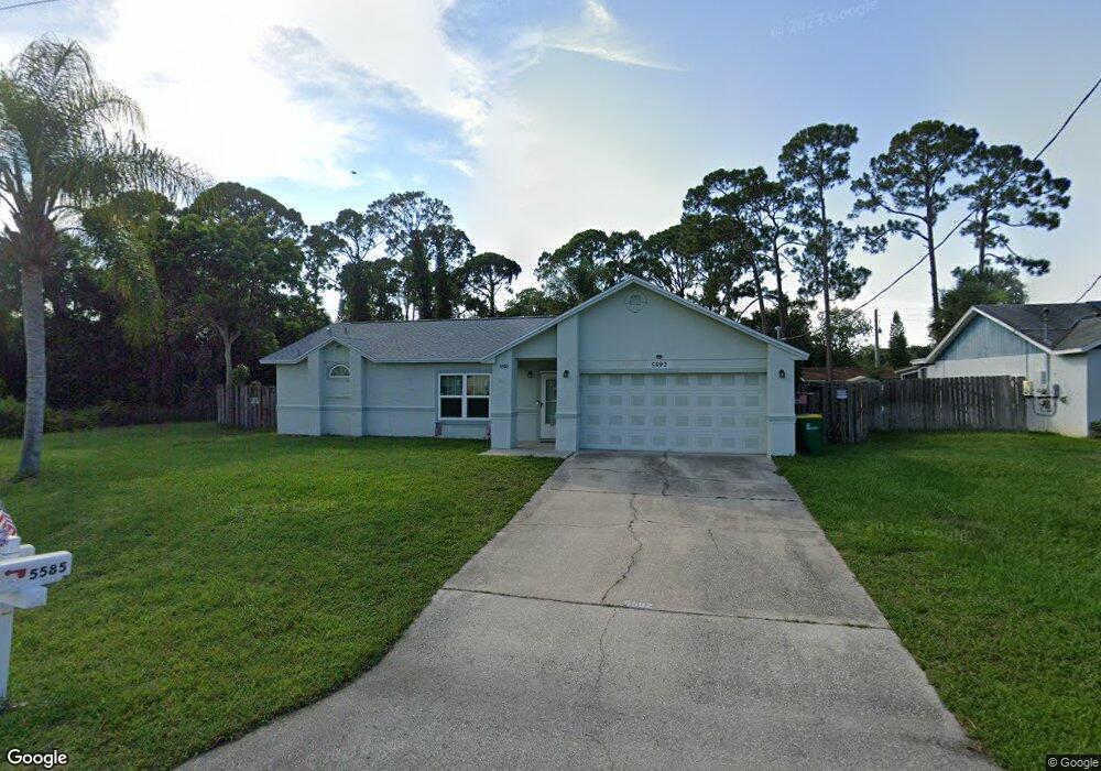
This home is located at 5592 Flint Rd, Cocoa, FL 32927 and is currently estimated at $358,958, approximately $163 per square foot. 5592 Flint Rd is a home located in Brevard County with nearby schools including Enterprise Elementary School, Space Coast Junior/Senior High School, and East Atlantic Prep of Brevard County.
Ownership History
Date
Name
Owned For
Owner Type
Purchase Details
Closed on
Aug 11, 1993
Sold by
James Douglas C and James Margaret W
Bought by
Miller Arnold S and Miller Pamela J
Current Estimated Value
Home Financials for this Owner
Home Financials are based on the most recent Mortgage that was taken out on this home.
Original Mortgage
$83,936
Interest Rate
7.26%
Create a Home Valuation Report for This Property
The Home Valuation Report is an in-depth analysis detailing your home's value as well as a comparison with similar homes in the area
Home Values in the Area
Average Home Value in this Area
Purchase History
| Date | Buyer | Sale Price | Title Company |
|---|---|---|---|
| Miller Arnold S | $82,900 | -- |
Source: Public Records
Mortgage History
| Date | Status | Borrower | Loan Amount |
|---|---|---|---|
| Closed | Miller Arnold S | $83,936 |
Source: Public Records
Tax History
| Year | Tax Paid | Tax Assessment Tax Assessment Total Assessment is a certain percentage of the fair market value that is determined by local assessors to be the total taxable value of land and additions on the property. | Land | Improvement |
|---|---|---|---|---|
| 2025 | $1,487 | $108,370 | -- | -- |
| 2024 | $1,446 | $105,320 | -- | -- |
| 2023 | $1,446 | $102,260 | $0 | $0 |
| 2022 | $1,348 | $99,290 | $0 | $0 |
| 2021 | $1,340 | $96,400 | $0 | $0 |
| 2020 | $1,261 | $95,070 | $0 | $0 |
| 2019 | $1,194 | $92,940 | $0 | $0 |
| 2018 | $1,183 | $91,210 | $0 | $0 |
| 2017 | $1,170 | $89,340 | $0 | $0 |
| 2016 | $1,167 | $87,510 | $18,000 | $69,510 |
| 2015 | $1,177 | $86,910 | $15,000 | $71,910 |
| 2014 | $1,176 | $86,220 | $11,000 | $75,220 |
Source: Public Records
Map
Nearby Homes
- 6438 Hudson Rd
- 5720 Flint Rd
- 6481 La Brea Ave
- 5715 Fairbridge St
- 5946 Deer Ln
- 5945 Coker Ave
- 6450 Ember Ave
- 5220 Holden Rd
- 5221 Carrick Rd
- 5215 Holden Rd
- 6581 Bancroft Ave
- 6020 Cannon Ave
- 6365 Homestead Ave
- 6615 Dock Ave
- 23-35-21-JX-B-2 Aruin St
- 6010 Fay Blvd
- 00 Unknown
- 6094 Cardiff Ave
- 6545 Addie Ave
- 6085 Edison St
Your Personal Tour Guide
Ask me questions while you tour the home.