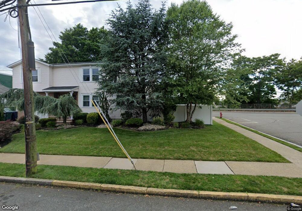
559A Hazel Ave Perth Amboy, NJ 08861
Chickentown NeighborhoodEstimated Value: $569,000 - $706,000
--
Bed
--
Bath
2,420
Sq Ft
$272/Sq Ft
Est. Value
About This Home
This home is located at 559A Hazel Ave, Perth Amboy, NJ 08861 and is currently estimated at $657,862, approximately $271 per square foot. 559A Hazel Ave is a home located in Middlesex County with nearby schools including Perth Amboy High School, Middlesex County STEM Charter School, and Academy for Urban Leadership Charter School.
Ownership History
Date
Name
Owned For
Owner Type
Purchase Details
Closed on
Oct 13, 2020
Sold by
Lara Luis and Ramos Migdalia
Bought by
Fayemi Ayodele and Abraham Roselyne
Current Estimated Value
Home Financials for this Owner
Home Financials are based on the most recent Mortgage that was taken out on this home.
Original Mortgage
$0
Interest Rate
2.9%
Mortgage Type
New Conventional
Purchase Details
Closed on
Dec 26, 2000
Sold by
Ourfall Ammar
Bought by
Lara Luis and Ramos Migdalia
Home Financials for this Owner
Home Financials are based on the most recent Mortgage that was taken out on this home.
Original Mortgage
$204,250
Interest Rate
7.64%
Purchase Details
Closed on
Jul 7, 1999
Sold by
Albaladejo Marie
Bought by
Ourfali Ammar and Orfali Bashar
Purchase Details
Closed on
Feb 26, 1997
Sold by
Kaczmarek Frank
Bought by
Albaladejo Marie
Create a Home Valuation Report for This Property
The Home Valuation Report is an in-depth analysis detailing your home's value as well as a comparison with similar homes in the area
Home Values in the Area
Average Home Value in this Area
Purchase History
| Date | Buyer | Sale Price | Title Company |
|---|---|---|---|
| Fayemi Ayodele | $450,000 | Title Trust | |
| Fayemi Ayodele | $450,000 | Title Trust | |
| Lara Luis | $215,000 | -- | |
| Ourfali Ammar | $35,000 | -- | |
| Albaladejo Marie | $34,000 | -- |
Source: Public Records
Mortgage History
| Date | Status | Borrower | Loan Amount |
|---|---|---|---|
| Closed | Fayemi Ayodele | $0 | |
| Open | Fayemi Ayodele | $427,500 | |
| Previous Owner | Lara Luis | $204,250 |
Source: Public Records
Tax History Compared to Growth
Tax History
| Year | Tax Paid | Tax Assessment Tax Assessment Total Assessment is a certain percentage of the fair market value that is determined by local assessors to be the total taxable value of land and additions on the property. | Land | Improvement |
|---|---|---|---|---|
| 2025 | $12,014 | $398,200 | $115,700 | $282,500 |
| 2024 | $11,990 | $398,200 | $115,700 | $282,500 |
| 2023 | $11,990 | $398,200 | $115,700 | $282,500 |
| 2022 | $11,846 | $398,200 | $115,700 | $282,500 |
| 2021 | $11,335 | $380,500 | $115,700 | $264,800 |
| 2020 | $9,973 | $334,900 | $115,700 | $219,200 |
| 2019 | $10,010 | $334,900 | $115,700 | $219,200 |
| 2018 | $9,923 | $334,900 | $115,700 | $219,200 |
| 2017 | $9,903 | $334,900 | $115,700 | $219,200 |
| 2016 | $9,645 | $334,900 | $115,700 | $219,200 |
| 2015 | $9,712 | $334,900 | $115,700 | $219,200 |
| 2014 | $9,772 | $334,900 | $115,700 | $219,200 |
Source: Public Records
Map
Nearby Homes
- 678 Bingle St
- 617 Lee St
- 6 Worden Ave
- 693 Hanson Ave
- 559 Compton Ave
- 552 Compton Ave
- 773 Colgate Ave
- 130-132 Judy Dr
- 113 Judy Dr Unit 115
- 133 Howard St
- 448 Baker Place
- 113-115 Judy Dr
- 689 Mary St
- 720 Donald Ave
- 485 Compton Ave
- 424 Steadman Place
- 744 Donald Ave
- 752 Donald Ave
- 63 Clinton Ave
- 28 Louis St