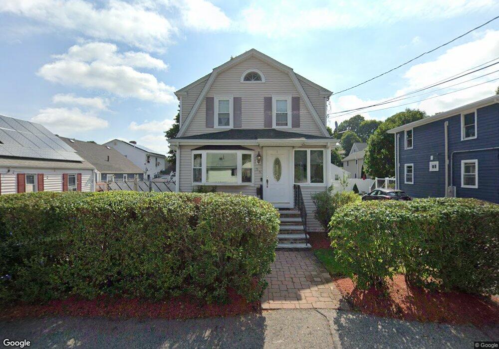
56 Bowdoin Ave Waltham, MA 02451
Piety Corner NeighborhoodEstimated Value: $705,970 - $786,000
3
Beds
3
Baths
1,496
Sq Ft
$509/Sq Ft
Est. Value
About This Home
This home is located at 56 Bowdoin Ave, Waltham, MA 02451 and is currently estimated at $761,993, approximately $509 per square foot. 56 Bowdoin Ave is a home located in Middlesex County with nearby schools including Douglas Macarthur Elementary School, John F Kennedy Middle School, and Waltham Sr High School.
Ownership History
Date
Name
Owned For
Owner Type
Purchase Details
Closed on
Sep 12, 2016
Sold by
Janessian Ohanes and Janessian Ani B
Bought by
Janessian Ft 2015
Current Estimated Value
Purchase Details
Closed on
Oct 30, 2003
Sold by
Mcquillan Charles T
Bought by
Janessian Ani B
Home Financials for this Owner
Home Financials are based on the most recent Mortgage that was taken out on this home.
Original Mortgage
$286,400
Interest Rate
6.05%
Mortgage Type
Purchase Money Mortgage
Purchase Details
Closed on
Aug 7, 2001
Sold by
Connaughton Patrick J
Bought by
Mcquillan Charles T
Home Financials for this Owner
Home Financials are based on the most recent Mortgage that was taken out on this home.
Original Mortgage
$200,000
Interest Rate
7.14%
Mortgage Type
Purchase Money Mortgage
Create a Home Valuation Report for This Property
The Home Valuation Report is an in-depth analysis detailing your home's value as well as a comparison with similar homes in the area
Home Values in the Area
Average Home Value in this Area
Purchase History
| Date | Buyer | Sale Price | Title Company |
|---|---|---|---|
| Janessian Ft 2015 | -- | -- | |
| Janessian Ani B | $358,000 | -- | |
| Mcquillan Charles T | $250,000 | -- |
Source: Public Records
Mortgage History
| Date | Status | Borrower | Loan Amount |
|---|---|---|---|
| Previous Owner | Janessian Ani B | $286,400 | |
| Previous Owner | Mcquillan Charles T | $200,000 |
Source: Public Records
Tax History Compared to Growth
Tax History
| Year | Tax Paid | Tax Assessment Tax Assessment Total Assessment is a certain percentage of the fair market value that is determined by local assessors to be the total taxable value of land and additions on the property. | Land | Improvement |
|---|---|---|---|---|
| 2025 | $6,174 | $628,700 | $324,600 | $304,100 |
| 2024 | $5,875 | $609,400 | $309,100 | $300,300 |
| 2023 | $5,807 | $562,700 | $282,200 | $280,500 |
| 2022 | $5,825 | $522,900 | $255,400 | $267,500 |
| 2021 | $5,732 | $506,400 | $255,400 | $251,000 |
| 2020 | $5,657 | $473,400 | $241,900 | $231,500 |
| 2019 | $5,325 | $420,600 | $227,900 | $192,700 |
| 2018 | $4,845 | $384,200 | $211,000 | $173,200 |
| 2017 | $4,581 | $364,700 | $191,500 | $173,200 |
| 2016 | $4,308 | $352,000 | $178,800 | $173,200 |
| 2015 | $4,311 | $328,300 | $168,000 | $160,300 |
Source: Public Records
Map
Nearby Homes
- 129 Lake St
- 30 Wampum Ave
- 234 Lake St
- 65 Montclair Ave
- 14 Piedmont Ave
- 249 Lake St
- 28 Hillcrest St
- 98 Seminole Ave
- 463 Lincoln St
- 44 Sachem St
- 92 Milner St
- 102 Milner St
- 15 Kings Way Unit 25
- 28 College Farm Rd Unit 2
- 30 Jacqueline Rd Unit C
- 11 Autumn Ln
- 15 Cedarcroft Ln
- 16 Winter St Unit 26C
- 511 Lexington St
- 49 Lincoln St