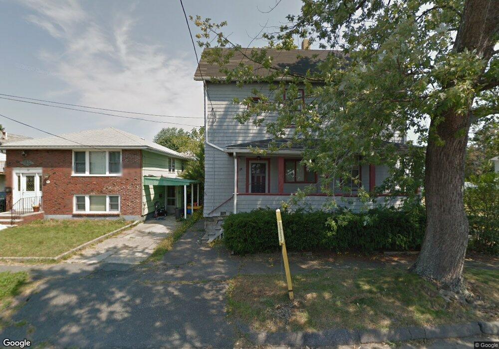
56 Bristow St Saugus, MA 01906
Cliftondale NeighborhoodEstimated Value: $827,852 - $1,018,000
3
Beds
3
Baths
1,677
Sq Ft
$538/Sq Ft
Est. Value
About This Home
This home is located at 56 Bristow St, Saugus, MA 01906 and is currently estimated at $902,463, approximately $538 per square foot. 56 Bristow St is a home located in Essex County with nearby schools including Saugus High School, Pioneer Charter School Of Science II, and Sacred Heart School.
Ownership History
Date
Name
Owned For
Owner Type
Purchase Details
Closed on
Oct 8, 2021
Sold by
Pereira Elias I and Pereira Marlene S
Bought by
Ibarra Kenneth
Current Estimated Value
Home Financials for this Owner
Home Financials are based on the most recent Mortgage that was taken out on this home.
Original Mortgage
$698,400
Outstanding Balance
$634,105
Interest Rate
2.8%
Mortgage Type
Purchase Money Mortgage
Estimated Equity
$268,358
Purchase Details
Closed on
Sep 29, 2017
Sold by
George Anthony T and George Thap N
Bought by
Pereira Elias I and Pereira Marlene S
Home Financials for this Owner
Home Financials are based on the most recent Mortgage that was taken out on this home.
Original Mortgage
$483,000
Interest Rate
3.89%
Mortgage Type
New Conventional
Purchase Details
Closed on
Dec 28, 2012
Sold by
Derosier Robert J
Bought by
George Anthony T and George Thap N
Purchase Details
Closed on
Jul 15, 1991
Sold by
Derosier Robert J
Bought by
Derosier Robert J
Home Financials for this Owner
Home Financials are based on the most recent Mortgage that was taken out on this home.
Original Mortgage
$112,000
Interest Rate
9.35%
Mortgage Type
Purchase Money Mortgage
Create a Home Valuation Report for This Property
The Home Valuation Report is an in-depth analysis detailing your home's value as well as a comparison with similar homes in the area
Home Values in the Area
Average Home Value in this Area
Purchase History
| Date | Buyer | Sale Price | Title Company |
|---|---|---|---|
| Ibarra Kenneth | $720,000 | None Available | |
| Ibarra Kenneth | $720,000 | None Available | |
| Pereira Elias I | $525,000 | -- | |
| Pereira Elias I | $525,000 | -- | |
| George Anthony T | $230,500 | -- | |
| George Anthony T | $230,500 | -- | |
| Derosier Robert J | $61,500 | -- | |
| Derosier Robert J | $61,500 | -- | |
| Derosier Robert J | $61,500 | -- | |
| Derosier Robert J | $61,500 | -- |
Source: Public Records
Mortgage History
| Date | Status | Borrower | Loan Amount |
|---|---|---|---|
| Open | Ibarra Kenneth | $698,400 | |
| Previous Owner | Pereira Elias I | $483,000 | |
| Previous Owner | Derosier Robert J | $112,000 |
Source: Public Records
Tax History Compared to Growth
Tax History
| Year | Tax Paid | Tax Assessment Tax Assessment Total Assessment is a certain percentage of the fair market value that is determined by local assessors to be the total taxable value of land and additions on the property. | Land | Improvement |
|---|---|---|---|---|
| 2025 | $8,384 | $785,000 | $329,300 | $455,700 |
| 2024 | $8,186 | $768,600 | $320,400 | $448,200 |
| 2023 | $7,989 | $709,500 | $280,400 | $429,100 |
| 2022 | $7,222 | $601,300 | $260,800 | $340,500 |
| 2021 | $6,775 | $549,000 | $216,300 | $332,700 |
| 2020 | $6,245 | $523,900 | $205,600 | $318,300 |
| 2019 | $5,921 | $486,100 | $195,800 | $290,300 |
| 2018 | $5,211 | $450,000 | $186,900 | $263,100 |
| 2017 | $4,832 | $401,000 | $178,000 | $223,000 |
| 2016 | $3,803 | $311,700 | $169,000 | $142,700 |
| 2015 | $3,569 | $296,900 | $161,000 | $135,900 |
| 2014 | -- | $302,700 | $161,000 | $141,700 |
Source: Public Records
Map
Nearby Homes
- 25 Piedmont Ave
- 41-43 Seagirt Ave
- 28 Naples Ave
- 22 Seagirt Ave
- 12 Seagirt Ave
- 9 Douglas Rd
- 0 Hampton St
- 18 Nason Rd
- 17 Elaine Ave
- 6 Sim Rd Unit 1
- 44 Ballard St
- 24 Ballard St
- 9 Spencer Ave
- 9 Oakwood Ave
- 5 Stanley Terrace
- 5 Springdale Ave
- 33 Springdale Ave
- 62 Chestnut St Unit 4
- 62 Chestnut St Unit 2
- 4 Foss Ave
- 56 Bristow St
- 56 Bristow St Unit 2
- 52 Bristow St
- 50 Bristow St
- 60 Bristow St
- 55 Bristow St
- 45 Serino Way
- 59 Bristow St
- 53 Bristow St
- 53 Bristow St Unit 2
- 49 Serino Way
- 43 Serino Way
- 63 Bristow St
- 41 Serino Way Unit 2
- 41 Serino Way
- 41 Serino Way Unit 1
- 48 Bristow St
- 7 Sussex St
- 51 Bristow St
- 51 Bristow St Unit A