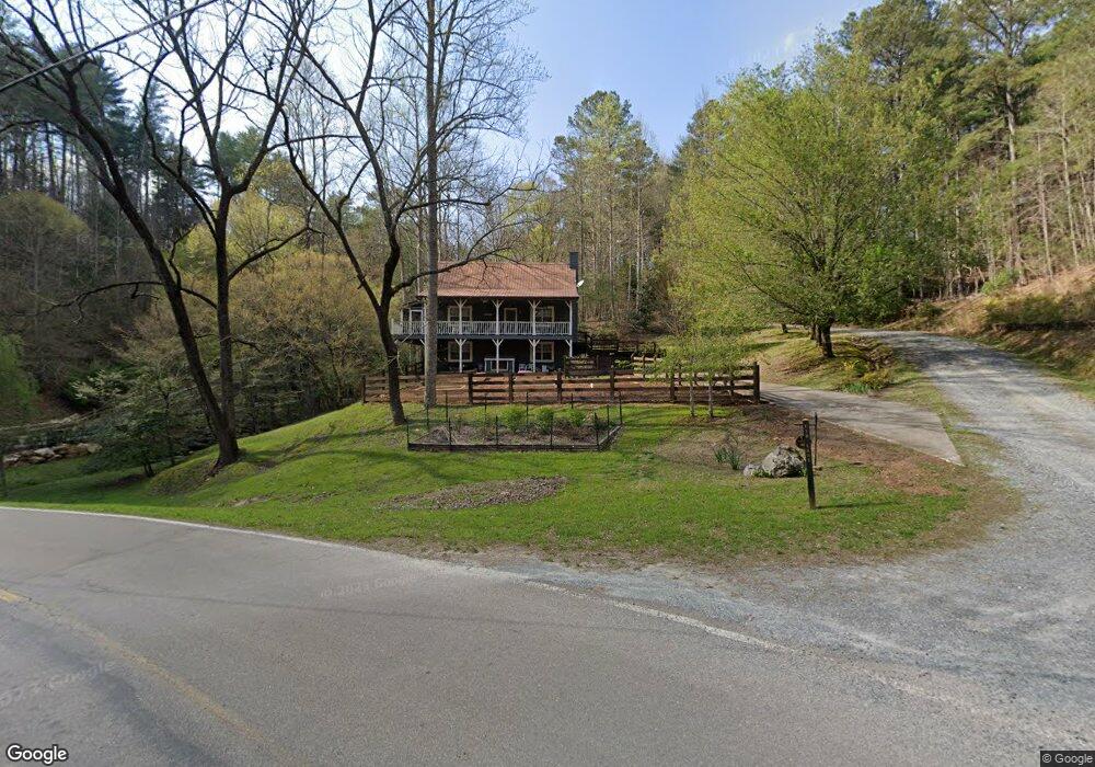
56 Cain Ct Ellijay, GA 30540
Estimated Value: $368,000 - $460,000
2
Beds
2
Baths
1,824
Sq Ft
$224/Sq Ft
Est. Value
About This Home
This home is located at 56 Cain Ct, Ellijay, GA 30540 and is currently estimated at $408,465, approximately $223 per square foot. 56 Cain Ct is a home located in Gilmer County with nearby schools including Mountain View Elementary School, Clear Creek Middle School, and Gilmer High School.
Ownership History
Date
Name
Owned For
Owner Type
Purchase Details
Closed on
Jan 1, 2008
Sold by
Jones Don T
Bought by
Jones Don T
Current Estimated Value
Purchase Details
Closed on
Oct 17, 2001
Sold by
Palmer Joe L
Bought by
Jones Don T
Purchase Details
Closed on
Sep 1, 1996
Bought by
Palmer Joe L
Purchase Details
Closed on
Aug 1, 1996
Bought by
Palmer Joe L
Purchase Details
Closed on
Jul 1, 1990
Bought by
Palmer Joe L
Purchase Details
Closed on
Oct 1, 1988
Bought by
Palmer Joe L
Create a Home Valuation Report for This Property
The Home Valuation Report is an in-depth analysis detailing your home's value as well as a comparison with similar homes in the area
Home Values in the Area
Average Home Value in this Area
Purchase History
| Date | Buyer | Sale Price | Title Company |
|---|---|---|---|
| Jones Don T | $142,100 | -- | |
| Jones Don T | $106,000 | -- | |
| Palmer Joe L | -- | -- | |
| Palmer Joe L | $35,000 | -- | |
| Palmer Joe L | -- | -- | |
| Palmer Joe L | -- | -- |
Source: Public Records
Tax History Compared to Growth
Tax History
| Year | Tax Paid | Tax Assessment Tax Assessment Total Assessment is a certain percentage of the fair market value that is determined by local assessors to be the total taxable value of land and additions on the property. | Land | Improvement |
|---|---|---|---|---|
| 2024 | $1,245 | $105,800 | $3,400 | $102,400 |
| 2023 | $1,198 | $96,680 | $2,920 | $93,760 |
| 2022 | $1,216 | $85,760 | $2,000 | $83,760 |
| 2021 | $1,195 | $71,400 | $2,000 | $69,400 |
| 2020 | $1,154 | $59,240 | $1,920 | $57,320 |
| 2019 | $1,183 | $59,000 | $1,680 | $57,320 |
| 2018 | $1,163 | $56,560 | $1,680 | $54,880 |
| 2017 | $1,126 | $45,760 | $2,000 | $43,760 |
| 2016 | $1,180 | $47,000 | $2,000 | $45,000 |
| 2015 | $1,005 | $40,760 | $1,800 | $38,960 |
| 2014 | $968 | $37,760 | $1,800 | $35,960 |
| 2013 | -- | $37,240 | $1,800 | $35,440 |
Source: Public Records
Map
Nearby Homes
- 1061 Fir Ln
- 940 Fir Ln Unit 3588, 3589
- 940 Fir Ln
- LT 3468 EAGLE M Fir Ln
- 3468 Fir Ln
- 55 Monitor Dr
- 928 Fir Ln Unit 3624
- 928 Fir Ln
- 1800 Hicks Ford Rd
- 1800 Hicks Ford Rd Unit 8
- 166 Clark Dr
- 60 Hickory Ln
- 230 Grove Ln Unit 3642
- 230 Grove Ln
- LOT 112 High River Crossing Unit 112
- LOT 112 High River Crossing
- 57 Cherry Ct
- 1095 Fir Ln
- 1466 Newport Dr
- 0 Graham Ct Unit 402061
- 15 Cain Ct
- 1278 Crossroads Church Rd Unit 7
- 1278 Crossroads Church Rd
- 130 Clark Dr
- 130 Clark Dr Unit 3584
- 144 Clark Dr
- 144 Clark Dr Unit 3585
- 144 Clark Dr
- 200 Clark Dr Unit 3587
- 200 Clark Dr
- 594 Fir Ln Unit 3575
- 594 Fir Ln
- 2350 Legion Rd
- 0 Fir Lane 3566&3567
- 63 Clark Dr
- 63 Clark Dr Unit 3606/3608
- 240 Woodstone Trail
- 132 Birch Ct Unit 9733
- 132 Birch Ct Unit 3 Lots
- 132 Birch Ct