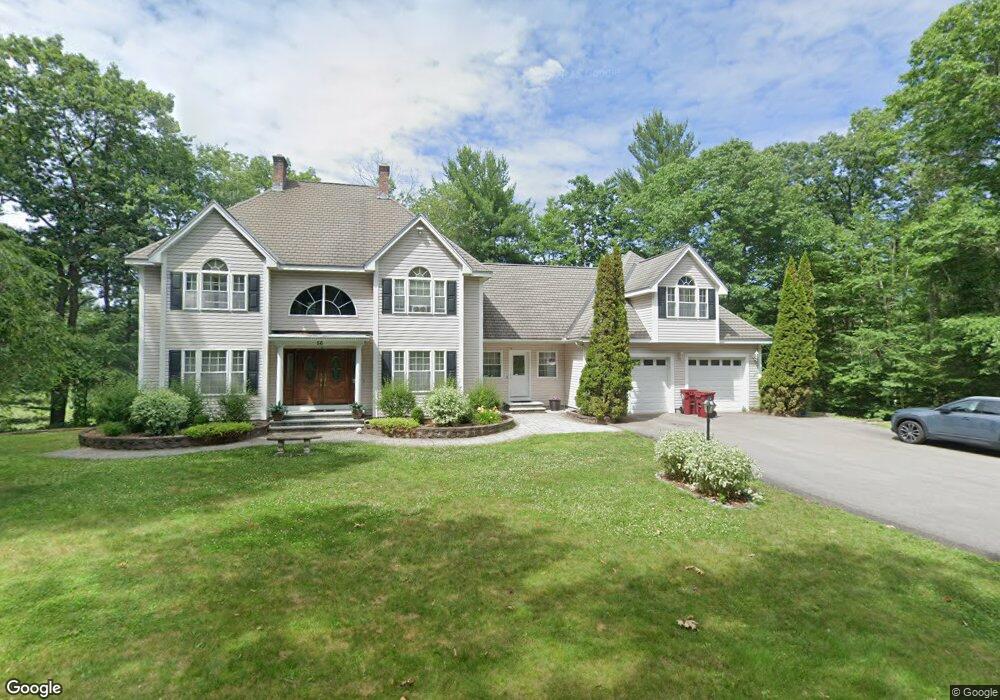
56 Constantine Dr Tyngsboro, MA 01879
Estimated Value: $923,437 - $1,288,000
3
Beds
3
Baths
4,500
Sq Ft
$235/Sq Ft
Est. Value
About This Home
This home is located at 56 Constantine Dr, Tyngsboro, MA 01879 and is currently estimated at $1,056,609, approximately $234 per square foot. 56 Constantine Dr is a home located in Middlesex County with nearby schools including Tyngsborough Elementary School, Tyngsborough Middle School, and Tyngsborough High School.
Ownership History
Date
Name
Owned For
Owner Type
Purchase Details
Closed on
May 10, 2016
Sold by
Smith Lynn G and Smith Philip S
Bought by
Demetropoulos Spyridon
Current Estimated Value
Purchase Details
Closed on
Jun 28, 2002
Sold by
Aubin Brian P and Siegel Teri Lynn
Bought by
Smith Lynn G and Smith Philip S
Home Financials for this Owner
Home Financials are based on the most recent Mortgage that was taken out on this home.
Original Mortgage
$275,000
Interest Rate
6.92%
Mortgage Type
Purchase Money Mortgage
Purchase Details
Closed on
Sep 18, 1995
Sold by
Constantine Arthur and Constantine Claire
Bought by
Aubin Brian P and Siegel Terri
Purchase Details
Closed on
Apr 25, 1994
Sold by
Sheehan Gertz Dev Inc
Bought by
Riesz Kenneth
Create a Home Valuation Report for This Property
The Home Valuation Report is an in-depth analysis detailing your home's value as well as a comparison with similar homes in the area
Home Values in the Area
Average Home Value in this Area
Purchase History
| Date | Buyer | Sale Price | Title Company |
|---|---|---|---|
| Demetropoulos Spyridon | $570,000 | -- | |
| Smith Lynn G | $482,500 | -- | |
| Aubin Brian P | $40,000 | -- | |
| Riesz Kenneth | $154,250 | -- |
Source: Public Records
Mortgage History
| Date | Status | Borrower | Loan Amount |
|---|---|---|---|
| Previous Owner | Riesz Kenneth | $310,000 | |
| Previous Owner | Riesz Kenneth | $275,000 | |
| Previous Owner | Riesz Kenneth | $250,000 |
Source: Public Records
Tax History
| Year | Tax Paid | Tax Assessment Tax Assessment Total Assessment is a certain percentage of the fair market value that is determined by local assessors to be the total taxable value of land and additions on the property. | Land | Improvement |
|---|---|---|---|---|
| 2025 | $105 | $854,600 | $247,500 | $607,100 |
| 2024 | $10,517 | $826,800 | $234,300 | $592,500 |
| 2023 | $7,019 | $710,500 | $195,100 | $515,400 |
| 2022 | $6,759 | $651,100 | $171,100 | $480,000 |
| 2021 | $9,546 | $594,000 | $155,900 | $438,100 |
| 2020 | $9,449 | $581,500 | $147,100 | $434,400 |
| 2019 | $9,088 | $536,800 | $140,600 | $396,200 |
| 2018 | $8,940 | $522,500 | $140,600 | $381,900 |
| 2017 | $8,601 | $501,200 | $140,600 | $360,600 |
| 2016 | $8,357 | $475,900 | $140,600 | $335,300 |
| 2015 | $8,071 | $475,900 | $140,600 | $335,300 |
Source: Public Records
Map
Nearby Homes
- 160 Westford Rd
- 0 Dunstable Rd
- 9 Jamie Way
- 48 Joco Dr
- 102 Russells Way
- 34 Shakespeare St
- 19 Sandstone Rd
- 22 Highland Rd
- 0 Lowell St
- 13 Grace Way
- 3 Bridgeview Cir Unit 53
- 4 Bridgeview Cir Unit 36
- 3 Bridgeview Cir Unit 58
- 27 Tyng Rd
- 28 Juniper Ln Unit 65
- 11 Juniper Ln Unit 14
- 30 Tamarack Way Unit 30
- 56 Frost Rd
- 76 Tenney Rd
- 4 Wood St
- 56 Constantine Dr
- 56 Constatine Dr
- 37 Constantine Dr
- 52 Constantine Dr
- 58 Constantine Dr
- 62 Constantine Dr
- 62 Constantine Dr Unit 1
- 35 Constantine Dr
- 41 Constantine Dr
- 436 Dunstable Rd
- 48 Constantine Dr
- 64 Constantine Dr
- 9 Constantine Dr
- 11 Constantine Dr
- 438 Dunstable Rd
- 74 Constantine Dr
- 31 Constantine Dr
- 15 Constantine Dr
- 84 Constantine Dr
- 442 Dunstable Rd
Your Personal Tour Guide
Ask me questions while you tour the home.