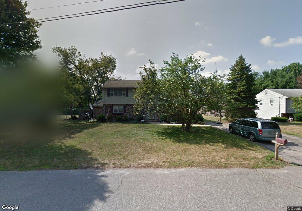
56 Coweeset Dr Brockton, MA 02301
Estimated Value: $627,000 - $720,000
4
Beds
2
Baths
2,500
Sq Ft
$260/Sq Ft
Est. Value
About This Home
This home is located at 56 Coweeset Dr, Brockton, MA 02301 and is currently estimated at $650,946, approximately $260 per square foot. 56 Coweeset Dr is a home located in Plymouth County with nearby schools including Hancock Elementary School, Manthala George Jr. School, and Louis F Angelo Elementary School.
Ownership History
Date
Name
Owned For
Owner Type
Purchase Details
Closed on
Nov 30, 2018
Sold by
Guzman Karen J and Guzman Richard A
Bought by
Gorman Robert F and Guzman Liana M
Current Estimated Value
Home Financials for this Owner
Home Financials are based on the most recent Mortgage that was taken out on this home.
Original Mortgage
$384,750
Outstanding Balance
$338,973
Interest Rate
4.8%
Mortgage Type
New Conventional
Estimated Equity
$311,973
Purchase Details
Closed on
Mar 18, 2004
Sold by
Doran Deborah and Doran Stephen
Bought by
Guzman Karen J and Guzman Richard A
Home Financials for this Owner
Home Financials are based on the most recent Mortgage that was taken out on this home.
Original Mortgage
$236,000
Interest Rate
5.71%
Mortgage Type
Purchase Money Mortgage
Purchase Details
Closed on
Feb 29, 1996
Sold by
Bernabei Marilyn E
Bought by
Mcfadden Andrew T
Create a Home Valuation Report for This Property
The Home Valuation Report is an in-depth analysis detailing your home's value as well as a comparison with similar homes in the area
Home Values in the Area
Average Home Value in this Area
Purchase History
| Date | Buyer | Sale Price | Title Company |
|---|---|---|---|
| Gorman Robert F | $407,000 | -- | |
| Gorman Robert F | $407,000 | -- | |
| Guzman Karen J | $365,000 | -- | |
| Guzman Karen J | $365,000 | -- | |
| Mcfadden Andrew T | $128,300 | -- | |
| Mcfadden Andrew T | $128,300 | -- |
Source: Public Records
Mortgage History
| Date | Status | Borrower | Loan Amount |
|---|---|---|---|
| Open | Gorman Robert F | $384,750 | |
| Closed | Gorman Robert F | $384,750 | |
| Previous Owner | Mcfadden Andrew T | $236,000 |
Source: Public Records
Tax History Compared to Growth
Tax History
| Year | Tax Paid | Tax Assessment Tax Assessment Total Assessment is a certain percentage of the fair market value that is determined by local assessors to be the total taxable value of land and additions on the property. | Land | Improvement |
|---|---|---|---|---|
| 2025 | $6,490 | $535,900 | $150,400 | $385,500 |
| 2024 | $6,139 | $510,700 | $150,400 | $360,300 |
| 2023 | $6,360 | $490,000 | $115,700 | $374,300 |
| 2022 | $6,137 | $439,300 | $105,400 | $333,900 |
| 2021 | $5,803 | $400,200 | $98,400 | $301,800 |
| 2020 | $5,842 | $385,600 | $94,300 | $291,300 |
| 2019 | $5,161 | $332,100 | $88,300 | $243,800 |
| 2018 | $4,729 | $325,600 | $88,300 | $237,300 |
| 2017 | $4,729 | $293,700 | $88,300 | $205,400 |
| 2016 | $4,774 | $275,000 | $84,400 | $190,600 |
| 2015 | $4,479 | $246,800 | $84,400 | $162,400 |
| 2014 | $4,542 | $250,500 | $84,400 | $166,100 |
Source: Public Records
Map
Nearby Homes
- 64 Coweeset Dr
- 47 Westfield Dr
- 55 Westfield Dr
- 39 Westfield Dr
- 55 Coweeset Dr
- 40 Coweeset Dr
- 70 Coweeset Dr
- 63 Westfield Dr
- 65 Coweeset Dr
- 39 Coweeset Dr
- 31 Westfield Dr
- 30 Torrey Side Rd
- 48 Westfield Dr
- 54 Westfield Dr
- 30 Coweeset Dr
- 78 Coweeset Dr
- 71 Westfield Dr
- 40 Westfield Dr
- 50 Westglow Rd
- 33 Coweeset Dr