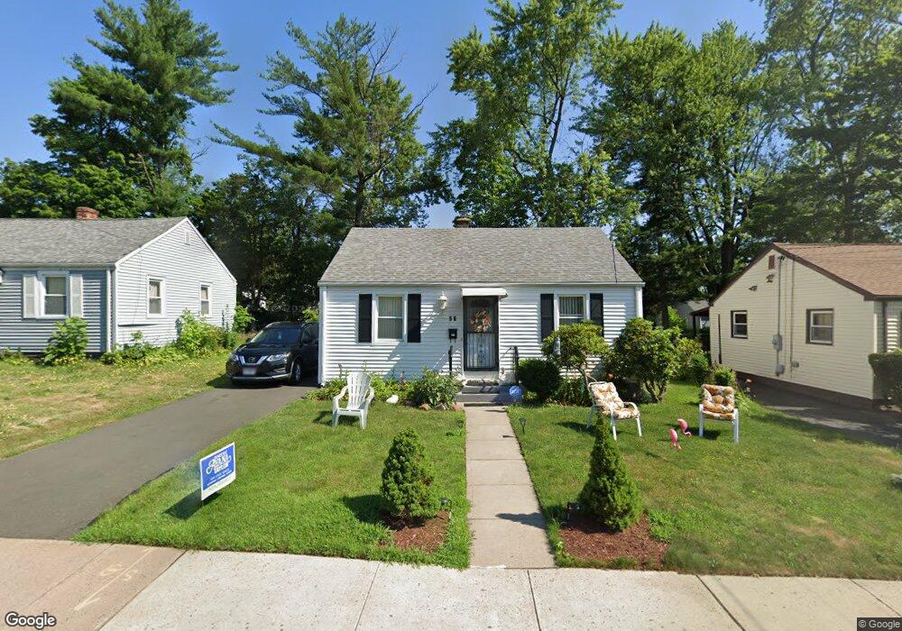
56 E Burnham St Hartford, CT 06112
Blue Hills NeighborhoodEstimated Value: $178,000 - $288,000
2
Beds
1
Bath
672
Sq Ft
$373/Sq Ft
Est. Value
About This Home
This home is located at 56 E Burnham St, Hartford, CT 06112 and is currently estimated at $250,817, approximately $373 per square foot. 56 E Burnham St is a home located in Hartford County with nearby schools including Rawson School, Breakthrough Magnet School - North Campus, and West Middle School.
Ownership History
Date
Name
Owned For
Owner Type
Purchase Details
Closed on
Oct 18, 2019
Sold by
Harmon Marian F
Bought by
Uliasz Sean
Current Estimated Value
Home Financials for this Owner
Home Financials are based on the most recent Mortgage that was taken out on this home.
Original Mortgage
$127,500
Outstanding Balance
$111,217
Interest Rate
3.4%
Mortgage Type
New Conventional
Estimated Equity
$139,600
Purchase Details
Closed on
Feb 26, 1988
Sold by
Reid Monica
Bought by
Speight Lonie L
Home Financials for this Owner
Home Financials are based on the most recent Mortgage that was taken out on this home.
Original Mortgage
$89,100
Interest Rate
10.49%
Mortgage Type
Purchase Money Mortgage
Create a Home Valuation Report for This Property
The Home Valuation Report is an in-depth analysis detailing your home's value as well as a comparison with similar homes in the area
Home Values in the Area
Average Home Value in this Area
Purchase History
| Date | Buyer | Sale Price | Title Company |
|---|---|---|---|
| Uliasz Sean | $177,500 | -- | |
| Speight Lonie L | $91,500 | -- |
Source: Public Records
Mortgage History
| Date | Status | Borrower | Loan Amount |
|---|---|---|---|
| Open | Speight Lonie L | $127,500 | |
| Previous Owner | Speight Lonie L | $65,000 | |
| Previous Owner | Speight Lonie L | $89,100 |
Source: Public Records
Tax History
| Year | Tax Paid | Tax Assessment Tax Assessment Total Assessment is a certain percentage of the fair market value that is determined by local assessors to be the total taxable value of land and additions on the property. | Land | Improvement |
|---|---|---|---|---|
| 2025 | $3,659 | $53,067 | $4,594 | $48,473 |
| 2024 | $3,659 | $53,067 | $4,594 | $48,473 |
| 2023 | $3,659 | $53,067 | $4,594 | $48,473 |
| 2022 | $3,659 | $53,067 | $4,594 | $48,473 |
| 2021 | $2,371 | $31,920 | $5,495 | $26,425 |
| 2020 | $2,371 | $31,920 | $5,495 | $26,425 |
| 2019 | $2,371 | $31,920 | $5,495 | $26,425 |
| 2018 | $2,291 | $30,844 | $5,310 | $25,534 |
| 2016 | $2,532 | $34,078 | $5,057 | $29,021 |
| 2015 | $2,532 | $32,459 | $4,816 | $27,643 |
| 2014 | $2,352 | $31,666 | $4,699 | $26,967 |
Source: Public Records
Map
Nearby Homes
- 97 E Burnham St
- 97 Boothbay St
- 11 Pershing St Unit 13
- 747 Blue Hills Ave
- 26 Baltic St Unit 28
- 35 Baltic St
- 18 Darby St
- 13 Patton Rd
- 200 Hartland St
- 110 Darby St
- 86 Hartland St
- 90 Manchester St
- 180 Brookline Ave
- 171 N Canaan St
- 83 Colebrook St Unit 85
- 216 Cornwall St
- 51 Pembroke St
- 166 Pembroke St
- 57 Love Ln
- 275 Westland St
- 60 E Burnham St
- 52 E Burnham St
- 64 E Burnham St
- 53 E Burnham St Unit 55
- 59 E Burnham St Unit 61
- 48 E Burnham St
- 49 E Burnham St Unit 51
- 63 E Burnham St Unit 65
- 68 E Burnham St
- 59 E Euclid St
- 55 E Euclid St
- 63 E Euclid St
- 51 E Euclid St
- 44 E Burnham St
- 69 E Burnham St Unit 71
- 72 E Burnham St
- 67 E Euclid St
- 130 Lebanon St Unit 132
- 40 E Burnham St
Your Personal Tour Guide
Ask me questions while you tour the home.