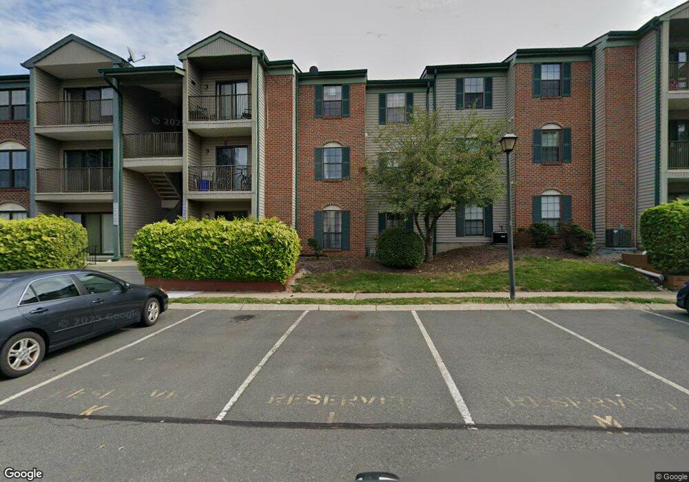
56 Fisher Dr Unit H2 Franklin Park, NJ 08823
Estimated Value: $249,290 - $300,000
--
Bed
--
Bath
853
Sq Ft
$323/Sq Ft
Est. Value
About This Home
This home is located at 56 Fisher Dr Unit H2, Franklin Park, NJ 08823 and is currently estimated at $275,573, approximately $323 per square foot. 56 Fisher Dr Unit H2 is a home located in Somerset County with nearby schools including Franklin High School, St. Augustine of Canterbury School, and Cheder Menachem.
Ownership History
Date
Name
Owned For
Owner Type
Purchase Details
Closed on
Nov 23, 2010
Sold by
Bynes Dionne C and Bynes Michael
Bought by
Patel Dinesh and Patel Sangita
Current Estimated Value
Purchase Details
Closed on
Jan 18, 2008
Sold by
Miller Dionne C and Bynes Michael
Bought by
Bynes Dionne C and Bynes Michael
Home Financials for this Owner
Home Financials are based on the most recent Mortgage that was taken out on this home.
Original Mortgage
$53,500
Interest Rate
6.58%
Mortgage Type
New Conventional
Purchase Details
Closed on
Jul 7, 1998
Sold by
Vigod Samuel M
Bought by
Miller Dionne
Home Financials for this Owner
Home Financials are based on the most recent Mortgage that was taken out on this home.
Original Mortgage
$47,000
Interest Rate
6.98%
Mortgage Type
VA
Create a Home Valuation Report for This Property
The Home Valuation Report is an in-depth analysis detailing your home's value as well as a comparison with similar homes in the area
Home Values in the Area
Average Home Value in this Area
Purchase History
| Date | Buyer | Sale Price | Title Company |
|---|---|---|---|
| Patel Dinesh | $97,250 | None Available | |
| Bynes Dionne C | -- | Foundation Title Llc | |
| Miller Dionne | $46,000 | -- |
Source: Public Records
Mortgage History
| Date | Status | Borrower | Loan Amount |
|---|---|---|---|
| Previous Owner | Bynes Dionne C | $53,500 | |
| Previous Owner | Miller Dionne | $47,000 | |
| Closed | Patel Dinesh | $0 |
Source: Public Records
Tax History Compared to Growth
Tax History
| Year | Tax Paid | Tax Assessment Tax Assessment Total Assessment is a certain percentage of the fair market value that is determined by local assessors to be the total taxable value of land and additions on the property. | Land | Improvement |
|---|---|---|---|---|
| 2025 | $3,696 | $245,000 | $130,000 | $115,000 |
| 2024 | $3,696 | $205,000 | $90,000 | $115,000 |
| 2023 | $3,748 | $195,000 | $80,000 | $115,000 |
| 2022 | $3,549 | $175,000 | $60,000 | $115,000 |
| 2021 | $3,539 | $165,000 | $50,000 | $115,000 |
| 2020 | $3,501 | $155,000 | $40,000 | $115,000 |
| 2019 | $3,087 | $135,000 | $20,000 | $115,000 |
| 2018 | $3,119 | $135,000 | $20,000 | $115,000 |
| 2017 | $2,291 | $98,800 | $20,000 | $78,800 |
| 2016 | $2,982 | $127,500 | $20,000 | $107,500 |
| 2015 | $2,295 | $98,800 | $20,000 | $78,800 |
| 2014 | $2,261 | $98,800 | $20,000 | $78,800 |
Source: Public Records
Map
Nearby Homes
- 69 Fisher Dr
- 1 Lyon La
- 1 Lyon Ln
- 44 Crabapple Ln
- 65 Townsend Ct Unit 213
- 65 Townsend Ct
- 9 Beekman Rd
- 107 Rachel Ct
- 139 Rachel Ct Unit D1
- 147 Rachel Ct
- 205 Rachel Ct
- 167 Rachel Ct
- 75 Pear Tree Ln Unit 10C
- 130 Lindsey Ct
- 3241 Route 27
- 124 Edward Dr
- 9 Donald Ave
- 13 Roberts St
- 8 Amethyst Way
- 13 Setter Place
- 60 Fisher Dr
- 52 Fisher Dr
- 51 Fisher Dr
- 55 Fisher Dr
- 55 Fisher Dr Unit 2608
- 49 Fisher Dr
- 57 Fisher Dr
- 59 Fisher Dr
- 53 Fisher Dr
- 65 Fisher Dr
- 50 Fisher Dr Unit 50
- 50 Fisher Dr
- 50 Fisher Dr Unit 2604
- 62 Fisher Dr Unit D1
- 54 Fisher Dr
- 54 Fisher Dr Unit 2605
- 66 Fisher Dr
- 61 Fisher Dr
- 58 Fisher Dr Unit B3
- 70 Fisher Dr