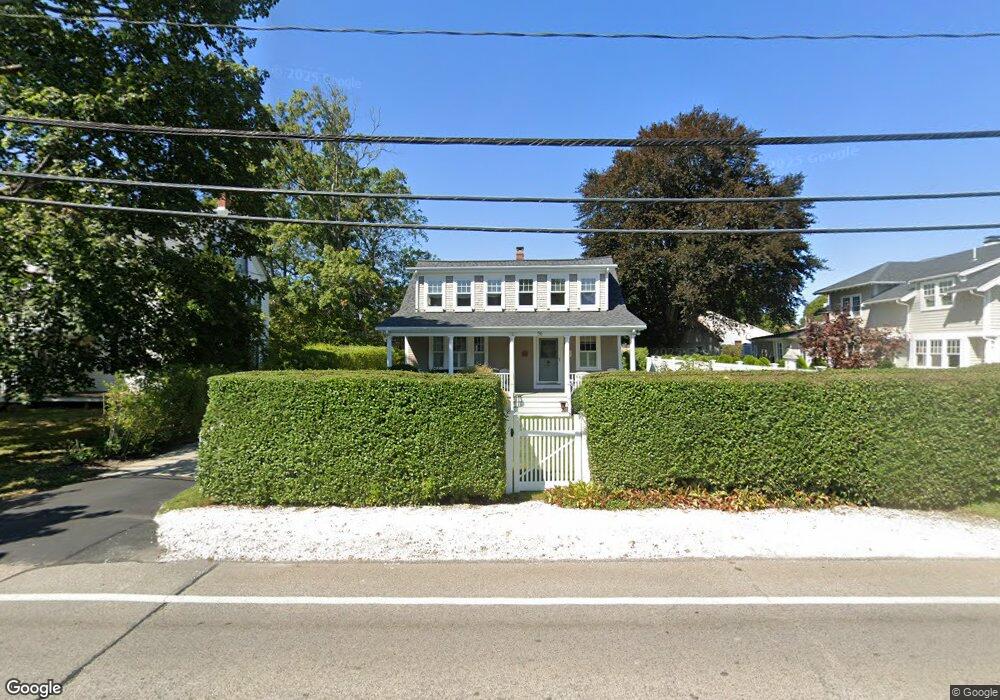
56 Gannett Rd Scituate, MA 02066
Estimated Value: $1,129,000 - $1,296,000
4
Beds
3
Baths
2,520
Sq Ft
$477/Sq Ft
Est. Value
About This Home
This home is located at 56 Gannett Rd, Scituate, MA 02066 and is currently estimated at $1,200,902, approximately $476 per square foot. 56 Gannett Rd is a home located in Plymouth County with nearby schools including Wampatuck Elementary School, Lester J. Gates Middle School, and Scituate High School.
Ownership History
Date
Name
Owned For
Owner Type
Purchase Details
Closed on
Nov 10, 2020
Sold by
Cronin Brian M and Cronin Susan A
Bought by
Susan A Cronin Ft
Current Estimated Value
Purchase Details
Closed on
Oct 2, 2000
Sold by
Erickson Jon A and Erickson Kristin G
Bought by
Cronin Brian M and Cronin Susan A
Purchase Details
Closed on
Dec 29, 1997
Sold by
Lopes Timothy J and Lopes Jennifer L
Bought by
Erickson Jon A and Erickson Kristin G
Purchase Details
Closed on
Jul 31, 1996
Sold by
Mandolini Linda M and Geyer David S
Bought by
Lopes Timothy J and Lopes Jennifer L
Purchase Details
Closed on
May 18, 1993
Sold by
Asmar Robert J and Asmar Kathleen E
Bought by
Geyer David S and Mandolini Linda M
Create a Home Valuation Report for This Property
The Home Valuation Report is an in-depth analysis detailing your home's value as well as a comparison with similar homes in the area
Home Values in the Area
Average Home Value in this Area
Purchase History
| Date | Buyer | Sale Price | Title Company |
|---|---|---|---|
| Susan A Cronin Ft | -- | None Available | |
| Cronin Brian M | $415,000 | -- | |
| Erickson Jon A | $266,900 | -- | |
| Lopes Timothy J | $240,000 | -- | |
| Geyer David S | $226,000 | -- |
Source: Public Records
Mortgage History
| Date | Status | Borrower | Loan Amount |
|---|---|---|---|
| Previous Owner | Geyer David S | $100,000 | |
| Previous Owner | Geyer David S | $35,000 |
Source: Public Records
Tax History Compared to Growth
Tax History
| Year | Tax Paid | Tax Assessment Tax Assessment Total Assessment is a certain percentage of the fair market value that is determined by local assessors to be the total taxable value of land and additions on the property. | Land | Improvement |
|---|---|---|---|---|
| 2025 | $8,399 | $840,700 | $333,700 | $507,000 |
| 2024 | $8,294 | $800,600 | $303,400 | $497,200 |
| 2023 | $8,100 | $735,100 | $292,000 | $443,100 |
| 2022 | $8,100 | $641,800 | $269,600 | $372,200 |
| 2021 | $7,717 | $578,900 | $256,800 | $322,100 |
| 2020 | $7,483 | $554,300 | $246,900 | $307,400 |
| 2019 | $7,317 | $532,500 | $242,000 | $290,500 |
| 2018 | $7,131 | $511,200 | $246,300 | $264,900 |
| 2017 | $7,058 | $500,900 | $236,000 | $264,900 |
| 2016 | $6,650 | $470,300 | $215,500 | $254,800 |
| 2015 | $6,026 | $460,000 | $205,200 | $254,800 |
Source: Public Records
Map
Nearby Homes
- 29 Country Club Cir
- 27 Cherry Ln
- 10 Baileys Causeway
- 85 Glades Rd
- 7 Border St
- 6 Tilden Ave
- 151 Glades Rd
- 24 Wood Island Rd
- 16 3 Ring Rd
- 112 Hollett St
- 26 Mordecai Lincoln Rd
- 70 Black Horse Ln
- 68 Black Horse Ln
- 378 Tilden Rd
- 392 S Main St
- 817 Country Way
- 100 Howard Gleason Rd
- 104 Howard Gleason Rd
- 59 Captain Peirce Rd
- 309 S Main St
- 52 Gannett Rd
- 58 Gannett Rd
- 53 Gannett Rd
- 583 Hatherly Rd
- 47 Gannett Rd
- 48 Gannett Rd
- 61 Gannett Rd
- 576 Hatherly Rd
- 585 Hatherly Rd
- 555 Hatherly Rd
- 65 Gannett Rd
- 65 Gannett Rd
- 65 Gannett Rd Unit none
- 65 Gannett Rd
- 45 Gannett Rd
- 578 Hatherly Rd
- 66 Gannett Rd
- 562 Hatherly Rd
- 43 Gannett Rd
- 582 Hatherly Rd