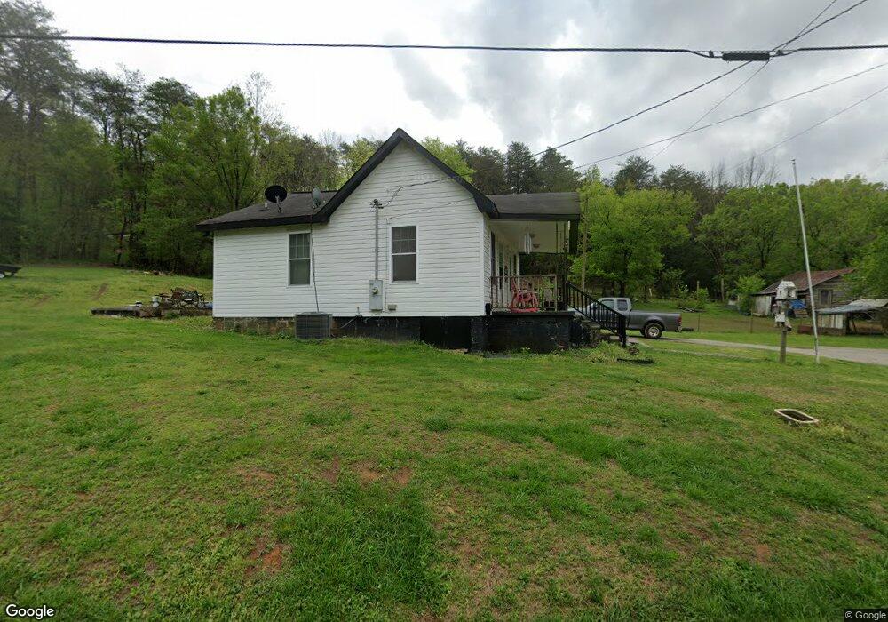
56 Lanham Rd Aragon, GA 30104
Estimated Value: $102,000 - $158,000
2
Beds
1
Bath
696
Sq Ft
$185/Sq Ft
Est. Value
About This Home
This home is located at 56 Lanham Rd, Aragon, GA 30104 and is currently estimated at $128,578, approximately $184 per square foot. 56 Lanham Rd is a home.
Ownership History
Date
Name
Owned For
Owner Type
Purchase Details
Closed on
Aug 7, 2013
Sold by
Singleton Joey L
Bought by
Sak Drucilla Lanham and Lanham Rayford Gerald
Current Estimated Value
Purchase Details
Closed on
May 6, 2011
Sold by
Sellers Jennifer L
Bought by
Singleton Joey L
Purchase Details
Closed on
Feb 26, 2010
Sold by
Sellers Jennifer L *)
Bought by
Sellers Jennifer L
Purchase Details
Closed on
Jun 24, 2004
Sold by
Brock Martha I
Bought by
Womack Debbie June Brock
Purchase Details
Closed on
Sep 29, 1988
Sold by
Brock Franklin
Bought by
Brock Martha I
Purchase Details
Closed on
Nov 22, 1965
Sold by
Lanham T C
Bought by
Brock Franklin
Purchase Details
Closed on
Apr 19, 1952
Bought by
Lanham T C
Create a Home Valuation Report for This Property
The Home Valuation Report is an in-depth analysis detailing your home's value as well as a comparison with similar homes in the area
Home Values in the Area
Average Home Value in this Area
Purchase History
| Date | Buyer | Sale Price | Title Company |
|---|---|---|---|
| Sak Drucilla Lanham | $5,000 | -- | |
| Singleton Joey L | $4,000 | -- | |
| Sellers Jennifer L | -- | -- | |
| Womack Debbie June Brock | -- | -- | |
| Brock Martha I | -- | -- | |
| Brock Franklin | -- | -- | |
| Lanham T C | -- | -- |
Source: Public Records
Tax History Compared to Growth
Tax History
| Year | Tax Paid | Tax Assessment Tax Assessment Total Assessment is a certain percentage of the fair market value that is determined by local assessors to be the total taxable value of land and additions on the property. | Land | Improvement |
|---|---|---|---|---|
| 2024 | $798 | $38,179 | $2,308 | $35,871 |
| 2023 | $602 | $25,381 | $2,308 | $23,073 |
| 2022 | $309 | $13,004 | $1,538 | $11,466 |
| 2021 | $313 | $13,004 | $1,538 | $11,466 |
| 2020 | $265 | $11,004 | $1,538 | $9,466 |
| 2019 | $61 | $2,258 | $1,538 | $720 |
| 2018 | $62 | $2,258 | $1,538 | $720 |
| 2017 | $61 | $2,258 | $1,538 | $720 |
| 2016 | $85 | $3,140 | $2,420 | $720 |
| 2015 | $86 | $3,140 | $2,420 | $720 |
| 2014 | $55 | $3,140 | $2,420 | $720 |
Source: Public Records
Map
Nearby Homes
- 51 Lanham Rd
- 40 Lanham Rd
- 37 Lanham Rd
- 0 Lanham Rd Unit 8239306
- 0 Lanham Rd Unit 8149298
- 0 Lanham Rd Unit 7073870
- 0 Lanham Rd
- 130 Portland Cir
- 15 Lanham Rd
- 168 Portland Cir
- 16 Crumley Rd
- 26 Crumley Rd
- 939 Portland Rd
- 163 Portland Cir
- 146 Portland Cir
- 50 Crumley Rd
- 921 Portland Rd
- 912 Portland Rd
- 909 Portland Rd
- 1234 Portland Rd