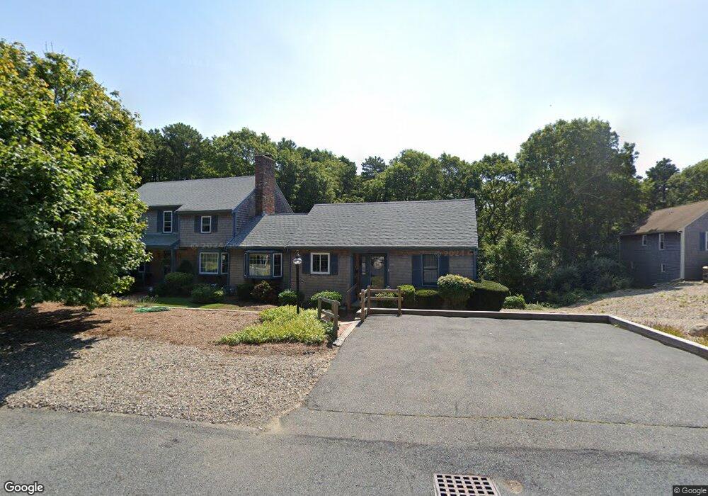
56 Miriah Dr Yarmouth Port, MA 02675
Yarmouth Port NeighborhoodEstimated Value: $464,000 - $519,000
3
Beds
3
Baths
1,201
Sq Ft
$416/Sq Ft
Est. Value
About This Home
This home is located at 56 Miriah Dr, Yarmouth Port, MA 02675 and is currently estimated at $499,958, approximately $416 per square foot. 56 Miriah Dr is a home located in Barnstable County with nearby schools including Dennis-Yarmouth Regional High School and St. Pius X. School.
Ownership History
Date
Name
Owned For
Owner Type
Purchase Details
Closed on
Jul 6, 2016
Sold by
Barsch Betty L and Fiscina Antoinette R
Bought by
Barsch Fiscina T
Current Estimated Value
Purchase Details
Closed on
Jan 26, 1996
Sold by
Robinson James G Est
Bought by
Barsch Betty L
Home Financials for this Owner
Home Financials are based on the most recent Mortgage that was taken out on this home.
Original Mortgage
$80,000
Interest Rate
7.13%
Mortgage Type
Purchase Money Mortgage
Create a Home Valuation Report for This Property
The Home Valuation Report is an in-depth analysis detailing your home's value as well as a comparison with similar homes in the area
Home Values in the Area
Average Home Value in this Area
Purchase History
| Date | Buyer | Sale Price | Title Company |
|---|---|---|---|
| Barsch Fiscina T | -- | -- | |
| Barsch Betty L | $100,000 | -- |
Source: Public Records
Mortgage History
| Date | Status | Borrower | Loan Amount |
|---|---|---|---|
| Previous Owner | Barsch Betty L | $73,000 | |
| Previous Owner | Barsch Betty L | $80,000 |
Source: Public Records
Tax History Compared to Growth
Tax History
| Year | Tax Paid | Tax Assessment Tax Assessment Total Assessment is a certain percentage of the fair market value that is determined by local assessors to be the total taxable value of land and additions on the property. | Land | Improvement |
|---|---|---|---|---|
| 2025 | $3,103 | $438,300 | $0 | $438,300 |
| 2024 | $3,396 | $460,200 | $0 | $460,200 |
| 2023 | $3,258 | $401,700 | $0 | $401,700 |
| 2022 | $2,655 | $289,200 | $0 | $289,200 |
| 2021 | $2,833 | $296,300 | $0 | $296,300 |
| 2020 | $2,859 | $285,900 | $0 | $285,900 |
| 2019 | $2,548 | $252,300 | $0 | $252,300 |
| 2018 | $2,510 | $243,900 | $0 | $243,900 |
| 2017 | $2,444 | $243,900 | $0 | $243,900 |
| 2016 | $2,184 | $218,800 | $0 | $218,800 |
| 2015 | $2,175 | $216,600 | $0 | $216,600 |
Source: Public Records
Map
Nearby Homes
- 16 Warren Rd Unit 16
- 16 Warren Rd
- 8 Rowley Ln
- 32 Deveau Ln
- 0 Forsyth Ave
- 40 Deveau Ln
- 68 Seminole Dr
- 209 Union St
- 33 Sparrow Way
- 30 Quartermaster Row
- 176 Beacon St
- 72 Quartermaster Row
- 76 Captain Chase Rd
- 17 Trowbridge Path
- 4 Old Colony Way
- 1 Winsome Rd
- 882 W Yarmouth Rd
- 38 N Dennis Rd
- 1 Hamblin Hill
- 50 Cottonwood St
- 58 Miriah Dr
- 58 Miriah Dr Unit 58
- 50 Miriah Dr
- 52 Miriah Dr
- 52 Miriah Dr Unit 22A
- 59 Miriah Dr
- 57 Miriah Dr
- 59 Miriah Dr Unit 59
- 59 Miriah Dr Unit C20B
- 51 Miriah Dr
- 49 Miriah Dr
- 42 Miriah Dr
- 44 Miriah Dr
- 45 Miriah Dr
- 43 Miriah Dr
- 43 Miriah Dr Unit A
- 49 Rhine Rd
- 45 Rhine Rd
- 53 Rhine Rd
- 124 German Hill Rd