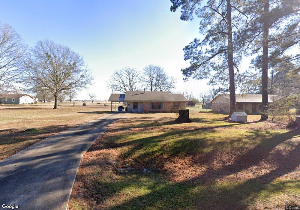
56 Orangewood Rd Texarkana, TX 75501
Estimated Value: $125,000 - $272,000
--
Bed
--
Bath
1,282
Sq Ft
$142/Sq Ft
Est. Value
About This Home
This home is located at 56 Orangewood Rd, Texarkana, TX 75501 and is currently estimated at $182,308, approximately $142 per square foot. 56 Orangewood Rd is a home with nearby schools including Liberty-Eylau Early Childhood Center, Liberty-Eylau C.K. Bender Elementary Campus, and Liberty-Eylau Primary School.
Ownership History
Date
Name
Owned For
Owner Type
Purchase Details
Closed on
Dec 5, 2006
Sold by
Davis Anthony E and Davis Renita T H
Bought by
Whatley Boyce
Current Estimated Value
Home Financials for this Owner
Home Financials are based on the most recent Mortgage that was taken out on this home.
Original Mortgage
$118,000
Interest Rate
8%
Mortgage Type
Commercial
Create a Home Valuation Report for This Property
The Home Valuation Report is an in-depth analysis detailing your home's value as well as a comparison with similar homes in the area
Home Values in the Area
Average Home Value in this Area
Purchase History
| Date | Buyer | Sale Price | Title Company |
|---|---|---|---|
| Whatley Boyce | $54,344 | None Available |
Source: Public Records
Mortgage History
| Date | Status | Borrower | Loan Amount |
|---|---|---|---|
| Closed | Whatley Boyce | $118,000 |
Source: Public Records
Tax History Compared to Growth
Tax History
| Year | Tax Paid | Tax Assessment Tax Assessment Total Assessment is a certain percentage of the fair market value that is determined by local assessors to be the total taxable value of land and additions on the property. | Land | Improvement |
|---|---|---|---|---|
| 2025 | $1,505 | $104,344 | $16,500 | $87,844 |
| 2024 | $1,505 | $101,886 | $16,500 | $85,386 |
| 2023 | $1,431 | $95,791 | $16,500 | $79,291 |
| 2022 | $1,575 | $91,411 | $14,500 | $76,911 |
| 2021 | $1,627 | $88,782 | $14,500 | $74,282 |
| 2020 | $1,575 | $85,329 | $14,500 | $70,829 |
| 2019 | $1,594 | $82,045 | $14,500 | $67,545 |
| 2018 | $1,545 | $79,525 | $14,500 | $65,025 |
| 2017 | $1,551 | $80,163 | $14,500 | $65,663 |
| 2016 | $1,542 | $79,663 | $14,000 | $65,663 |
| 2015 | $1,466 | $79,036 | $14,000 | $65,036 |
| 2014 | $1,466 | $78,406 | $14,000 | $64,406 |
Source: Public Records
Map
Nearby Homes
- 3088 Buchanan Loop Rd
- 2043 Randall Rd
- 0 Randall Rd
- 403 Brookfield St
- 115 Krobot Cir
- 1 Starlite Dr
- 6514 Buchanan Loop Rd
- 310 Springridge Dr
- 2 S Pineview Dr
- 0 Urban Dr
- 101 Redwood Dr
- 39 Quail Brook Dr
- 144 Joe Tyl Rd
- 6815 Buchanan Loop Rd
- 5789 U S 59
- TBD Lp Frontage Wallace Pkwy
- 6 Southridge St
- 229 Alan St
- 194 W Starlite Dr
- 327 Crudip Ln
- 36 Orangewood Rd
- 20 Orangewood Rd
- 4628 S Kings Hwy
- 61 Orangewood Rd
- 4630 S Kings Hwy
- 81 Orangewood Rd
- 4632 S Kings Hwy
- 1711 Cummings Ln
- 4618 S Kings Hwy
- 1683 Cummings Ln
- 4623 S Kings Hwy
- 4732 S Kings Hwy
- 1613 Cummings Ln
- 5010 S Kings Hwy S
- 1611 Cummings Ln
- 162 Lemontree Cir
- 4707 S Kings Hwy
- 1563 Cummings Ln
- 4612 S Kings Hwy
- 4625 S Kings Hwy